Estudio geotécnico in Balearic Islands
Do you need a Estudio geotécnico?
Find the best price and service in Balearic Islands. Get a free quote.
Más de 1000 estudios realizados
Approximate price 750€
We can contact you via WhatsApp, phone, or email, whichever you prefer.
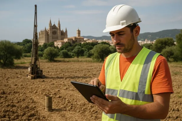
Estudios Geotécnicos Integrales
Estudios Geotécnicos Integrales
Combinamos análisis de campo y ensayos de laboratorio para ofrecer informes técnicos precisos y soluciones de cimentación.


Profesionales expertos
Profesionales expertos
Técnicos con más de 15 años de experiencia en el sector. Somos especialistas en accesos a lugares difíciles como sitios con desniveles, sótanos, etc.
Acreditados
Acreditados
Los cálculos geotécnicos cumplen con las reglas establecidas por el Eurocódigo 7, norma UNE-EN ISO 22476-4 de 2016.

Mejor precio
Mejor precio
Precios muy competitivos. Los mejores precios de estudios geotécnicos en España. Pide presupuesto y compruébalo.
Rapidez y calidad
Rapidez y calidad
En el plazo de 7 a 10 días obtendrás un informe firmado por un geólogo. Es obligatorio para hacer una construcción nueva, reformas que impliquen modificaciones de la estructura.

Work areas
We provide service Estudio geotécnico in all localities of Balearic Islands.
This includes the following geographical areas: Balearic Islands Balearic Islands and surrounding areas.
We go to your home in Balearic Islands whenever suits you best, agreeing a day and time.

Tipos de terreno en Balearic Islands
The region of the Balearic Islands, located in the Mediterranean Sea, comprises the provinces of Mallorca, Menorca, Ibiza and Formentera, characterised by predominantly mountainous relief and an extensive area of coastlines. The topography in Mallorca features several comarcas such as the Sierra de Tramuntana, with steep slopes and soils mainly of limestone origin, forming rock outcrops and natural terraces that are ideal for geotechnical studies related to foundations in areas with steep slopes.
In Menorca, sedimentary-type soils predominate, with flat ground and clayey soils in the inland areas, facilitating stability assessments in agricultural fields or urban developments. Ibiza and Formentera show calcareous soils with areas of exposed rock, suggesting significant disturbances in bearing capacity. The heterogeneity of soil types across the different islands, together with the region’s tectonic characteristics, requires detailed analyses for construction or infrastructure projects, taking into account the variability of the substrate strength in each specific area.
Calizas, Dolomías y Mármoles
33.16%Arenas finas y limos
27.81%Yesos, Anhidrita y Sales
20.77%
Construction risks in Balearic Islands
Approximate estimates. They do not replace the geotechnical study.
| Soil type | Expansivity | Settlements | Water table | Seismicity | Minimum foundation |
|---|---|---|---|---|---|
| Calizas, Dolomías y Mármoles | Nula | Media | Media | Baja | Generalmente cimentación directa mediante zapatas arrios... |
| Arenas finas y limos | Nula | Alta | Alta | Alta | Para evitar punzonamientos locales se usa profusamente l... |
| Yesos, Anhidrita y Sales | Media | Alta | Alta | Media | La cimentación debe diseñarse para resistir la pérdida l... |
| Arcillas Expansivas Blancas/Blandas | Alta | Alta | Baja | Baja | Inviable la zapata superficial pura. O bien losa hiperrí... |
| Areniscas, Conglomerados y Flysch | Nula | Media | Media | Media | Cimentación directa viable en la mayoría de los casos. P... |
Interactive geological map · Balearic Islands
Mapping: IGME GEODE 50k · IGME MAGNA 50 · ICGC (Catalonia)
Geological Viewer
IGME · ICGC- Click on the map to see the geology at the point.
- Use the layer buttons to switch between geological views (GEODE, MAGNA, Lithology, Hydrogeology).
- Adjust the opacity of the geological layer with the control below.
- Press the full-screen button to expand the viewer.
Geological information
Typical stratigraphic profile
Indicative subsurface cross-section in Balearic Islands · Based on GEODE soil types
Indicative profile based on GEODE soil types and typical CTE thicknesses
Seismic risk in Balearic Islands
Seismic risk is assessed at municipal level. These are aggregated data for the area.
- 1 M 3.2 2005
- 2 M 3 2025
- 3 M 2.9 2010
¿Cómo realizamos tu estudio geotécnico?
¿Cómo realizamos tu estudio geotécnico?
Step
Presupuesto gratuito
Presupuesto gratuito
Pide un presupuesto para tu estudio geotécnico. Totalmente gratuito y sin compromiso.
Step
Concertamos un día
Concertamos un día
Buscamos un día y hora para hacer el estudio de campo.
Step
Realización del estudio
Realización del estudio
Nos desplazamos y realizamos el estudio. En una hora o dos habremos acabado.
Step
Envío del informe
Envío del informe
En una semana te enviamos los documentos del estudio firmado por un geólogo acreditado.
Filter Estudio geotécnico in
Balearic Islands
Also available in
Spain’s most populated cities
Useful information about Estudio geotécnico
In-depth articles


Entities and institutions


