Estudio geotécnico in Mancor de la Vall
Do you need a Geotechnical study?
Find the best price and service in Mancor de la Vall. Get a free quote.
More than 1000 geotechnical studies carried out
Approximate price 750€
We can contact you via WhatsApp, phone, or email, whichever you prefer.
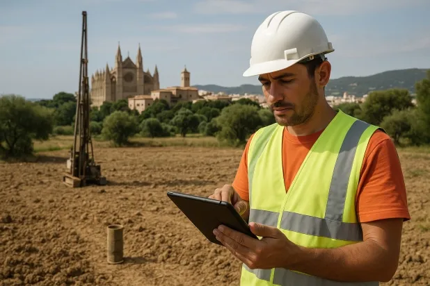
Comprehensive Geotechnical Studies
Comprehensive Geotechnical Studies
We combine field analysis and laboratory testing to provide accurate technical reports and foundation solutions.


Expert professional
Expert professional
Technicians with more than 15 years of experience in the industry. We are specialists in access to difficult locations such as sites with level changes, basements, etc.
Accredited
Accredited
Geotechnical calculations comply with the rules established by Eurocode 7, UNE-EN ISO 22476-4:2016.

Best price
Best price
Very competitive prices. The best prices for geotechnical studies in Spain. Request a quote and check it.
Speed and quality
Speed and quality
Within 7 to 10 days you will receive a signed report from a geologist. It is mandatory in order to carry out new construction or refurbishment works that involve modifications to the structure.

Work areas
We provide Geotechnical study in all towns and localities of Mancor de la Vall.
This includes the following geographical areas: Balearic Islands, Islas Baleares and surrounding areas.
We come to your home in Mancor de la Vall when it suits you, agreeing a day and time.

Types of ground in Mancor de la Vall
In Mancor de la Vall, fine sands and silts predominate, accounting for more than 70% of the surface materials, occasionally accompanied by gypsum, anhydrite, salts and some fractions of limestones and dolomites. The presence of predominantly granular soils, together with layers of soluble nature such as gypsum and salts, requires a detailed analysis of bearing capacity and behaviour under loads, since the dissolution of these materials can compromise the stability of foundations. In addition, generally low permeability can limit the drainage of water, increasing vulnerability to certain geotechnical processes.
The seismic activity in the area is moderate, with 24 events over thirty years and a maximum magnitude of 3.2, which does not constitute a critical constraint for structural design. However, the presence of karstic development associated with the calcareous substratum makes it necessary to carry out a prior, thorough verification before undertaking any foundation. Since the substratum is not clayey, the risk of expansivity is ruled out. As the main constraint, the need to assess both the possibility of dissolution processes in gypsum and salts and the existence of karstic risk in the subsoil stands out.
Fine sands and silts
73.69%Gypsum, Anhydrite and Salts
18.21%
Construction risks in Mancor de la Vall
Approximate estimates. They do not replace the geotechnical study.
| Soil type | Expansivity | Settlements | Water table | Seismicity | Minimum foundation |
|---|---|---|---|---|---|
| Fine sands and silts | None | High | High | High | To avoid local punching, the foundation slab is used ext... |
| Gypsum, Anhydrite and Salts | Media | High | High | Media | The foundation must be designed to withstand local loss ... |
| Limestones, Dolomites and Marbles | None | Media | Media | Downward | In general, direct foundation using braced strip footing... |
Interactive geological map · Mancor de la Vall
Mapping: IGME GEODE 50k · IGME MAGNA 50 · ICGC (Catalonia)
Geological Viewer
IGME · ICGC- Click on the map to see the geology at the point.
- Use the layer buttons to switch between geological views (GEODE, MAGNA, Lithology, Hydrogeology).
- Adjust the opacity of the geological layer with the control below.
- Press the full-screen button to expand the viewer.
Geological information
Typical stratigraphic profile
Indicative subsurface cross-section in Mancor de la Vall · Based on GEODE soil types
Indicative profile based on GEODE soil types and typical CTE thicknesses
Seismic risk in Mancor de la Vall
Seismic risk is assessed at municipal level. These are aggregated data for the area.
- 1 M 3.2 2005
- 2 M 3 2025
- 3 M 2.9 2010
How do we carry out your geotechnical study?
How do we carry out your geotechnical study?
Step
Free quote
Free quote
Request a quotation for your geotechnical study. Completely free and with no obligation.
Step
We arrange a day
We arrange a day
We are looking for a day and time to carry out the field study.
Step
Conducting the geotechnical study
Conducting the geotechnical study
We’re going to move and carry out the study. In an hour or two we’ll have finished.
Step
Report submission
Report submission
Within a week we will send you the signed documents of the geotechnical study by an accredited geologist.
Also available in
Spain’s most populated cities
Useful information about Geotechnical study
In-depth articles


Entities and institutions


