Estudio geotécnico in Gijón
Do you need a Estudio geotécnico?
Find the best price and service in Gijón. Get a free quote.
Más de 1000 estudios realizados
Get personalized attention
We can contact you via WhatsApp, phone, or email, whichever you prefer.
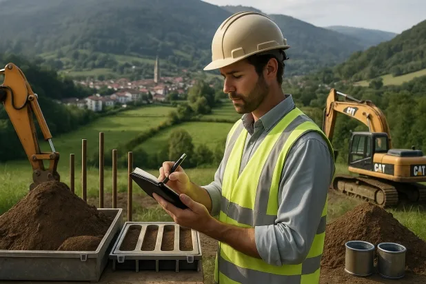
Estudios Geotécnicos Integrales
Estudios Geotécnicos Integrales
Combinamos análisis de campo y ensayos de laboratorio para ofrecer informes técnicos precisos y soluciones de cimentación.


Profesionales expertos
Profesionales expertos
Técnicos con más de 15 años de experiencia en el sector. Somos especialistas en accesos a lugares difíciles como sitios con desniveles, sótanos, etc.
Acreditados
Acreditados
Los cálculos geotécnicos cumplen con las reglas establecidas por el Eurocódigo 7, norma UNE-EN ISO 22476-4 de 2016.

Mejor precio
Mejor precio
Precios muy competitivos. Los mejores precios de estudios geotécnicos en España. Pide presupuesto y compruébalo.
Rapidez y calidad
Rapidez y calidad
En el plazo de 7 a 10 días obtendrás un informe firmado por un geólogo. Es obligatorio para hacer una construcción nueva, reformas que impliquen modificaciones de la estructura.

Work areas
We provide Estudio geotécnico in all locations of Gijón.
This includes the following geographical areas: Allande, Aller, Avilés, Belmonte de Miranda, Bimenes, Boal, Cabrales, Cabranes, Candamo, Cangas del Narcea, Cangas de Onís, Carreño, Case, Castrillón, Castropol, Coaña, Colunga, Corvera de Asturias, Cudillero, The Franco, Gijón, Gozón, Grade, Ibias, Illas, Langreo, Laviana, Lena, Valdés, Llanera, Llanes, Mieres, Morcín, Walls of Nalón, Nava, Navia, Noreña, Oviedo, Parres, Peñamellera Baja, Piloña, Pravia, Quirós, Las Regueras, Ribadedeva, Ribadesella, Ribera de Arriba, Riosa, Salas, San Martín del Rey Aurelio, Sariego, Siero, Somiedo, Soto del Barco, Tapia de Casariego, Teverga, Tineo, Vegadeo, Villaviciosa, Villayón, Asturias and surrounding areas.
We come to your home in Gijón when it suits you, agreeing a day and time.

Tipos de terreno en Gijón
In Gijón, the predominant subsoil is made up of sandstones and conglomerates, materials that exhibit good mechanical properties and provide adequate bearing capacity for building. Although less common, flysch and the occasional presence of limestones, dolomites, and marbles can locally alter foundation conditions, whereas fine sands and silts, as well as slates, occur more limitedly. The characteristic low permeability of these formations may favour the existence of shallow aquifers, but generally they do not represent a significant problem for founding conventional structures on these subsoils.
In terms of seismic hazard, Gijón experiences moderate seismicity, with 15 events over 30 years and a low maximum magnitude (Mmax 1.7), so its influence on structural design is limited. The noteworthy feature in the region is the possible occurrence of karst processes due to the presence, although in the minority, of limestones and dolomites; in these cases, it is essential to check for cavities before defining the foundation. With a non-clayey subsoil, the risk of expansivity is ruled out, and verification of karst is the factor that may most significantly condition the feasibility and the type of foundation to choose in this municipality.
Arenas finas y limos
2.52%Pizarras y Esquistos
2.18%
Construction risks in Gijón
Approximate estimates. They do not replace the geotechnical study.
| Soil type | Expansivity | Settlements | Water table | Seismicity | Minimum foundation |
|---|---|---|---|---|---|
| Areniscas, Conglomerados y Flysch | Nula | Media | Media | Media | Cimentación directa viable en la mayoría de los casos. P... |
| Calizas, Dolomías y Mármoles | Nula | Media | Media | Baja | Generalmente cimentación directa mediante zapatas arrios... |
| Arenas finas y limos | Nula | Alta | Alta | Alta | Para evitar punzonamientos locales se usa profusamente l... |
| Pizarras y Esquistos | Nula | Media | Media | Media | Cimentación superficial si el estrato es competente. Se ... |
Interactive geological map · Gijón
Mapping: IGME GEODE 50k · IGME MAGNA 50 · ICGC (Catalonia)
Geological Viewer
IGME · ICGC- Click on the map to see the geology at the point.
- Use the layer buttons to switch between geological views (GEODE, MAGNA, Lithology, Hydrogeology).
- Adjust the opacity of the geological layer with the control below.
- Press the full-screen button to expand the viewer.
Geological information
Typical stratigraphic profile
Indicative subsurface cross-section in Gijón · Based on GEODE soil types
Indicative profile based on GEODE soil types and typical CTE thicknesses
Seismic risk in Gijón
Seismic risk is assessed at municipal level. These are aggregated data for the area.
- 1 M 1.7 2010
- 2 M 1.7 2010
- 3 M 1.7 2009
¿Cómo realizamos tu estudio geotécnico?
¿Cómo realizamos tu estudio geotécnico?
Step
Presupuesto gratuito
Presupuesto gratuito
Pide un presupuesto para tu estudio geotécnico. Totalmente gratuito y sin compromiso.
Step
Concertamos un día
Concertamos un día
Buscamos un día y hora para hacer el estudio de campo.
Step
Realización del estudio
Realización del estudio
Nos desplazamos y realizamos el estudio. En una hora o dos habremos acabado.
Step
Envío del informe
Envío del informe
En una semana te enviamos los documentos del estudio firmado por un geólogo acreditado.
Also available in
Spain’s most populated cities
Useful information about Estudio geotécnico
In-depth articles


Entities and institutions


