Estudio geotécnico in Campanet
Do you need a Geotechnical study?
Find the best price and service in Campanet. Get a free quote.
More than 1000 geotechnical studies carried out
Approximate price 750€
We can contact you via WhatsApp, phone, or email, whichever you prefer.
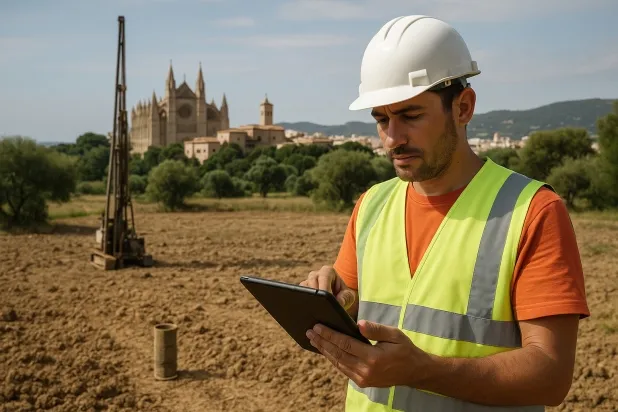
Comprehensive Geotechnical Studies
Comprehensive Geotechnical Studies
We combine field analysis and laboratory testing to provide accurate technical reports and foundation solutions.


Expert professional
Expert professional
Technicians with more than 15 years of experience in the industry. We are specialists in access to difficult locations such as sites with level changes, basements, etc.
Accredited
Accredited
Geotechnical calculations comply with the rules established by Eurocode 7, UNE-EN ISO 22476-4:2016.

Best price
Best price
Very competitive prices. The best prices for geotechnical studies in Spain. Request a quote and check it.
Speed and quality
Speed and quality
Within 7 to 10 days you will receive a signed report from a geologist. It is mandatory in order to carry out new construction or refurbishment works that involve modifications to the structure.

Work areas
We provide Geotechnical study services in all localities of Campanet.
This includes the following geographical areas: Balearic Islands, Islas Baleares and the surrounding areas.
We travel to your home in Campanet when it suits you, agreeing a day and time.

Types of ground in Campanet
In Campanet, soils of fine sands and silts predominate, characterised by a poorly cemented texture that may limit the bearing capacity in certain areas, especially in the presence of high moisture. A relevant aspect is the occasional occurrence of gypsum, anhydrite and salts, which introduces a potential risk of dissolution and subsidence that must be analysed before selecting the foundation depth. Although the presence of limestones and dolomites is marginal, it is advisable to pay attention to local variations in the substrate that could influence ground stability for building projects.
The seismicity in Campanet can be considered moderate, with 24 events over 30 years and a maximum magnitude of 3.2, so it does not represent a significant constraint for structural design. Nevertheless, it is an area with karst development, so the possible presence of voids in the subsurface must be verified without fail before executing any foundation, thereby minimising geotechnical risks associated with unexpected collapses. The non-clayey substrate rules out issues relating to expansivity, leaving as the main constraint the assessment of areas with gypsum and the verification of the karst risk.
Fine sands and silts
70.08%Gypsum, Anhydrite and Salts
18.33%
Construction risks in Campanet
Approximate estimates. They do not replace the geotechnical study.
| Soil type | Expansivity | Settlements | Water table | Seismicity | Minimum foundation |
|---|---|---|---|---|---|
| Fine sands and silts | None | High | High | High | To avoid local punching, the foundation slab is used ext... |
| Gypsum, Anhydrite and Salts | Media | High | High | Media | The foundation must be designed to withstand local loss ... |
| Limestones, Dolomites and Marbles | None | Media | Media | Downward | In general, direct foundation using braced strip footing... |
| Sandstones, Conglomerates and Flysch | None | Media | Media | Media | Direct foundation is feasible in most cases. For flysch ... |
Interactive geological map · Campanet
Mapping: IGME GEODE 50k · IGME MAGNA 50 · ICGC (Catalonia)
Geological Viewer
IGME · ICGC- Click on the map to see the geology at the point.
- Use the layer buttons to switch between geological views (GEODE, MAGNA, Lithology, Hydrogeology).
- Adjust the opacity of the geological layer with the control below.
- Press the full-screen button to expand the viewer.
Geological information
Typical stratigraphic profile
Indicative subsurface cross-section in Campanet · Based on GEODE soil types
Indicative profile based on GEODE soil types and typical CTE thicknesses
Seismic risk in Campanet
Seismic risk is assessed at municipal level. These are aggregated data for the area.
- 1 M 3.2 2005
- 2 M 3 2025
- 3 M 2.9 2010
How do we carry out your geotechnical study?
How do we carry out your geotechnical study?
Step
Free quote
Free quote
Request a quotation for your geotechnical study. Completely free and with no obligation.
Step
We arrange a day
We arrange a day
We are looking for a day and time to carry out the field study.
Step
Conducting the geotechnical study
Conducting the geotechnical study
We’re going to move and carry out the study. In an hour or two we’ll have finished.
Step
Report submission
Report submission
Within a week we will send you the signed documents of the geotechnical study by an accredited geologist.
Also available in
Spain’s most populated cities
Useful information about Geotechnical study
In-depth articles


Entities and institutions


