Parcent, the valley the Triassic shaped and where the Moriscos lived for centuries
In the subsurface of Parcent, three radically different geological epochs coexist: limestones from a tropical sea, gypsum from an arid desert, and sands from recent rivers. Together they built a valley so fertile that for centuries it was almost exclusively Moorish. Until, in 1609, they emptied it out overnight.

Parcent historia geologica
Have you ever wondered why the valley of Pop has such a peculiar shape, that closed basin hemmed in by mountains on all sides, with the river Gorgos cutting through it from west to east as though it were looking for an exit? Or why Parcent, with a little over a thousand inhabitants today, was for centuries a settlement that was almost entirely Morisco, coveted by lords and monasteries, the setting for rebellions and expulsions that shook the whole kingdom of Valencia?
The answer, once again, lies in the geology. The valley of Pop is not an accident of the landscape. It is the result of millions of years of geological history that created exactly the right conditions — fertile soil, groundwater, protective reliefs — which made Parcent a place that people have always wanted to live in.
And that they also wanted to defend.
The tropical sea that built the mountains on the horizon
It starts with what is most obvious: the mountain ranges that close off the valley on all sides. The Sierra de les Coves, the Carrascal de Parcent to the west, the Sierra del Ferrer connecting via the Coll de Rates to the north. They are the walls of the basin that contains Parcent.
Those mountain ranges are limestone. 52,17% of the municipality’s subsurface — the rock that crops out in the highest reliefs within the area — is limestone, dolomite and marble: the compacted residue of a tropical sea that covered this part of the Iberian Peninsula during the Mesozoic, between 65 and 250 million years ago.
Here, in the Marina Alta, limestone does not form plateaux or isolated hills. The Alpine Orogeny — the same that lifted the Alps and the Pyrenees — folded these limestones with particular energy, creating the characteristic north-east–south-west oriented mountain ranges of the comarca. Steep ranges, with vertical cliffs, that fall towards the interior valleys.
And those interior valleys are what makes Parcent special.
Triassic gypsum: when this was an arid desert
Because the floor of the valley of Pop is not limestone. It is something completely different, and that difference explains everything.
Wikipedia describes it with geological precision: Parcent occupies "a short depression of Triassic marls partly covered by the Quaternary." The Triassic is a geological period that predates even the Jurassic: between 200 and 250 million years ago, when the continents were still joined in Pangea and the global climate was arid and warm.
Under those conditions, gypsum, anhydrite and salts were formed, appearing today between 15 and 27 metres deep in Parcent’s subsurface, representing 11,08% of the total. The process is the same as the one we saw in Ademuz: a closed basin with no outlet to the sea, where the water evaporates faster than it arrives, and the dissolved minerals precipitate, forming layers of gypsum and salt. A lake that dries up. A desert that used to be sea.
Those Triassic materials — softer and more erodible than the hard limestone of the surrounding mountain ranges — are what the river Gorgos and its prehistoric predecessors were preferentially carving out over millions of years, creating the depression where Parcent sits today. The limestone ranges resisted. The Triassic floor gave way. And the result is the valley: a fertile bowl, protected by mountains, irrigated by the river.
It is geology that designed the valley. And it was the valley that attracted everyone who came later.
Ground types in Parcent
Characteristic soils in the area, ordered by relevance.
-
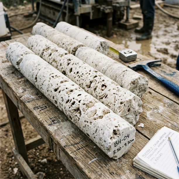
Limestones, Dolomites and Marbles
karstic structures (caves, sinkholes, dolines) that pose the main geotechnical risk.
View details -
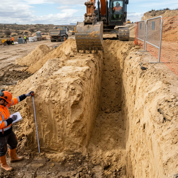
Fine sands and silts
Fine to very fine granular soils with medium to loose compacity. Typical of floodplains and coastlines. Although they can support light buildings, they are treacherous soils linked to water processes:
View details -
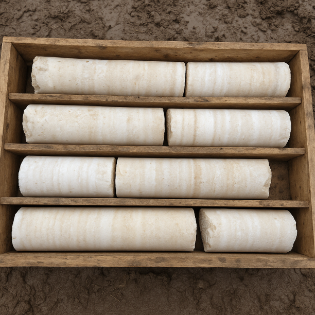
Gypsum, Anhydrite and Salts
Chemically formed sedimentary rocks produced by the precipitation of minerals dissolved in closed basins. Gypsum predominates (calcium sulphate) and, to a lesser extent, anhydrite and salts (halite).
View details -
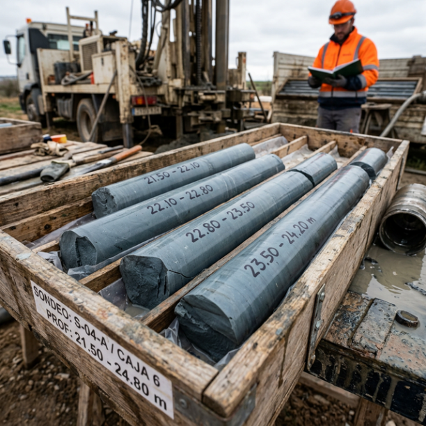
Overconsolidated clays and marls (Duras)
Cohesive soils with a hard feel, sometimes with a rock-like appearance when dry (grey marls, pre-Pyrenean facies, deep Guadalquivir basin). They have a long history of geological compression in the pa
View details -
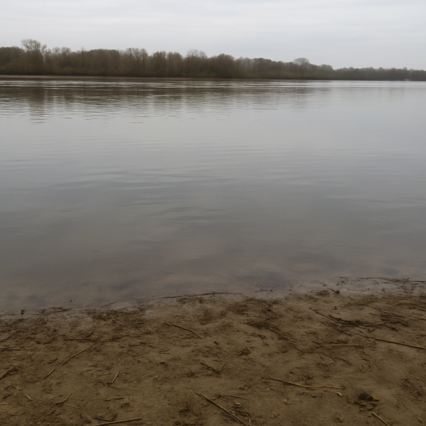
Water mass
Area corresponding to rivers, lakes, reservoirs, lagoons, permanent marshes or submerged coastal strips. The point consulted lies on a body of water identified cartographically by the IGME in its geol
View details
Sand and water: why Parcent’s soil was so coveted
On top of the Triassic gypsum, covering the valley floor, the third major material in Parcent’s subsurface appears: fine sands and silts, 21,06% of the total, deposited by the river Gorgos and the gullies that feed into it throughout the recent Quaternary.
Sand and silt are the materials that make a valley fertile. They are well-aerated soils, with good water-retention capacity, and they are easy to work. And in Parcent they have an added feature: the elevated groundwater level that the geotechnical data records in this material indicates that the groundwater, filtered from the surrounding limestone mountain ranges, emerges easily on the valley floor. Springs, seepages, weirs, mills. The water wealth that the Ajuntament de Parcent mentions explicitly in its history of the municipality: "springs, washhouses, weirs or an old mill called Molí del Primo."
That is why, for centuries, Parcent was almost exclusively Morisco. Not by historical coincidence, but because that valley with fertile soil, abundant water and protective mountain ranges was exactly the kind of territory that farming communities valued. The Moriscos knew it. And they cultivated it for generations.
November 1609: when the valley emptied in two months
There is an episode in Parcent’s history that concentrates the whole drama of the expulsion of the Moriscos from the kingdom of Valencia in an almost cinematic way.
When Philip III signed the decree of expulsion in September 1609, the Moriscos from the valleys of Pop and Laguart — the immediate territory of Parcent — did not accept leaving. More than 19.000 of them, led by Minilli, a miller from Guadalest, took refuge and made a stand at the castle of Pop, in the mountain ranges surrounding the valley. The very same limestone ranges that for centuries had been their natural protection became their final stronghold.
The royal troops laid siege to them for two months. After the deaths of more than 4.000 people, the Moriscos capitulated in November 1609. The valley was left empty. At that time, the barony of Parcent had 52 Morisco houses that were completely uninhabited overnight.
The silence that followed must have been absolute. Fields left uncultivated, mills standing idle, springs with nobody to use them. Three years later, in August 1612, the prior of the Cartuja de Nuestra Señora de las Fuentes — the new lord of the barony — granted a charter of settlement in favour of 52 Christian settlers so that they could inhabit the places of Parcent, Benichembla and Vernissa. The number of families was the same. The valley was the same. But all the people who knew it had disappeared.
Risk that no one sees: gypsum beneath fertile ground
The same geology that made the valley of Pop fertile and turned it into a coveted place for centuries conceals, at a depth of fifteen metres, the municipality’s biggest geotechnical constraint: Triassic gypsum.
Gypsum is soluble. Water dissolves it slowly, opening cavities and creating voids beneath the surface that cannot be detected from above. In the Marina Alta, where the groundwater level is high and water circulates permanently through the subsurface materials, this dissolution process is real and active. That is why geotechnical studies in Parcent identify karstification and gypsum as the main factor to verify before any foundation: what the eye sees as firm ground may hide, just a few metres down, materials in the process of dissolution.
The valley floor that the river carved into the Triassic marls, the ground that the Moriscos cultivated for centuries, is also the ground that requires the most attention before building. Geology gives nothing for free.
What Parcent’s subsurface keeps, layer by layer
|
Depth |
What there is |
What it was |
|---|---|---|
|
0 – 5 m |
Fine sands and silts |
Alluvium of the river Gorgos. The fertile soil that the Moriscos cultivated |
|
5 – 15 m |
Overconsolidated clays and marls |
Transition between recent deposits and the Triassic substratum |
|
15 – 27 m |
Gypsum, anhydrite and salts |
Arid basin with evaporation during the Triassic (around ~230 million years ago) |
|
27 – 47 m+ |
Limestones, dolomites and marbles |
Sea floor of a tropical Mesozoic. The mountain ranges that close off the valley |
Four layers. Two hundred and thirty million years of geological history that created a fertile, protected and well-irrigated valley. A place that the Moriscos inhabited for centuries, that Philip III’s troops emptied in a single winter, and that today is still, at the bottom, the same valley that geology designed.
Sources: Geological subsurface data (soil types, percentages, stratigraphic profile): estudiogeotecnico.pro/es/estudio-geotecnico-en-parcent, based on IGME GEODE 50k and MAGNA 50 mapping. Seismic data: Seismic Portal EMSC/IGN. Geological description of the municipal area: Wikipedia, article «Parcent» (es.wikipedia.org/wiki/Parcent). History of Parcent and expulsion of the Moriscos: Wikipedia, article «Parcent»; Ajuntament de Parcent (parcent.es/el-municipo/historia); MACMA (test.macma.org/turismo/pueblos/parcent). Expulsion of the Moriscos from the kingdom of Valencia: Wikipedia, article «Historia_de_los_moriscos» (es.wikipedia.org/wiki/Historia_de_los_moriscos). Siege of the castle of Pop in 1609: Wikipedia, article «Parcent»; Ajuntament de Parcent.
Do you need a geotechnical study in Parcent?
Request a no-obligation quote. We’ll advise you on the type of study you need.
- Studies signed by a licensed geologist
- Compliant with the CTE and Eurocode 7
- Coverage throughout Spain


Más de 1000 estudios realizados
Request a free quote
We can contact you via WhatsApp, phone, or email, whichever you prefer.


