Salou, the Cape That Made a Port
Before it became a holiday coast, Salou was a natural harbor sheltered by the cape. This stretch of coastline supported routes, fleets and defenses; when the commercial port ceased to operate, the town found another way to live by the sea.
Salou Cape sheltered a natural harbor. In 1229, James I assembled a fleet here, together with Tarragona and Cambrils, to set out for Mallorca. The cape was not merely a backdrop to history: its shelter made this stretch of coast a meeting point for ships, merchants and decisions about war. For centuries, this advantage sustained the port’s importance. But the same coastline that offered refuge could not prevent corsair attacks or stop the coastal economy from changing much later.
A cape in the service of ships
Salou’s history returns time and again to the relationship between the cape and the port. The municipal source describes its natural conditions as exceptional, and historical tradition places an important port here since antiquity. The accepted hypothesis about the Greek founding of Salaurio dates the settlement to the sixth century BCE; centuries later, the Roman city of Salauris also stood out as a port. There is no need to imagine a specific ancient pier to see the continuity: the coastal shelter made this place a maritime gateway used in different eras.
The terrain, however, did not offer absolute protection. The port could facilitate trade and bring ships together, but Catalan merchant fleets were attacked by Mallorcan Saracen pirates. In 1229, at the request of merchants from Barcelona, Tarragona and Tortosa, James I assembled a fleet at Salou, Tarragona and Cambrils to conquer Mallorca. The episode shows how the coast served both as a refuge and as a launchpad: the port offered a strategic opportunity, while the danger at sea made it necessary to organize defenses.
Under the coast, limestone and cavities
The coastal strip has another, quieter history, visible in the municipality’s cavities. The speleological inventory lists five: four caves and one pit. All are formed in limestone. Together they extend for 158 meters and reach a maximum depth of six meters. They are not large underground systems, but they are tangible evidence that alongside the landscape of beaches and port lies a rocky substrate with hollows, passages and water.
The longest cavity, Coves del Lladre, extends for 92 meters on Salou Cape. The description presents them as spacious, with abundant water, and interconnected. In Cova de Cala Font, which is 40 meters long, the passage is irregular and narrow; large angular blocks are present, and the gallery follows NE-SW-oriented joints. A joint is a fracture in rock. Here, that direction offers a view of the massif’s actual structure, without confusing it with a line traced by the sea or a constructed wall.
The other cavities add different small traces. Bufador del Pas de la Mala Dona is a 12-meter passage that connects to the sea and reaches a depth of six meters. Cova del Reguerot del Clavegar, ten meters long, contains marine sediments and charcoal; Cova de la Falconera, four meters long, lies at sea level and runs between blocks. Limestone thus appears in varied forms: passages, fractures and spaces between blocks, some containing water or sediments.
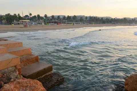
La playa y el borde de agua muestran el litoral que empezó a recibir bañistas cuando Salou dejó atrás su antigua función portuaria.
On a broader scale, the geotechnical study distinguishes three groups of materials: gravel and compact sands (54.55%), limestone, dolomite and marble (27.27%), and hard overconsolidated clays and marls (18.18%). These categories describe the municipality; they do not automatically assign a specific rock to each structure or cove. Three boreholes, with an average depth of 88.7 meters, recorded water at an average depth of 7.2 meters; individual measurements range from 0.6 to 15 meters. These are subsurface observation points, distinct from the coastal cavities described separately in the inventory.
The shelter did not stop the attacks
Port activity coexisted with a coastline exposed to raids. From the second half of the fourteenth century onward, living conditions in Salou became difficult: the war between Peter I of Castile and Peter of Aragon, together with pirate raids, led to another depopulation. The place that attracted ships could also attract threats. This tension was not resolved by abandoning the coast forever; it was addressed through defenses and new ways of organizing the territory.
In 1530, Pere de Cardona, Archbishop of Tarragona, ordered the construction of Torre Vella to protect people and property from corsair attacks. The tower remains part of local memory and is now an arts center. More than a century later, during the Catalan Revolt, Juan de Garay compelled the inhabitants of Reus in 1649 to destroy Salou’s fortifications to prevent the Catalan somatens or their French allies from using them. The defenses thus had a changing fate: first, fortifications were built against corsairs; later, in a different conflict, they were dismantled so that they could not serve the opposing side.
When the port ceased to rule
The port remained commercially important during the eighteenth century and the first years of the nineteenth. In 1820, the Harbourmaster’s Office and the New Customs House were built on Barcelona Street. But in November of that same year, a decree of the Constitutional Cortes put an end to the port’s operations. The change did not erase its presence overnight: the cape’s lighthouse was inaugurated in 1858, even though the port’s decline was already evident. The navigation infrastructure remained while the place’s commercial role faded.
Salou then began to turn toward another use of the coast. In 1863, bathing huts were authorized on Ponent Beach; the railway station began operating in 1865 and, in 1887, the Reus-Salou tramway, known as the Carrilet, was inaugurated. The line brought the first holidaymakers closer. This was not simply a matter of replacing ships with trains: it changed who came to the coast and why. The port had brought together trade and navigation; the beach began to attract visitors who came to bathe and spend the season.
The coast takes on a new role
During the 1920s, Modernist villas began to be built along Jaime I promenade. From the 1960s onward, tourism-driven urban growth accelerated the transformation. In 1965, the monument to James I was erected, by then a symbol of contemporary Salou. The cape and coastal strip remained the recognizable setting, but the economic life organized around them had changed: the former commercial port gave way at the center of the story to beaches, promenades and the tourist town.
The transformation also had an administrative consequence. In the 1970s, an organized popular movement promoted Salou’s separation from Vila-seca. The Supreme Court granted administrative independence on October 30, 1989; new investments in services, urban renewal and population growth followed. The old port’s end did not mean that the cape ceased to matter, but that it no longer supported the same activity. Its shelter had helped make Salou a port; the railway, bathing and tourism led to a new identity by the sea.
Today, the cape’s limestone cavities and the urbanized coast belong to the same municipality, although they tell different stories about the terrain. The port no longer governs local life as it did during the centuries of trade, but the cape still has the shape that made that shelter possible. The shore remains; what Salou expects from it has changed.
Ground types in Salou
Characteristic soils in the area, ordered by relevance.
-
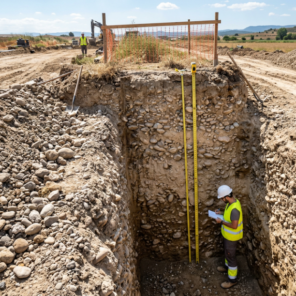
Compact gravels and sands
High-compacity granular deposits, typically associated with old fluvial terraces (Ebro, Duero, Tajo, Guadalquivir rivers) and Pleistocene glacis. They have no cohesion (they are not clays) but their a
View details -
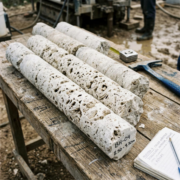
Limestones, Dolomites and Marbles
karstic structures (caves, sinkholes, dolines) that pose the main geotechnical risk.
View details -
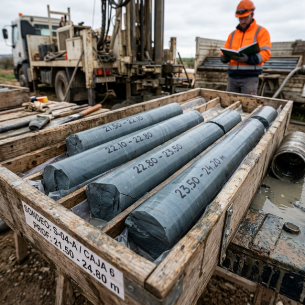
Overconsolidated clays and marls (Duras)
Cohesive soils with a hard feel, sometimes with a rock-like appearance when dry (grey marls, pre-Pyrenean facies, deep Guadalquivir basin). They have a long history of geological compression in the pa
View details
Do you need a geotechnical study in Salou?
Request a no-obligation quote. We’ll advise you on the type of study you need.
- Studies signed by a licensed geologist
- Compliant with the CTE and Eurocode 7
- Coverage throughout Spain


Más de 1000 estudios realizados
Request a free quote
We can contact you via WhatsApp, phone, or email, whichever you prefer.


