Manresa, the city built on a sea that dried up: the story through its geology that nobody told you
Beneath the streets of Manresa there are sandstones and conglomerates from a tropical sea that died of thirst, sands and silts from the Llobregat river, and expansive clays from a basin that closed 35 million years ago. And all of this, however impossible it may seem, explains why the Gothic Seu was erected on that particular outcrop, what happens underground in the region with the salt and potash, and why karst is the main factor of risk in any construction project in Manresa today.

Manresa
Have you ever wondered why the basilica of the Seu de Manresa rises exactly there, on that rugged promontory that drops straight down over the Cardener river, and not at any other point in the town? Or why the medieval bridge that crosses the Cardener has stood since the 14th century while other bridges in the area did not survive the floods? The answer is not in history books. It is several metres beneath your feet, written in rock.
The subsoil of Manresa is an archive of 40 million years. And we know this because every time geologists bore into the ground in this city —to build a building, for a technical report, to study the subsoil— they find the same layers in the same order: first sands and silts in the first metres close to the rivers, then expansive clays in the transitional zones, and finally, very deep down, the hard rock: the sandstones, conglomerates and flysch that make up 75% of the subsoil and on which the town’s historic heart is founded.
Three materials. Three histories. Three worlds that no longer exist but that continue here, beneath us.
The sea that dried up (and the salt left in the subsoil of the Bages)
Let’s start at the beginning. Between 36 and 45 million years ago, during the middle and upper Eocene, what today is the comarca of the Bages was covered by a warm, shallow inland sea. Not so different from the present-day Red Sea: restricted, temperate, with little circulation, and surrounded on all sides by emergent land. To the north, the forming Pyrenees discharged into it with powerful rivers that deposited conglomerates and sandstones in enormous deltaic fans. To the south, the Catalan massif did the same. In the middle of it all, in the central part of the basin, the finer sediments —marl, clays, silts— were deposited in the calmer, deeper waters.
This duality is what explains the geology of Manresa: the town sits exactly at the point where those coarse, resistant materials coming from the great deltas meet the finer materials of the basin’s centre. The sandstones and conglomerates that today make up 75% of the subsoil are the remains of those Eocene rivers and those deltaic fans. The flysch that appears interbedded between them is the trace of turbulent currents that carried the sediments down towards the deeper zones.
But the most extraordinary thing happened when that sea began to dry up. Around 35 million years ago, the progressive uplift of the Pyrenees was closing the basin, cutting off its connection with the open sea. Without any new supply of water, but with constant evaporation driven by the Mediterranean sun, the water level dropped. And when the water evaporates faster than it arrives, the dissolved minerals precipitate in a very specific order: first carbonates, then gypsum, and finally —when the concentration is extreme— rock salt and potassium salts. This is exactly what happened in the Bages: the so-called Cardona Formation, a megabed of evaporites up to 300 metres thick that today crops out in the spectacular Salt Mountain of Cardona, just 25 kilometres from Manresa, and that extends throughout the comarca beneath the ground.
This saline formation is not only geological history: it is the origin of the karst that today constitutes the main geotechnical risk in the subsoil of Manresa. Salt is the most soluble material that exists in nature. One litre of water dissolves 357 grams of rock salt until saturation is reached. By comparison, limestone —the rock that gives rise to conventional karst caves— dissolves only about 0.6 grams per litre. Wherever groundwater comes into contact with those evaporites, it can form cavities at a rate that is thousands of times greater than in a calcareous karst. And those cavities are not always visible from above.
The rock outcrop of the Seu (and the secret of the promontory that saved Manresa)
But if the evaporites are the story of the deep subsoil of the Bages, the story of the ground on which Manresa was built is that of the sandstones and conglomerates that cover them. And this is where geology and medieval history meet in the most direct way possible.
The Puigcardener —the rocky promontory on which the old town of Manresa sits and on which the Seu was erected from 1328 onwards— is an Eocene spur of sandstone and conglomerate that the erosion of the Cardener river has been carving out over millions of years. The hard rock withstood it. The soft ground around it gave way. And the result was that natural cliff that the earliest Iberian settlers, the Romans and the medieval people instinctively recognised as the safest and easiest place in the whole Bages plain to defend.
The architect Berenguer de Montagut —the same one who designed the Basilica of Santa María del Mar in Barcelona— chose that site in 1322 to build the Seu. He did not choose it for aesthetic whim: he chose it because the rock was firm, the escarpment made defensive construction possible, and the local sandstone provided construction material at the building site. The ashlar blocks of the Gothic Seu are made with the same Eocene sandstone that forms the substrate of the Puigcardener. The cathedral was, in a literal sense, born from the ground on which it stands.
The Pont Vell —considered one of the oldest bridges in Catalonia, of Roman origin— and the medieval Pont Nou, which cross the Cardener, rest on those same conglomerates and sandstones from the riverbed. The bearing capacity of that rock, generally good and stable, is what has allowed these structures to survive centuries of floods, wars and the passage of time.
Ground types in Manresa
Characteristic soils in the area, ordered by relevance.
-
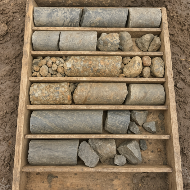
Sandstones, Conglomerates and Flysch
Sedimentary rocks formed by the cementation of fragments of other pre-existing rocks. They include sandstones (cemented sand), conglomerates (cemented gravels) and the rhythmic alternation of sandston
View details -
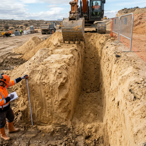
Fine sands and silts
Fine to very fine granular soils with medium to loose compacity. Typical of floodplains and coastlines. Although they can support light buildings, they are treacherous soils linked to water processes:
View details -
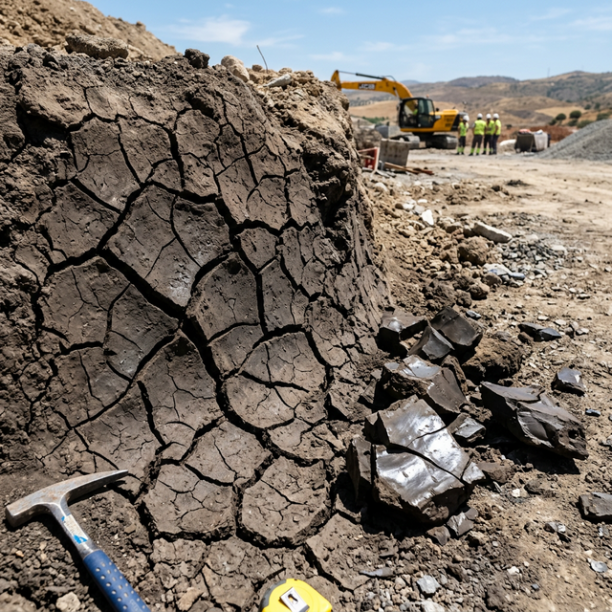
White/Soft Expansive Clays
The great queens of pathology in civil building in Spain. They are frequently found in the lands of barros of Córdoba and Badajoz, the vegas of the Guadalquivir (Mairena, Carmona), the Miocene basin o
View details
The sands and the silts (and the treacherous ground by the river)
However, the subsoil of Manresa is not uniform. Modern Manresa has expanded well beyond the historic core on the Puigcardener, and that expansion has occupied land that is very different geologically.
Areas close to the Llobregat and Cardener rivers are covered by recent Quaternary sediments: fine sands and silts deposited by the currents during their flood periods, as well as terrace gravels. These are much more recent materials —from thousands to tens of thousands of years—and much less consolidated than the sandstones and conglomerates of the deep substrate. Their bearing capacity is more variable, and their behaviour when there is water in the ground can be very different from that of rock.
Fine sands and silts have a feature that makes them particularly treacherous soils for construction: when they are saturated with water, they can behave almost like a fluid. This is the phenomenon known as liquefaction; although in Manresa it does not reach the magnitude of areas that are seismically active, it can still generate significant differential settlements in poorly designed shallow foundations. In addition, fluctuations in the groundwater level alongside the river —which in Manresa can vary considerably between seasons— can affect foundations if they are not taken into account in the calculations.
This is why geotechnical studies in the floodplain and river-terrace areas of Manresa are so important: what appears to be flat, stable ground may hide a layer of soft silt or fine sand that, under a new load, yields unevenly.
The invisible karst: the threat that the eyes do not see
There is a geotechnical risk in Manresa that leaves no surface signs until it is too late. It is not expansive clay, it is not the river silts. It is karst.
The Cardona Formation —that package of rock salt and potassium salts that extends through the subsoil of the Bages— does not crop out in Manresa as it does in Cardona. Here it is covered by metres and metres of sandstone, conglomerate and Quaternary materials. But the groundwater does reach it. And when it arrives, it dissolves it. Slowly in some places. With astonishing speed in others, as demonstrated by Cardona’s more recent history, where mining activity accelerated a karst process that in 2000 forced the Cardener river to be diverted through a tunnel to prevent it being swallowed by the underground galleries.
In the subsoil of Manresa and its surroundings, this dissolution process may be occurring naturally, invisibly and silently, creating voids and cavities that have no expression on the surface until the moment the roof collapses. Geotechnical studies in Manresa must pay particular attention to this possibility: the presence of evaporitic materials in the deep subsoil, even if they are dozens of metres below ground level, is a factor that the foundation design cannot ignore.
The comarca of the Bages forms part of UNESCO’s World Geopark of Central Catalonia precisely because of the exceptional nature of this geological heritage: the best European examples of evaporitic basins, the salt karst of Cardona, the conglomerates of Montserrat. It is an extraordinary territory for science. And for that same reason, it is a territory that demands that anyone building there knows what lies beneath.
What the subsoil of Manresa keeps, layer by layer
Everything above can be read in an indicative stratigraphic profile of the subsoil of Manresa. From the surface down:
| Depth | What there is | What it was |
| 0 – 5 m | Fine sands and silts (floodplain areas) | Llobregat and Cardener fluvial deposits. Recent Quaternary (1 M years) |
| 5 – 13 m | White/soft expansive clays | Lacustrine deposits of the closed upper Eocene basin (~35-40 M years) |
| 13 – 28 m+ | Sandstones, conglomerates and flysch | Deltas, beaches and Eocene marine bottoms (~40-45 M years) |
| Deep subsoil | Evaporites (salt, gypsum, potash) — Fm. Cardona | Dried up inland sea. Upper Eocene (~35-40 M years) |
Four layers. Four worlds. And above all, a town that has been building cathedrals, bridges and factories on top of them for centuries, without knowing exactly what supports its foundations.
Sources: Geological data extracted from the IGME National Geological Map (GEODE 50k and MAGNA 50, sheets 329 and 330) and ICGC. Cardona Formation and geology of the Bages: UNESCO World Geopark of Central Catalonia (geoparc.cat); El medi natural del Bages i del Moianès (elmedinaturaldelbages.cat). History of Manresa: Wikipedia (Manresa), Seu de Manresa (seudemanresa.cat). Salt karst of Cardona: publications of Espeleo Club de Gràcia and Geocamp (geo-camp.net). Seismic data: EMSC/IGN.
Do you need a geotechnical study in Manresa?
Request a no-obligation quote. We’ll advise you on the type of study you need.
- Studies signed by a licensed geologist
- Compliant with the CTE and Eurocode 7
- Coverage throughout Spain


Más de 1000 estudios realizados
Request a free quote
We can contact you via WhatsApp, phone, or email, whichever you prefer.


