The Ría of Vigo was not always here: 20,000 years ago it was a dry valley
Slate and schist forged within the core of the Hespérico Massif. Sandstones that were beaches and deltas in seas that no longer exist. Fine sands on the vega that, for thousands of years, was the bed of a river without the sea. The subsurface of Vigo is the archive of a coastline that changed shape several times before the harbour existed.

Vigo historia
The Berbés fish market, the largest in Europe by volume of fresh fish according to the European Union, is built upon a city that the ocean did not conquer until relatively recently. In geological terms, the present is an oddity: the ria that defines Vigo—that 35-kilometre sea inlet that makes possible the port, the shipyards and the mussel rafts—is a young structure. The valley existed first. The sea arrived later. And the rocks that lie beneath everything—slates, schists, sandstones—have been here for much longer than there has ever been an Atlantic Ocean.
Understanding Vigo’s subsoil means understanding that the city you see is not the only Vigo that has existed.
The oldest rock in the city: stone before Galicia existed
Beneath Vigo, between 20 and 40 metres deep and outcropping in many places across the surface, lies the rock that forms the skeleton of this entire part of the north-west of the Iberian Peninsula: metamorphic slates and schists. Its origin is not Galicia—because Galicia did not exist then—but the Hercynian Massif, the ancient core of the Iberian Peninsula, formed between the Precambrian and the Silurian, between 600 and 400 million years ago. At that time there was no Atlantic, no Pyrenees, no nothing that resembles the current map. What there were were shallow marine basin floors where muds and sands were deposited which, through pressure and heat from the Hercynian Orogeny, were transformed into the metamorphic rocks that IGME maps today beneath Vigo as the Vigo-Pontevedra Complex.
These slates and schists, when the rock mass is healthy and compact, offer good bearing capacity for direct foundation. The historic city knew them well without realising it: Monte do Castro, the hill on which the pre-Roman castro was established and which the Romans later turned into Vicus Spacorum, is made of these same hard rocks. The elevation was not solely a strategic accident. It was geology.
The risk associated with these rocks does not stem from their strength but from their structure: slatey cleavage—those characteristic planes of weakness parallel to the schists—can create slip surfaces when slopes are poorly orientated with respect to the foliation. In a city as irregular as Vigo—built on steep slopes descending to the sea—this factor is not minor.
From the Paleozoic to today: the sandstones that time has not erased
Between the deep slates and the superficial sediments, another material appears in Vigo’s geotechnical profile: sandstones, conglomerates and flysch, between 5 and 20 metres deep. These sedimentary rocks formed during different episodes in the geological history of the Hercynian Cordillera—ancient beaches, deltas and continental platform floors where layers of sand and clay alternated in the rhythmic sequence that geologists call flysch. They are not as old as the slates, but they are also not recent: they have been here since the upper Paleozoic, metamorphosed and deformed to a lesser degree than the rocks beneath them.
In general, they offer favourable conditions for direct foundation, with medium bearing capacity and moderate settlements. The important nuance is that they are not homogeneous: the alternation of harder layers (sandstone) and softer ones can create sharp variations in strength over short distances, something that a geotechnical study must identify precisely at each construction point.
Ground types in Vigo
Characteristic soils in the area, ordered by relevance.
-
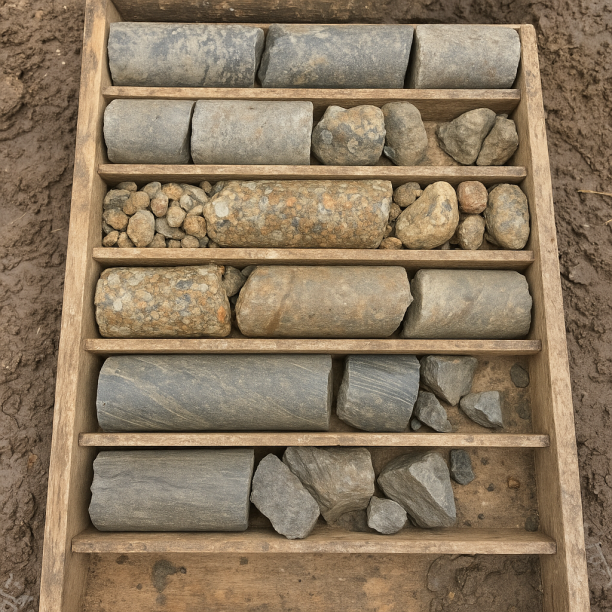
Sandstones, Conglomerates and Flysch
Sedimentary rocks formed by the cementation of fragments of other pre-existing rocks. They include sandstones (cemented sand), conglomerates (cemented gravels) and the rhythmic alternation of sandston
View details -
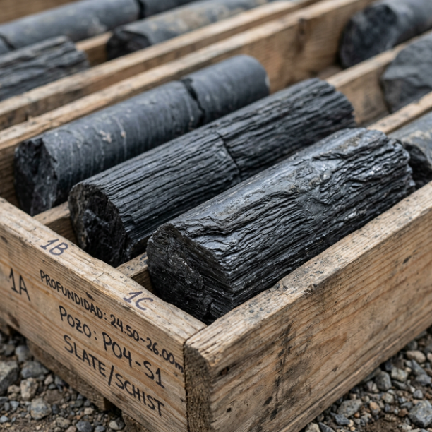
Phyllites and schists
Metamorphic rocks characterised by their foliation (parallel planes of weakness or slaty cleavage). Very common in Galicia, Asturias, the north of León, Extremadura and Sierra Morena. They are highly
View details -
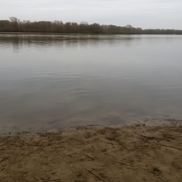
Water mass
Area corresponding to rivers, lakes, reservoirs, lagoons, permanent marshes or submerged coastal strips. The point consulted lies on a body of water identified cartographically by the IGME in its geol
View details -
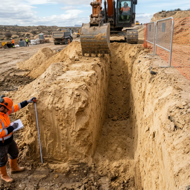
Fine sands and silts
Fine to very fine granular soils with medium to loose compacity. Typical of floodplains and coastlines. Although they can support light buildings, they are treacherous soils linked to water processes:
View details
The sands of the ria: the memory of a valley the sea had not yet found
At the surface, in the first 5 metres of the subsoil, Vigo accumulates fine sands and silts. These are the most recent sediments in the profile, and their story is the most surprising of the three.
20,000 years ago, at the peak of the last glaciation, the sea level was approximately 120 metres below the present. The Vigo ria did not exist. Where there is water today there was a broad fluvial valley traversed by the Verdugo-Oitavén river, which flowed towards a coastline displaced several kilometres to the west of today’s Islas Cíes. These islands—today a national park, today an Atlantic heritage site—were then mountains surrounded by sand flats. From Vigo you could walk to them.
The fine sands and silts that the geotechnical study finds in low-lying areas and the river meadows are, in large part, the sediments from that river and from the times when the sea was rising and depositing its own materials on the bottom of the valley that it was inundating. The San Simón inlet, the inner end of the ria, is the clearest example: a calm-water seabed where the Verdugo and Oitavén rivers have deposited their solid loads for thousands of years, forming layers of mud and poorly consolidated sand.
Geotechnically, these are the most problematic materials in the municipality. Fine sands and silts have high compressibility, a high groundwater table and a punching shear risk when they bear concentrated loads. They are not soils in which you can build direct foundations without careful analysis.
A land that shakes little, but whose sea keeps surprises
The seismicity recorded in the municipality of Vigo over the last 30 years is moderate: 11 events between 1996 and 2026, with a maximum magnitude of M 3.2 (recorded in 1999) and an average magnitude of M 2.04. The last recorded earthquake was in 2025, M 1.5. An earthquake of equivalent magnitude to the maximum occurs approximately every ten years. This level usually does not condition the structural design of conventional buildings.
However, the Galician Atlantic coast has a seismic history that goes beyond recent local records. The Lisbon earthquake of 1 November 1755—one of the largest in European history, estimated between M 8.5 and 9.0—was strongly felt throughout Galicia, with documented effects in Vigo: furniture and picture frames falling, and widespread alarm among the population, according to sources from the time collected by researchers of historical Galician seismicity. An earthquake with an Atlantic epicentre of that magnitude has no equivalent today in the modern record.
In January 2022, an earthquake of M 4.6 with an epicentre in the Atlantic, about 50 km from the coast, was felt in Vigo and in numerous municipalities in the province. The Director of the National Seismic Network, Juan Vicente Cantavella, described it as the largest for which there is evidence in that marine area. It did not cause structural damage, but its existence—together with dozens of small tremors beforehand in Mondariz—reminded people that the Galician Atlantic margin is not tectonically inert.
What Vigo’s subsoil holds, layer by layer
|
Depth |
What there is |
What it was |
|
0–5 m |
Fine sands and silts |
Sediments from the fluvial valley inundated by the ria, and overbank deposits from the Lagares river |
|
5–20 m |
Sandstones, conglomerates and flysch |
Beaches, deltas and upper Paleozoic continental platform deposits, deformed by the Hercynian Orogeny |
|
20–40 m+ |
Slates and schists (Vigo-Pontevedra Complex) |
Marine basin floors from the Precambrian-Silurian, metamorphosed 300-400 Ma ago. The oldest rock in the city |
The Islas Cíes were mountains. The ria was a valley. Monte do Castro was a slate outcrop on plains that the ocean had not yet reached. Vigo has been built upon these rocks since the first inhabitants of the Palaeolithic walked along a coastline that no longer exists, more than 300,000 years ago, according to archaeological evidence from the surrounding area. The current city is the most recent version of a geological history that is not finished.
Sources consulted
· Geotechnical data: https://www.estudiogeotecnico.pro/es/estudio-geotecnico-en-vigo
· Wikipedia in Spanish: article “Vigo” and article “Ría de Vigo”
· Concello de Vigo (hoxe.vigo.org): “La ría de Vigo en el Paleolítico” and “La Ría que fue río” — historical reconstruction of coastal evolution
· Marine Geology Group, University of Vigo: “Los fondos de la Ría de Vigo” (Researchgate, 2008). Geology of the Vigo-Pontevedra Complex and Quaternary sediments
· Historical Galician seismicity: Aretxabala, A. (2013) “Sismicidad en Galicia: desde el Ferrol 1910 y Pontevedra 1920...” (academic blog). Includes reference to the Lisbon earthquake of 1755 and its effects in Vigo.
· M 4.6 earthquake of January 2022: Diario de Pontevedra / Atlántico. Statements by the Director of the National Seismic Network, Juan Vicente Cantavella (IGN).
· Seismic data 1996-2026: Seismic Portal (EMSC/IGN), via data incorporated into estudiogeotecnico.pro
Do you need a geotechnical study in Vigo?
Request a no-obligation quote. We’ll advise you on the type of study you need.
- Studies signed by a licensed geologist
- Compliant with the CTE and Eurocode 7
- Coverage throughout Spain


Más de 1000 estudios realizados
Request a free quote
We can contact you via WhatsApp, phone, or email, whichever you prefer.


