Molina de Aragón, the mineral that bears its name was formed on the seabed of a Triassic sea
Gypsum, dolomites and sandstones below 1.161 metres in altitude. A subsoil that held the secret of a mineral discovered alongside the River Gallo and which today is studied in universities all over the world under a name taken from this city.

Molina de Aragón historia
In 1788, the German mineralogist Abraham Gottlob Werner took some crystals collected alongside the River Gallo, in Molina de Aragón, and subjected them to analysis. They were calcium carbonate, the same as calcite, but with a different crystal structure. Sufficient to declare it a new mineral. He named it after the place where it was found: Molina de Aragón, which he believed to belong to Aragón. The geographical error was recorded forever. The mineral is called aragonite, and its type locality —the point on the planet where it was described for the first time for science— is this city of Guadalajara.
What Werner did not know is that those hexagonal crystals, which locals called «torrecillas», are the direct trace of an inland sea that covered this territory 220 million years ago. The ground of Molina de Aragón is not just earth. It is a stratified archive that runs from the Triassic to the Quaternary and, layer by layer, explains why this place has a medieval castle, why the river carved out spectacular canyons and why the city habitually records the lowest temperatures in Spain.
The gypsum at the bottom of the world (0–12 m)
The first layers you would find if you excavated in Molina de Aragón are gypsum, anhydrite and salts. On the surface of the municipality, this material forms a strip that affects foundations and advises serious prior studies before building anything.
Imagine the Dead Sea, but much bigger, and 220 million years ago. That is what was here during the Upper Triassic, in the period that geologists call the Keuper. A closed basin with no outlet to the ocean, in an arid climate close to the equator. The water evaporated. The dissolved minerals precipitated on the bottom and formed layers of gypsum, salt and anhydrite. Year after year, over millions of years.
It is precisely in those Triassic layers that aragonite grows naturally: the mineral discovered here is typically found in Keuper gypsums and marls, as documented by Wikipedia in the article on aragonite. The «torrecillas» that Torrubia described in 1754 in his Aparato para la Historia Natural Española —the first written reference to the mineral— were on a small hillock by the River Gallo, exactly over that Triassic evaporitic substrate.
Geotechnically, gypsum is the most delicate material in the Molinés subsurface: medium expansivity, high settlements, high groundwater level. Foundations on top of it must be designed to resist possible volume loss due to dissolution. Water here works slowly, but does not stop.
The dolomites of the Jurassic sea (12–27 m)
Further down, between 12 and 27 metres, the subsurface changes its record. Sandstones, conglomerates and flysch appear: detrital materials that represent more than 47% of the Molinés subsurface according to the data from estudiogeotecnico.pro. And alongside them, at greater depth, Jurassic limestones and dolomites provide most of the ground’s bearing capacity.
Between 200 and 145 million years ago, Molina de Aragón was covered by a shallow tropical sea, similar to the current Persian Gulf. Marine organisms —corals, sea urchins, molluscs— built their shells with calcium carbonate. When they died, they accumulated on the seabed. Over time and under pressure, that sediment consolidated into limestone. Dolomitisation came afterwards: the magnesium in the marine water replaced part of the calcium, transforming the limestone into dolomite.
These Jurassic dolomites are what the River Gallo has been cutting for millions of years. The result is the spectacular canyons in the surroundings of the Parque Natural del Alto Tajo, declared a site of geological interest in the application for the Geopark of Molina and the Alto Tajo. The same rock that supports the foundations of the medieval castle —whose Arab alcázar dates from the 10th century, according to Wikipedia, and which was extended by the Counts of Lara until the end of the 13th century— is the one the river sculpts into tens-of-metres cuttings downstream.
The risk in these layers does not come from strength —dolomites are hard and competent materials— but from karst. Acid water dissolves limestone and dolomitic rock over time, creating cavities and underground conduits invisible from the surface. Before building foundations in Molina de Aragón, it is advisable to verify that no such discontinuities exist beneath the points of loading.
Ground types in Molina de Aragón
Characteristic soils in the area, ordered by relevance.
-
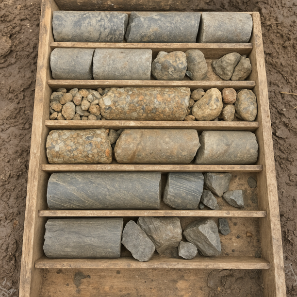
Sandstones, Conglomerates and Flysch
Sedimentary rocks formed by the cementation of fragments of other pre-existing rocks. They include sandstones (cemented sand), conglomerates (cemented gravels) and the rhythmic alternation of sandston
View details -
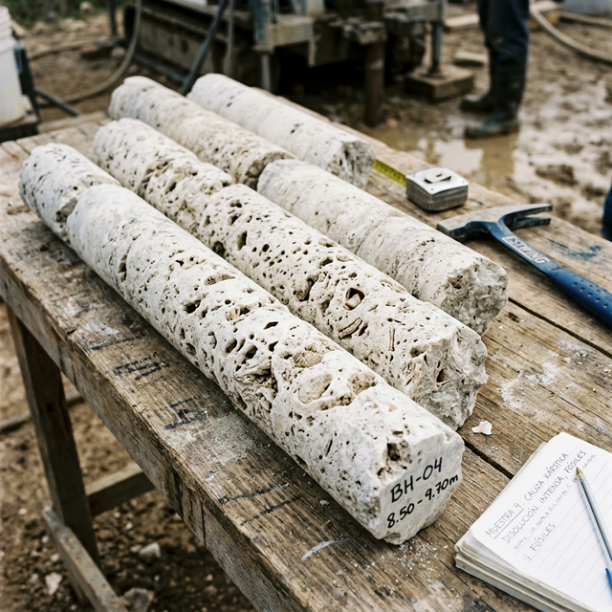
Limestones, Dolomites and Marbles
karstic structures (caves, sinkholes, dolines) that pose the main geotechnical risk.
View details -
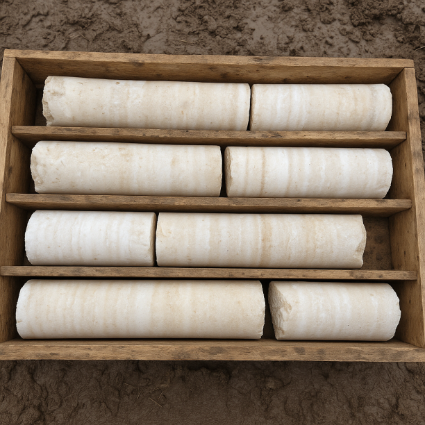
Gypsum, Anhydrite and Salts
Chemically formed sedimentary rocks produced by the precipitation of minerals dissolved in closed basins. Gypsum predominates (calcium sulphate) and, to a lesser extent, anhydrite and salts (halite).
View details
The sandstones of the rivers that are no longer there (27–47 m +)
Bringing everything together, sandstones and conglomerates speak of very different periods: some correspond to the Triassic, others to the Miocene —just about 20 million years ago, in geological terms almost yesterday— and they appear in the south-eastern part of the municipal area, as documented by the IGME in sheets 489, 490 and 514 of the MAGNA geological map.
Sandstones are ancient seabeds, deltas or rivers with tranquil flow. Conglomerates —cemented rounded pebbles— are evidence of rivers far more energetic than those present today. The River Gallo that today runs through Molina was, at some point in the geological past, part of a river network on a very different scale. The Miocene conglomerates in the south-east are the trace of that system.
It is likely that the Celtiberians who settled in this territory from the 7th century BC —sources record archaeological sites in the areas of Tartanedo and La Yunta— chose the terraces above the River Gallo for the same reason that water does: resistant, well-drained materials with good bearing capacity. Geology does not decide history, but it channels it.
The land that hardly trembles
The seismic record of Molina de Aragón is notably calm. The data from the Seismic Portal (EMSC/IGN) available on estudiogeotecnico.pro show a single event in the last 30 years: an earthquake of magnitude 2.1 that occurred in 2010. Imperceptible to most residents. The maximum magnitude recorded is, precisely, that same M 2.1.
Molina’s tectonic position explains it: the Sistema Ibérico, the mountain range on which the city sits, is a geologically mature structure, with none of the active stresses that characterise the plate boundaries. There are no relevant active faults nearby that accumulate significant tension.
This contrasts with other parts of Castilla-La Mancha where historical seismicity has been higher. Molina’s seismic calm means that the main geotechnical constraint is not structural design against earthquakes, but the management of karst and gypsum dissolution: slow, silent risks that work on a different time scale.
What the subsurface of Molina de Aragón keeps, layer by layer
|
Depth |
What there is |
What it was |
|
0–12 m |
Gypsum, anhydrite and salts |
Evaporitic closed basin of the Upper Triassic (Keuper), ~220 M.a. An inland sea that slowly dried out under an arid equatorial climate. Origin of aragonite. |
|
12–27 m |
Sandstones, conglomerates and flysch |
Beaches, deltas and rivers of the Triassic and Jurassic. Transition between the seas and the fluvial systems that replaced them. The rock that bears the weight of the castle. |
|
27–47 m + |
Limestones, dolomites and marbles |
Deep, shallow tropical Jurassic seabed (200–145 M.a.). The same materials that the River Gallo cuts today in the canyons of Alto Tajo. Competent base of the territory. |
There are cities that owe their name to a river, a founder, a battle. Molina de Aragón owes it to a rebellion: in 1366, its inhabitants rejected the cession of the lordship to a French lieutenant and decided to place themselves under the Crown of Aragón, as recorded by Wikipedia. The name remained even though the city returned to Castile nine years later. And since 1788, that name has also travelled in mineralogy manuals around the world, in the term aragonite, for some crystals collected alongside the Gallo on a seabed that has been turned into rock for 220 million years.
Sources
• Estudio Geotécnico PRO — estudiogeotecnico.pro/es/estudio-geotecnico-en-molina-de-aragon
• Wikipedia in Spanish — Molina de Aragón (history, geology, geography)
• Wikipedia in Spanish — Aragonito (mineral history and type locality)
• IGME — Sheets 489, 490 and 514 of the MAGNA Geological Map 50 (1:50,000, second series)
• Museo Nacional de Ciencias Naturales (CSIC) — «El aragonito no procedía de Aragón». Blog MNCN. Accessed June 2026.
• Torrubia, J. (1754). Aparato para la Historia Natural Española. First written reference to aragonite.
• EMSC / IGN — Seismic Portal. Historical seismicity for Molina de Aragón (minimum magnitude: 1.5). Accessed June 2026.
• Geopark of the Comarca de Molina y el Alto Tajo Candidature Report (geoparquemolina.es).
• Turismo Molina de Aragón — molinadearagonturismo.es/descubre-molina-de-aragon/historia/. Accessed June 2026.
Do you need a geotechnical study in Molina de Aragón?
Request a no-obligation quote. We’ll advise you on the type of study you need.
- Studies signed by a licensed geologist
- Compliant with the CTE and Eurocode 7
- Coverage throughout Spain


Más de 1000 estudios realizados
Request a free quote
We can contact you via WhatsApp, phone, or email, whichever you prefer.


