Jerez de la Frontera: the city that learned to store grain and wine because the subsoil never forgot
Beneath the stones of the Alcázar, time is not only seen: it is stored. Ancient silos, the remains of hut floors, and layers of materials that today make up the ground explain why this area attracted settlements and why the landscape, with its more or less “capable” and more or less stable soil, conditioned trades and decisions.

Vista de excavaciones en el Alcázar de Jerez de la Frontera, donde se documentaron fondos de cabañas y huellas de antiguos silos (hallazgos ligados al Calcolítico).
Between the arcades of the Alcázar, the air seems still. But if you pause to look at the excavated ground, that stillness is deceptive: there are traces of silos and of life from thousands of years ago, as if the subsoil had been a kind of natural storehouse for societies that needed to keep time, moisture and chance under control.
The key lies in how the material beneath your feet is distributed: a calcareous base and associated rocks from ancient marine environments, alternating with sands and silts, plus a smaller fraction of expansive clays that — when they appear in certain areas — can make construction more delicate. With that “map” under the ground, Jerez was able to support long-lasting settlements and, later on, turn agriculture and trade into an urban driving force.
Limestones, dolomites and marbles: the “foundation” that favours permanence
There are landscapes that change in just a few generations, like a river changing its course. Calcareous bedrock, by contrast, tends to provide stability: limestones and dolomites are rocks which, when they dominate, generally resist the rapid transformation of the ground better than softer materials. In the geological past, this type of rock is usually formed in marine settings, and in western Andalucía it appears as part of the rocky “framework” that supports much of the soils.
In the case of Jerez, this set occupies 39.75% of the subsoil according to the geotechnical study used for the outreach work.
This predominance does not, by itself, explain human history, but it does help to understand why the area could be chosen again and again: when the ground provides a relatively consistent base for foundations, it is easier for structures, routes and land uses to be maintained over centuries. And in Jerez, moreover, archaeology shows continuity: at the Alcázar, findings have been described of the floors of dwellings and the footprint of ancient silos, linked to a Chalcolithic settlement from 5000 years ago.
Fine sands and silts: the material that “works” with water
The silt zone between solid and loose ground is sometimes where settlements begin: sands and silts behave differently in the presence of moisture, and that affects how sites are prepared for living and for storage. Against the idea that “rock” always means difficulty, nuance matters here: sandy-silty ground can provide useful conditions for crops and, furthermore, for building solutions adapted to the behaviour of the ground.
In the subsoil distribution of Jerez, fine sands and silts account for 21.85%.
The documented history does not speak of “sand-silt” as a direct cause of trade, but it does place Jerez within a sequence of cultures from early times. Human presence is evidenced from the Chalcolithic or the upper Neolithic, drawn by the wealth of the Lacus Ligustinus that existed at the time. With that combination of nearby resources and ground suitable for supporting communities, it becomes easier to understand why settlements were not isolated episodes.
Sandstones, conglomerates and flysch: layers that tell a past of coasts and riverbanks
If limestones are the resilient “body”, sandstones, conglomerates and flysch act like the geological scar of ancient transport environments. Where there were once currents capable of moving sediments — beaches, deltas, riverbanks or marine slopes — today materials may remain that help explain why the territory was “readable” to human generations: not only was what could be sown valuable, but also what could be excavated, levelled and built.
Ground types in Jerez de la Frontera
Characteristic soils in the area, ordered by relevance.
-
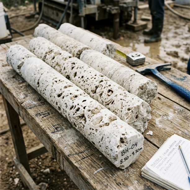
Limestones, Dolomites and Marbles
karstic structures (caves, sinkholes, dolines) that pose the main geotechnical risk.
View details -
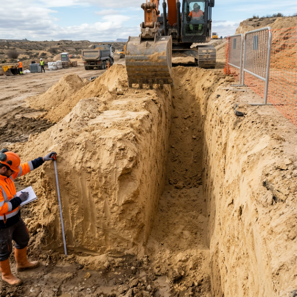
Fine sands and silts
Fine to very fine granular soils with medium to loose compacity. Typical of floodplains and coastlines. Although they can support light buildings, they are treacherous soils linked to water processes:
View details -
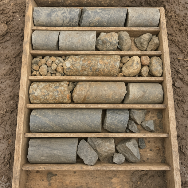
Sandstones, Conglomerates and Flysch
Sedimentary rocks formed by the cementation of fragments of other pre-existing rocks. They include sandstones (cemented sand), conglomerates (cemented gravels) and the rhythmic alternation of sandston
View details -
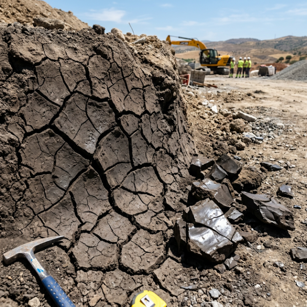
White/Soft Expansive Clays
The great queens of pathology in civil building in Spain. They are frequently found in the lands of barros of Córdoba and Badajoz, the vegas of the Guadalquivir (Mairena, Carmona), the Miocene basin o
View details
In the subsoil of Jerez, this package occupies 12.77%.
The link with human time can be seen by looking at the Alcázar as a setting for continued uses. During excavations carried out in July 2009, the floors of dwellings and the footprint of silos corresponding to prehistoric settlements from the Chalcolithic period were documented, together with a reference to a long cultural sequence spanning Tartessian, Phoenician, Roman, Visigothic, Muslim, Jewish and Christian periods.
It is likely that this “reading” of the ground — where it could be disturbed more easily, where conditions differed in terms of compaction or drainage — helped influence the choice of certain areas for storage. There is no single record that proves it step by step, but the combination of silo archaeology and the distribution of subsoil materials fits with a city which, even before being “wine”, was already solving an essential issue: how to store.
Expansive clays: when the ground changes character
There is a type of ground that does not always fail, but it can become unpredictable when water enters and leaves. In Jerez, the white/soft expansive clays appear with a lower weight in the overall subsoil set (8.42%), but the study links them to risk areas for expansivity of low to high depending on the site and the climatic context.
In practical terms for urban history, this does not mean that “Jerez could not build”. It means something subtler: in some areas of the municipality, expansion and contraction of the ground may require adaptations in foundations and in the way structures are founded. When one looks at the city’s long duration, it becomes clearer why, over time, civil works tend to incorporate adaptation techniques: the subsoil is not a neutral surface.
In addition, the geotechnical study records other processes to monitor, such as possible areas of karst subsidence associated with gypsum and/or carbonated formations, and ground movements such as landslides in soft formations. Again, this is not about turning it into an alarm: it is about recognising that the “underground landscape” conditions everything.
Seismic section: relative calm with recorded earthquakes
The seismicity of a place is not remembered in the same way as one remembers a church date. It is measured with data and compared against collective memory. In Jerez, the records from the seismological portal consulted for this work (EMSC/IGN via Seismic Portal) show behaviour with events, but of moderate magnitudes.
Over the last 30 years (the period consulted in the reference study for seismicity), 167 events were recorded. The maximum magnitude recorded in that set was 4.4 (type mb), with the date 2005-06-15. The magnitude of the most recent earthquake within the list used is 1.9 (type ml), with the date 2026-03-12.
With these values, the seismic message for urban history is clear: Jerez is not defined by large, frequent shocks, but by a territory where life continues while the subsoil “works” through events of low to moderate energy. This aligns with the archaeological continuity that the local record itself attributes to the municipal area.
What the subsoil of Jerez de la Frontera holds, layer by layer
| Depth | What is there | What it used to be |
|---|---|---|
| 0 – 5 m | Fine sands and silts (21.85%) | Floors and low-energy zones where fine sediments accumulated, such as a floodplain-type environment or calm accumulations around ancient bodies of water. |
| 5 – 20 m | Limestones, dolomites and marbles (39.75%) | Rocky material of marine origin, associated with seabeds where carbonates accumulated and, over time, transformed into consolidated rocks. |
| 20 – 50 m | Sandstones, conglomerates and flysch (12.77%) | Deposits linked to transport by currents and to coastal or marine environments with sand inputs and, in some layers, gravels and mixed sediments. |
| 50 – 100 m | White/soft expansive clays (8.42%) | Clays associated with sedimentation phases of quiet waters; the clay component can respond to changes in moisture with expansivity. |
In Jerez, the archaeology of the Alcázar speaks not only of people who lived there: it speaks of a relationship between storing and building. Under the city, the mixture of limestones and fine sediments creates a setting in which settlement could be repeated, while clays and other processes forced living alongside ground that does not always behave in the same way. And when you look back at the stones, you understand that time is not only in the walls: it is also in the soil.
Do you need a geotechnical study in Jerez de la Frontera?
Request a no-obligation quote. We’ll advise you on the type of study you need.
- Studies signed by a licensed geologist
- Compliant with the CTE and Eurocode 7
- Coverage throughout Spain


Más de 1000 estudios realizados
Request a free quote
We can contact you via WhatsApp, phone, or email, whichever you prefer.

