Estudio geotécnico in Gandia
Do you need a Geotechnical study?
Find the best price and service in Gandia. Get a free quote.
More than 1000 geotechnical studies carried out
Approximate price 750€
We can contact you via WhatsApp, phone, or email, whichever you prefer.
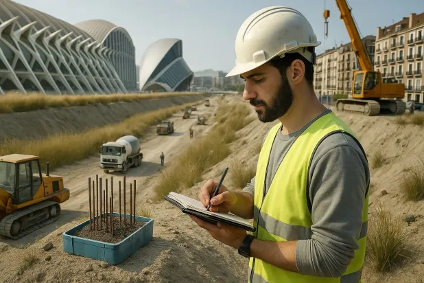
Comprehensive Geotechnical Studies
Comprehensive Geotechnical Studies
We combine field analysis and laboratory testing to provide accurate technical reports and foundation solutions.


Expert professional
Expert professional
Technicians with more than 15 years of experience in the industry. We are specialists in access to difficult locations such as sites with level changes, basements, etc.
Accredited
Accredited
Geotechnical calculations comply with the rules established by Eurocode 7, UNE-EN ISO 22476-4:2016.

Best price
Best price
Very competitive prices. The best prices for geotechnical studies in Spain. Request a quote and check it.
Speed and quality
Speed and quality
Within 7 to 10 days you will receive a signed report from a geologist. It is mandatory in order to carry out new construction or refurbishment works that involve modifications to the structure.

Work areas
We provide Geotechnical study in all towns of Gandia.
This includes the following geographic areas: Alicante, Castellón, Valencia, Comunidad Valenciana and surrounding areas.
We come to your home in Gandia when it suits you best, agreeing a day and time.

Types of ground in Gandia
In Gandia, the predominant composition of the subsoil is dominated by limestones, dolomites and marbles, accompanied by frequent fine sands and silts. The presence of these materials generally implies favourable bearing capacity in most of the municipality, thanks to the mechanical strength of the carbonated materials and the compactness of some sandy fractions. However, the possible occurrence of white or soft expansive clays, although occasional, requires special attention in the identified areas, as they can affect the uniformity of the settlement of shallow foundations. The high permeability levels associated with the presence of extensive aquifers must also be taken into account for foundation design and protection against moisture.
Seismicity in Gandia is classified as very low, with only 5 events over 30 years and a maximum magnitude below 4.5, so it does not represent a relevant constraint for conventional structural design. However, as it is a geological setting dominated by carbonated materials, it is essential to carry out a prior verification of karst phenomena before proceeding with the foundation, due to the potential presence of underground cavities and sinkholes that could compromise stability. Finally, the absence of a predominant clayey substrate makes it possible to rule out the risk of expansivity as a determining factor.
Calizas, Dolomías y Mármoles
32.22%Arenas finas y limos
20.60%Masa de agua
2.47%
Construction risks in Gandia
Approximate estimates. They do not replace the geotechnical study.
| Soil type | Expansivity | Settlements | Water table | Seismicity | Minimum foundation |
|---|---|---|---|---|---|
| Calizas, Dolomías y Mármoles | Nula | Media | Media | Baja | Generalmente cimentación directa mediante zapatas arrios... |
| Arenas finas y limos | Nula | Alta | Alta | Alta | Para evitar punzonamientos locales se usa profusamente l... |
| Arcillas Expansivas Blancas/Blandas | Alta | Alta | Baja | Baja | Inviable la zapata superficial pura. O bien losa hiperrí... |
| Gravas y Arenas compactas | Nula | Baja | Alta | Baja | Cimentación superficial convencional sin problemas. Losa... |
| Areniscas, Conglomerados y Flysch | Nula | Media | Media | Media | Cimentación directa viable en la mayoría de los casos. P... |
| Arcillas y Margas sobreconsolidadas (Duras) | Media | Media | Baja | Baja | Cimentación directa viable. Rara vez se acude al pilotaj... |
| Masa de agua | Nula | Baja | Alta | Baja | No es posible cimentar sobre una masa de agua. Si la par... |
Interactive geological map · Gandia
Mapping: IGME GEODE 50k · IGME MAGNA 50 · ICGC (Catalonia)
Geological Viewer
IGME · ICGC- Click on the map to see the geology at the point.
- Use the layer buttons to switch between geological views (GEODE, MAGNA, Lithology, Hydrogeology).
- Adjust the opacity of the geological layer with the control below.
- Press the full-screen button to expand the viewer.
Geological information
Typical stratigraphic profile
Indicative subsurface cross-section in Gandia · Based on GEODE soil types
Indicative profile based on GEODE soil types and typical CTE thicknesses
Seismic risk in Gandia
- 1 M 3.5 1999
- 2 M 3.2 1998
- 3 M 2.3 2021
How do we carry out your geotechnical study?
How do we carry out your geotechnical study?
Step
Free quote
Free quote
Request a quotation for your geotechnical study. Completely free and with no obligation.
Step
We arrange a day
We arrange a day
We are looking for a day and time to carry out the field study.
Step
Conducting the geotechnical study
Conducting the geotechnical study
We’re going to move and carry out the study. In an hour or two we’ll have finished.
Step
Report submission
Report submission
Within a week we will send you the signed documents of the geotechnical study by an accredited geologist.
Also available in
Spain’s most populated cities
Useful information about Geotechnical study
In-depth articles


Entities and institutions


