For seven million years, Elche has been accumulating what the Mediterranean left behind as it receded
Fine sand, coastal silt, and karst limestone: the subsoil of the palm grove capital holds three distinct chapters of the same marine history. And that history explains why La Dama emerged exactly where it did.

Elche histórica
The Vinalopó River wasn’t always as meager as it is today. Seven million years ago, when the western Mediterranean Sea still covered much of the southeastern part of the Iberian Peninsula, the plain where Elche stands today was the seafloor. Not a dark abyss, but a shallow, warm shelf with fine sediments that settled slowly. As the sea receded, it left behind layers of sand, silt, and fragments of calcareous organisms that gradually compacted under their own weight. What you walk on today in Elche—beneath the cobblestones, beneath the palm grove, beneath the foundations of the Basilica of Santa María—is the result of that long process of abandonment.
Three materials dominate Elche’s subsoil. Each has its own age, origin, and behavior when it comes to foundation work. And all three, read in order, tell a story that stretches from the seabed to the river plain where the Iberians decided to build their city.
The sands left behind by the sea as it receded
The most superficial material in Elche’s subsoil consists of fine sands and silts, which occupy the first five meters of depth across most of the municipal area. Their presence dominates the city’s geotechnical profile. From a construction standpoint, they are the most problematic material: low bearing capacity, a tendency toward differential settlement, and a water table close to the surface in many areas.
Why is there so much fine sand in Elche? Because during the Miocene and Pliocene epochs, this territory was a transition zone between the open sea and the coastline. Fine sand and silt are the characteristic sediments of ancient beaches, deltas, and floodplains near the coast. Similar deposits form today in the Nile Delta or on the low-lying coasts of the Persian Gulf: calm environments where the smallest particles settle because the water’s energy is insufficient to carry them any further.
Geology suggests that for millions of years this was an amphibious territory, straddling the receding sea and the rivers advancing from the Betic Mountains to the north. The Vinalopó River, which today flows through the city with a meager flow, was not always so modest. The silt and sand of its lower basin bear witness to times when it carried much more water—and with it, more sediment.
This sedimentary legacy has a direct consequence: the Elche palm grove, designated a UNESCO World Heritage Site in 2000, is not merely a legacy of Arab agriculture. It is also, albeit unintentionally, a millennia-old solution to soft soil. The deep roots of the date palm—which can reach fifteen meters in search of water—are perfect for sandy subsoil with a high water table. Arab farmers, without realizing it, chose the ideal species for that terrain.
Ground types in Elx/Elche
Characteristic soils in the area, ordered by relevance.
-
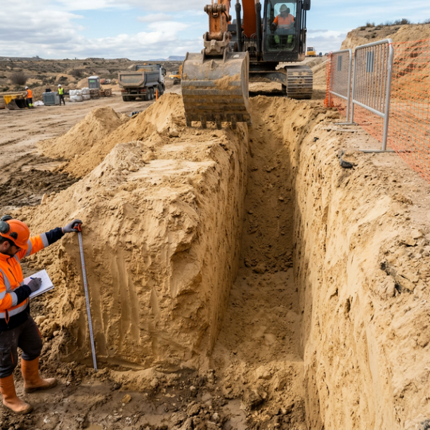
Fine sands and silts
Fine to very fine granular soils with medium to loose compacity. Typical of floodplains and coastlines. Although they can support light buildings, they are treacherous soils linked to water processes:
View details -
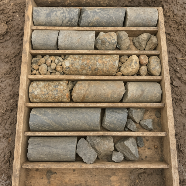
Sandstones, Conglomerates and Flysch
Sedimentary rocks formed by the cementation of fragments of other pre-existing rocks. They include sandstones (cemented sand), conglomerates (cemented gravels) and the rhythmic alternation of sandston
View details -
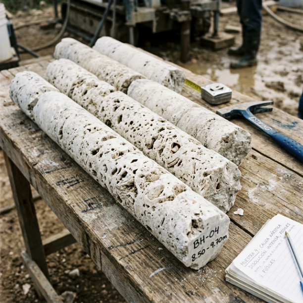
Limestones, Dolomites and Marbles
karstic structures (caves, sinkholes, dolines) that pose the main geotechnical risk.
View details
Sandstones, conglomerates, and the memory of torrential rivers
Between five and twenty meters deep, the subsoil changes character. Loose sand gives way to sandstones, conglomerates, and flysch: older, more compact materials formed when this region was subject to a different geological dynamic.
Sandstones are sand that has been cemented over time. Conglomerates are rounded gravel—river pebbles—that became trapped in a matrix. Both materials tell the story of powerful rivers, of torrents capable of carrying fragments of rock all the way from the Baetic Mountains. Flysch—a rhythmic alternation of layers of sand and clay—is the record of the continental shelf, where turbidity currents deposited increasingly finer materials as they moved away from the coast.
These three materials are more resistant than surface sands, but they exhibit notable variability: their bearing capacity depends on their degree of cementation and the alternation of layers. In construction terms, they allow for direct foundation placement in most cases, though with precautions.
There is a direct historical connection between these materials and Elche’s monumental heritage. The Lady of Elche—the Iberian bust carved between the 5th and 4th centuries B.C., now housed in the National Archaeological Museum in Madrid and discovered by chance in 1897 at the La Alcudia site—was carved from limestone. That limestone did not come from far away: it likely originated from the limestone outcrops in the mountain ranges near the northern part of the city, the final foothills of the Baetic Mountains that form the northern boundary of the municipal area. The sandstones and limestones of the Elche area were also the source of the ashlars used to construct the Roman buildings of Colonia Iulia Ilici Augusta. La Alcudia, the archaeological site where that city stood for more than eight centuries, sits on a small elevation—an artificial tell formed by the layering of successive cultures—whose geological base consists precisely of these more compact detrital materials.
The limestones at the bottom: what the tropical sea left behind twenty million years ago
Starting at a depth of twenty meters, the subsoil of Elche changes in nature. Sandstones and conglomerates give way to limestones, dolomites, and marbles: carbonate rocks formed in a tropical marine environment, tens of millions of years before the sediments that cover them.
The limestones are a record of shallow, warm seas, similar to the Caribbean today. On those seafloors, the skeletons of corals, mollusks, and other organisms that secreted calcium carbonate accumulated. Over time, this accumulation compacted and lithified. The mountain ranges surrounding Elche to the north—the Sierra de la Madera, the Sierra Negra, and the Tabaiá—are outcrops of these same limestones, which lie twenty or more meters deep beneath the city.
These rocks are, in principle, the most resistant in Elche’s stratigraphic profile. But they pose a specific risk that the geotechnical assessment identifies as a priority: karstification. Slightly acidic water, as it flows for millions of years through fractures in the limestone, dissolves the rock and creates cavities. Cavities that are invisible from the surface. That give no warning. And that can suddenly compromise the stability of any foundation that has not verified their existence.
The localized presence of these karstic limestones beneath Elche makes geotechnical verification an indispensable technical requirement, especially in areas where the topsoil is thin or where limestone outcrops or lies close to the surface.
Twenty-one earthquakes in thirty years: the relative seismic calm of the Lower Vinalopó
Elche has moderate seismicity. Over the past thirty years—between 1996 and 2026—21 seismic events with a magnitude greater than 1.5 have been recorded in the area. The maximum recorded magnitude is 3.6 (in 2001), with an average magnitude of 2.12. The most recent recorded earthquake occurred this year, 2026, with a magnitude of 1.7. Statistically, an earthquake of a magnitude similar to the maximum occurs approximately every fifteen years.
These figures place Elche at a level of seismic risk that does not require exceptional structural measures, but which is by no means negligible. The province of Alicante is part of a tectonically active region: the Baetic Mountains, which run along the southeastern edge of the Iberian Peninsula, are the result of the collision between the Iberian Plate and the African Plate, a process that began about 25 million years ago and has not yet concluded.
This tectonic activity has a verified historical record in the region. The 1829 Torrevieja earthquake—one of the most destructive in Spanish history, with an estimated magnitude of around 6.6 according to IGN records—severely affected towns in the province of Alicante and caused the total destruction of Torrevieja and Guardamar del Segura. Elche, about 30 kilometers away, felt the earthquake with enough intensity to cause damage to buildings in the historic district, according to documentation from that period. That 1829 event serves as the historical benchmark for understanding seismic activity in the area: the relative calm of recent decades does not erase the geological memory of the Torrevieja fault, which runs south of the municipal boundary.
What Elche’s Subsoil Holds, Layer by Layer
|
Depth |
What’s there |
What it used to be |
|---|---|---|
|
0–5 m |
Fine sands and silts |
Ancient beach, coastal plain, and river delta. Quaternary and Late Pliocene deposits |
|
5–20 m |
Sandstones, conglomerates, and flysch |
Torrential rivers and continental shelf. Upper Miocene materials cemented over time |
|
20–40 m+ |
Limestones, dolomites, and marbles |
Shallow tropical seafloor. Marine origin, with a risk of karst cavities |
For seven million years, Elche has been a place where things have been deposited. First the sea, then the rivers, then the palm trees, then the Iberians, then the Romans, then the Arabs, then the shoemakers. Each layer on top of the one before. The subsoil is not the bottom of history: it is its backbone.
Sources consulted:
- Estudiogeotecnico.pro: https://www.estudiogeotecnico.pro/es/estudio-geotecnico-en-elxelche — data on soil types, stratigraphic profile, and seismicity
- Spanish Wikipedia: "Elche" article — history, geography, heritage
- Spanish Wikipedia: “La Alcudia Archaeological Site” article — Lady of Elche, archaeological stratigraphy
- IGN / EMSC (via Seismic Portal): historical seismic data, event catalog 1996–2026
- IGME GEODE 50k: digital geological reference mapping for the Elche area
- Web.igme.es: Fluvial dynamics of the Vinalopó River during the Holocene (Ferrer García, 2018, Geological and Mining Bulletin)
- VisitElche.com and University of Alicante (L'Alcúdia Foundation): verified information about the site
Do you need a geotechnical study in Elx/Elche?
Request a no-obligation quote. We’ll advise you on the type of study you need.
- Studies signed by a licensed geologist
- Compliant with the CTE and Eurocode 7
- Coverage throughout Spain


Más de 1000 estudios realizados
Request a free quote
We can contact you via WhatsApp, phone, or email, whichever you prefer.

