Estudio geotécnico in Villamayor
Do you need a Geotechnical study?
Find the best price and service in Villamayor. Get a free quote.
More than 1000 geotechnical studies carried out
Get personalized attention
We can contact you via WhatsApp, phone, or email, whichever you prefer.
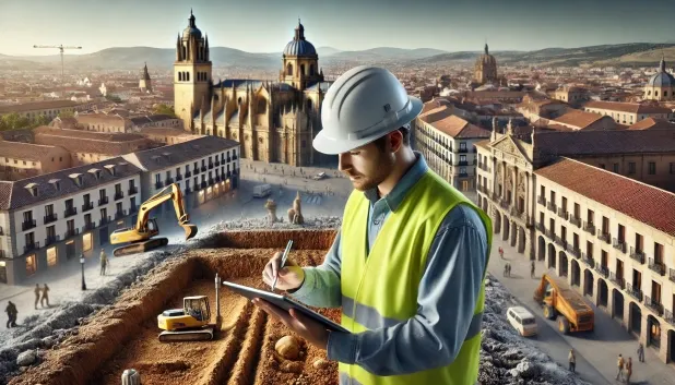
Comprehensive Geotechnical Studies
Comprehensive Geotechnical Studies
We combine field analysis and laboratory testing to provide accurate technical reports and foundation solutions.


Expert professional
Expert professional
Technicians with more than 15 years of experience in the industry. We are specialists in access to difficult locations such as sites with level changes, basements, etc.
Accredited
Accredited
Geotechnical calculations comply with the rules established by Eurocode 7, UNE-EN ISO 22476-4:2016.

Best price
Best price
Very competitive prices. The best prices for geotechnical studies in Spain. Request a quote and check it.
Speed and quality
Speed and quality
Within 7 to 10 days you will receive a signed report from a geologist. It is mandatory in order to carry out new construction or refurbishment works that involve modifications to the structure.

Work areas
We provide Geotechnical study in all localities of Villamayor.
This includes the following geographical areas: Avila Province, Province of Burgos, Province of León, Province of Palencia, Province of Salamanca, Segovia Province, Province of Soria, Province of Valladolid, Zamora Province, Castilla y León and surrounding areas.
We visit your home in Villamayor when it suits you, agreeing on a day and time.

Types of ground in Villamayor
In Villamayor, sandstone, conglomerate and flysch substrates predominate, which present favourable mechanical conditions for shallow foundations due to their good bearing capacity and stability. In areas where there are compact gravels and sands, the bearing capacity is also adequate, although its possible lateral variability should be assessed. Although slates and schists are present only occasionally, they generally provide an efficient response to support buildings, except in areas where they may present alteration or fracturing. Overall, these soils favour foundation stability and allow flexible support options, always bearing in mind the particular characteristics of each stratum.
Seismic activity in Villamayor is very low, with only 3 events over 30 years and a maximum magnitude Mmax of 2.4, which implies that seismic risk is practically negligible for structural design. Since the substrate is not clayey, the risk of expansivity is ruled out, ensuring greater reliability against volumetric ground movements. There are no indications of relevant karst phenomena. Thus, the main geotechnical constraint is the low permeability of the formations, which may influence hydrogeological behaviour and the management of groundwater for the foundations.
Compact gravels and sands
18.43%Phyllites and schists
5.03%
Construction risks in Villamayor
Approximate estimates. They do not replace the geotechnical study.
| Soil type | Expansivity | Settlements | Water table | Seismicity | Minimum foundation |
|---|---|---|---|---|---|
| Sandstones, Conglomerates and Flysch | None | Media | Media | Media | Direct foundation is feasible in most cases. For flysch ... |
| Compact gravels and sands | None | Downward | High | Downward | Conventional shallow foundation without problems. Raft f... |
| Phyllites and schists | None | Media | Media | Media | Shallow foundation if the stratum is competent. Strong b... |
Interactive geological map · Villamayor
Mapping: IGME GEODE 50k · IGME MAGNA 50 · ICGC (Catalonia)
Geological Viewer
IGME · ICGC- Click on the map to see the geology at the point.
- Use the layer buttons to switch between geological views (GEODE, MAGNA, Lithology, Hydrogeology).
- Adjust the opacity of the geological layer with the control below.
- Press the full-screen button to expand the viewer.
Geological information
Typical stratigraphic profile
Indicative subsurface cross-section in Villamayor · Based on GEODE soil types
Indicative profile based on GEODE soil types and typical CTE thicknesses
Seismic risk in Villamayor
Seismic risk is assessed at municipal level. These are aggregated data for the area.
- 1 M 2.4 2009
- 2 M 2.3 2015
- 3 M 1.8 2022
How do we carry out your geotechnical study?
How do we carry out your geotechnical study?
Step
Free quote
Free quote
Request a quotation for your geotechnical study. Completely free and with no obligation.
Step
We arrange a day
We arrange a day
We are looking for a day and time to carry out the field study.
Step
Conducting the geotechnical study
Conducting the geotechnical study
We’re going to move and carry out the study. In an hour or two we’ll have finished.
Step
Report submission
Report submission
Within a week we will send you the signed documents of the geotechnical study by an accredited geologist.
Also available in
Spain’s most populated cities
Useful information about Geotechnical study
In-depth articles


Entities and institutions


