Estudio geotécnico in Turégano
Do you need a Geotechnical study?
Find the best price and service in Turégano. Get a free quote.
More than 1000 geotechnical studies carried out
Get personalized attention
We can contact you via WhatsApp, phone, or email, whichever you prefer.
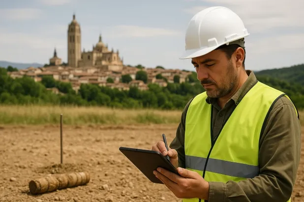
Comprehensive Geotechnical Studies
Comprehensive Geotechnical Studies
We combine field analysis and laboratory testing to provide accurate technical reports and foundation solutions.


Expert professional
Expert professional
Technicians with more than 15 years of experience in the industry. We are specialists in access to difficult locations such as sites with level changes, basements, etc.
Accredited
Accredited
Geotechnical calculations comply with the rules established by Eurocode 7, UNE-EN ISO 22476-4:2016.

Best price
Best price
Very competitive prices. The best prices for geotechnical studies in Spain. Request a quote and check it.
Speed and quality
Speed and quality
Within 7 to 10 days you will receive a signed report from a geologist. It is mandatory in order to carry out new construction or refurbishment works that involve modifications to the structure.

Work areas
We provide Geotechnical study in all locations across Turégano.
This includes the following geographical areas: Avila Province, Province of Burgos, Province of León, Province of Palencia, Province of Salamanca, Segovia Province, Province of Soria, Province of Valladolid, Zamora Province, Castilla y León and surrounding areas.
We travel to your home in Turégano when it suits you, agreeing on a day and time.

Types of ground in Turégano
In Turégano, a substratum of slates and schists predominates, providing a solid base and high compactness for foundations, although its low permeability influences the drainage of groundwater. Compact gravels and sands, which occur occasionally, offer good conditions for bearing capacity, while sandstones, conglomerates and flysch contribute to a lithological diversity that must be well characterised in any geotechnical study prior to design. The low presence of limestones and dolomites reduces, though it does not eliminate, the risk of alteration due to dissolution; therefore, precise identification of the support layer is essential for determining the optimal foundation type.
The area shows high seismicity, with more than 150 recorded events and a maximum magnitude of 4.7, which requires that structural design and foundation solutions consider seismic actions in accordance with current regulations. Although the substratum is not clayey and rules out the risk of expansivity, the possible existence of karst processes must be verified before executing foundations, given the occasional occurrence of carbonate materials in the subsoil. In conclusion, the main constraint for a geotechnical study in Turégano lies in the combined seismicity with the need to rule out local karst phenomena.
Phyllites and schists
53.86%Compact gravels and sands
18.03%
Construction risks in Turégano
Approximate estimates. They do not replace the geotechnical study.
| Soil type | Expansivity | Settlements | Water table | Seismicity | Minimum foundation |
|---|---|---|---|---|---|
| Phyllites and schists | None | Media | Media | Media | Shallow foundation if the stratum is competent. Strong b... |
| Sandstones, Conglomerates and Flysch | None | Media | Media | Media | Direct foundation is feasible in most cases. For flysch ... |
| Compact gravels and sands | None | Downward | High | Downward | Conventional shallow foundation without problems. Raft f... |
| Limestones, Dolomites and Marbles | None | Media | Media | Downward | In general, direct foundation using braced strip footing... |
Interactive geological map · Turégano
Mapping: IGME GEODE 50k · IGME MAGNA 50 · ICGC (Catalonia)
Geological Viewer
IGME · ICGC- Click on the map to see the geology at the point.
- Use the layer buttons to switch between geological views (GEODE, MAGNA, Lithology, Hydrogeology).
- Adjust the opacity of the geological layer with the control below.
- Press the full-screen button to expand the viewer.
Geological information
Typical stratigraphic profile
Indicative subsurface cross-section in Turégano · Based on GEODE soil types
Indicative profile based on GEODE soil types and typical CTE thicknesses
Seismic risk in Turégano
Seismic risk is assessed at municipal level. These are aggregated data for the area.
- 1 M 4.7 2006
- 2 M 4.6 1998
- 3 M 4.6 2007
How do we carry out your geotechnical study?
How do we carry out your geotechnical study?
Step
Free quote
Free quote
Request a quotation for your geotechnical study. Completely free and with no obligation.
Step
We arrange a day
We arrange a day
We are looking for a day and time to carry out the field study.
Step
Conducting the geotechnical study
Conducting the geotechnical study
We’re going to move and carry out the study. In an hour or two we’ll have finished.
Step
Report submission
Report submission
Within a week we will send you the signed documents of the geotechnical study by an accredited geologist.
Also available in
Spain’s most populated cities
Useful information about Geotechnical study
In-depth articles


Entities and institutions


