Estudio geotécnico in Tortosa
Do you need a Geotechnical study?
Find the best price and service in Tortosa. Get a free quote.
More than 1000 geotechnical studies carried out
Approximate price 750€
We can contact you via WhatsApp, phone, or email, whichever you prefer.
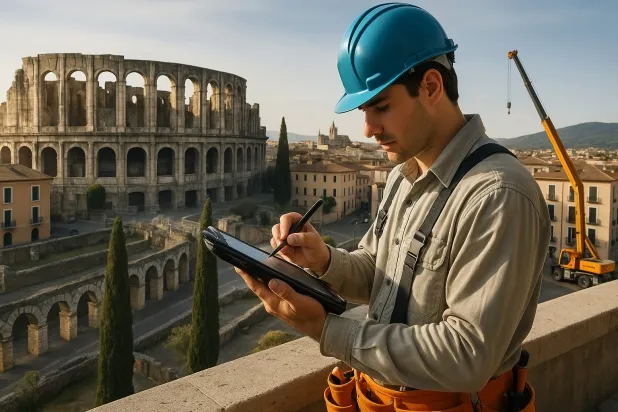
Comprehensive Geotechnical Studies
Comprehensive Geotechnical Studies
We combine field analysis and laboratory testing to provide accurate technical reports and foundation solutions.


Expert professional
Expert professional
Technicians with more than 15 years of experience in the industry. We are specialists in access to difficult locations such as sites with level changes, basements, etc.
Accredited
Accredited
Geotechnical calculations comply with the rules established by Eurocode 7, UNE-EN ISO 22476-4:2016.

Best price
Best price
Very competitive prices. The best prices for geotechnical studies in Spain. Request a quote and check it.
Speed and quality
Speed and quality
Within 7 to 10 days you will receive a signed report from a geologist. It is mandatory in order to carry out new construction or refurbishment works that involve modifications to the structure.

Work areas
We provide Geotechnical study in all locations of Tortosa.
This includes the following geographical areas: Province of Barcelona, Girona Province, Province of Lleida, Province of Tarragona, Cataluña and surrounding areas.
We travel to your home in Tortosa when it suits you, agreeing on a day and time.

Types of ground in Tortosa
In Tortosa, the predominant geotechnical subsoil is made up of fine sands and silts, occasionally accompanied by calcareous formations, dolomites, marbles, as well as gravel and compacted sands. This composition implies variable geomechanical behaviour: while fine sands and silts exhibit moderate bearing capacity and require particular attention to settlement control, episodes of carbonate materials can increase ground strength, offering more favourable options for foundations. It is essential to accurately identify the location of muds or masses of water, as these represent points where it is not advisable to support isolated footings or slabs.
The seismicity of Tortosa, with 23 events in the last 30 years and a moderate maximum magnitude (Mmax 2.6), is considered to be of intermediate level, so it is worth paying attention to, but without extreme constraints in structural design. The risk posed by karstified ground due to the presence of limestones and dolomites makes it necessary to verify any underground cavities before carrying out any foundation works, in order to avoid unexpected subsidence. Likewise, detecting gypsum and salts in the subsurface introduces the possibility of dissolution-related phenomena that must be analysed during the geotechnical study phase. As no expansive clay soils are identified, the risk associated with expansivity is ruled out, leaving the need to control the existence of karstified zones and associated dissolutions as the main constraint.
Fine sands and silts
34.84%Water mass
14.34%
Construction risks in Tortosa
Approximate estimates. They do not replace the geotechnical study.
| Soil type | Expansivity | Settlements | Water table | Seismicity | Minimum foundation |
|---|---|---|---|---|---|
| Fine sands and silts | None | High | High | High | To avoid local punching, the foundation slab is used ext... |
| Water mass | None | Downward | High | Downward | It is not possible to found on a body of water. If the p... |
| Limestones, Dolomites and Marbles | None | Media | Media | Downward | In general, direct foundation using braced strip footing... |
| Sandstones, Conglomerates and Flysch | None | Media | Media | Media | Direct foundation is feasible in most cases. For flysch ... |
| Compact gravels and sands | None | Downward | High | Downward | Conventional shallow foundation without problems. Raft f... |
| Gypsum, Anhydrite and Salts | Media | High | High | Media | The foundation must be designed to withstand local loss ... |
Interactive geological map · Tortosa
Mapping: IGME GEODE 50k · IGME MAGNA 50 · ICGC (Catalonia)
Geological Viewer
IGME · ICGC- Click on the map to see the geology at the point.
- Use the layer buttons to switch between geological views (GEODE, MAGNA, Lithology, Hydrogeology).
- Adjust the opacity of the geological layer with the control below.
- Press the full-screen button to expand the viewer.
Geological information
Typical stratigraphic profile
Indicative subsurface cross-section in Tortosa · Based on GEODE soil types
Indicative profile based on GEODE soil types and typical CTE thicknesses
Seismic risk in Tortosa
- 1 M 2.6 2011
- 2 M 2.6 2008
- 3 M 2.2 2008
How do we carry out your geotechnical study?
How do we carry out your geotechnical study?
Step
Free quote
Free quote
Request a quotation for your geotechnical study. Completely free and with no obligation.
Step
We arrange a day
We arrange a day
We are looking for a day and time to carry out the field study.
Step
Conducting the geotechnical study
Conducting the geotechnical study
We’re going to move and carry out the study. In an hour or two we’ll have finished.
Step
Report submission
Report submission
Within a week we will send you the signed documents of the geotechnical study by an accredited geologist.
Also available in
Spain’s most populated cities
Useful information about Geotechnical study
In-depth articles


Entities and institutions


