Estudio geotécnico in Tables
Do you need a Geotechnical study?
Find the best price and service in Tables. Get a free quote.
More than 1000 geotechnical studies carried out
Get personalized attention
We can contact you via WhatsApp, phone, or email, whichever you prefer.
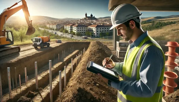
Comprehensive Geotechnical Studies
Comprehensive Geotechnical Studies
We combine field analysis and laboratory testing to provide accurate technical reports and foundation solutions.


Expert professional
Expert professional
Technicians with more than 15 years of experience in the industry. We are specialists in access to difficult locations such as sites with level changes, basements, etc.
Accredited
Accredited
Geotechnical calculations comply with the rules established by Eurocode 7, UNE-EN ISO 22476-4:2016.

Best price
Best price
Very competitive prices. The best prices for geotechnical studies in Spain. Request a quote and check it.
Speed and quality
Speed and quality
Within 7 to 10 days you will receive a signed report from a geologist. It is mandatory in order to carry out new construction or refurbishment works that involve modifications to the structure.

Work areas
We provide Geotechnical study in all locations of Tables.
This includes the following geographical areas: Avila Province, Province of Burgos, Province of León, Province of Palencia, Province of Salamanca, Segovia Province, Province of Soria, Province of Valladolid, Zamora Province, Castilla y León and surrounding areas.
We travel to your home in Tables whenever it suits you, agreeing a day and time.

Types of ground in Tables
In the municipality of Cuadros, sandstones, conglomerates and flysch predominate, accompanied in significant proportions by gravels, compacted sands and stretches of fine sands with silts. These materials, for the most part, show good mechanical performance and a high bearing capacity, favouring shallow foundation solutions across most of the area. The widespread permeability of these aquifers, which are extensive and highly productive, ensures rapid drainage of water, although it is essential to control the groundwater level and the possible risk of internal erosion in the event of deep foundations.
Seismicity in Cuadros is very low, with only 2 events over 30 years and a maximum magnitude of 1.5, which makes it possible to rule out significant design restrictions for structural purposes for this reason. There are no notable karst phenomena or associated risk of significant clay expansion, since these occur subordinately and in environments without any marked water deficit. The main factor to consider in the geotechnical study in Cuadros will be ensuring stability against possible variations in the level of the groundwater table and selecting the most competent support level.
Compact gravels and sands
31.17%Fine sands and silts
21.87%Water mass
6.38%
Construction risks in Tables
Approximate estimates. They do not replace the geotechnical study.
| Soil type | Expansivity | Settlements | Water table | Seismicity | Minimum foundation |
|---|---|---|---|---|---|
| Sandstones, Conglomerates and Flysch | None | Media | Media | Media | Direct foundation is feasible in most cases. For flysch ... |
| Compact gravels and sands | None | Downward | High | Downward | Conventional shallow foundation without problems. Raft f... |
| Fine sands and silts | None | High | High | High | To avoid local punching, the foundation slab is used ext... |
| Water mass | None | Downward | High | Downward | It is not possible to found on a body of water. If the p... |
Interactive geological map · Tables
Mapping: IGME GEODE 50k · IGME MAGNA 50 · ICGC (Catalonia)
Geological Viewer
IGME · ICGC- Click on the map to see the geology at the point.
- Use the layer buttons to switch between geological views (GEODE, MAGNA, Lithology, Hydrogeology).
- Adjust the opacity of the geological layer with the control below.
- Press the full-screen button to expand the viewer.
Geological information
Typical stratigraphic profile
Indicative subsurface cross-section in Tables · Based on GEODE soil types
Indicative profile based on GEODE soil types and typical CTE thicknesses
Seismic risk in Tables
- 1 M 1.5 2010
- 2 M 1.5 2009
How do we carry out your geotechnical study?
How do we carry out your geotechnical study?
Step
Free quote
Free quote
Request a quotation for your geotechnical study. Completely free and with no obligation.
Step
We arrange a day
We arrange a day
We are looking for a day and time to carry out the field study.
Step
Conducting the geotechnical study
Conducting the geotechnical study
We’re going to move and carry out the study. In an hour or two we’ll have finished.
Step
Report submission
Report submission
Within a week we will send you the signed documents of the geotechnical study by an accredited geologist.
Also available in
Spain’s most populated cities
Useful information about Geotechnical study
In-depth articles


Entities and institutions


