Estudio geotécnico in Range
Do you need a Geotechnical study?
Find the best price and service in Range. Get a free quote.
More than 1000 geotechnical studies carried out
Approximate price 750€
We can contact you via WhatsApp, phone, or email, whichever you prefer.
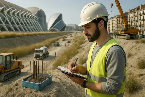
Comprehensive Geotechnical Studies
Comprehensive Geotechnical Studies
We combine field analysis and laboratory testing to provide accurate technical reports and foundation solutions.


Expert professional
Expert professional
Technicians with more than 15 years of experience in the industry. We are specialists in access to difficult locations such as sites with level changes, basements, etc.
Accredited
Accredited
Geotechnical calculations comply with the rules established by Eurocode 7, UNE-EN ISO 22476-4:2016.

Best price
Best price
Very competitive prices. The best prices for geotechnical studies in Spain. Request a quote and check it.
Speed and quality
Speed and quality
Within 7 to 10 days you will receive a signed report from a geologist. It is mandatory in order to carry out new construction or refurbishment works that involve modifications to the structure.

Work areas
We provide Geotechnical study services in all localities of Range.
This includes the following geographical areas: Alicante, Castellón, Valencia, Comunidad Valenciana and surrounding areas.
We travel to your home in Range when it suits you, agreeing a day and time.

Types of ground in Range
In the municipality of Serra, the predominant geological materials are formed by limestones, dolomites and marbles, together with a significant proportion of sandstones, conglomerates and flysch. These types of rock usually offer good bearing capacity, facilitating the design of shallow foundations in areas with rock outcrop. However, the occasional presence of fine sands and silts implies that there may be locally limited zones with reduced support capacity, which will require specific checks before defining the foundation solution. On the other hand, the existence of gypsum, anhydrite and salts introduces the risk of dissolution processes, which may affect both foundation stability and structural durability; this aspect must be examined thoroughly during the geotechnical study phase.
As regards natural hazards, Serra shows moderate seismicity (27 events in 30 years, Mmax of 3.4), which suggests that the seismic context should be taken into account in the analysis, although the activity is not high. The confirmed presence of karstification requires a detailed verification before carrying out any foundation work to avoid differential settlement or the appearance of unexpected cavities. Since the dominant substrate is not clayey, the risk of expansivity is ruled out. The main geotechnical constraint in Serra focuses on the possible presence of karst cavities and, secondarily, on the dissolution of sulphated materials—key aspects to analyse in order to ensure the safety and feasibility of the works.
Fine sands and silts
13.65%Water mass
2.15%
Construction risks in Range
Approximate estimates. They do not replace the geotechnical study.
| Soil type | Expansivity | Settlements | Water table | Seismicity | Minimum foundation |
|---|---|---|---|---|---|
| Limestones, Dolomites and Marbles | None | Media | Media | Downward | In general, direct foundation using braced strip footing... |
| Sandstones, Conglomerates and Flysch | None | Media | Media | Media | Direct foundation is feasible in most cases. For flysch ... |
| Fine sands and silts | None | High | High | High | To avoid local punching, the foundation slab is used ext... |
| Gypsum, Anhydrite and Salts | Media | High | High | Media | The foundation must be designed to withstand local loss ... |
| Water mass | None | Downward | High | Downward | It is not possible to found on a body of water. If the p... |
Interactive geological map · Range
Mapping: IGME GEODE 50k · IGME MAGNA 50 · ICGC (Catalonia)
Geological Viewer
IGME · ICGC- Click on the map to see the geology at the point.
- Use the layer buttons to switch between geological views (GEODE, MAGNA, Lithology, Hydrogeology).
- Adjust the opacity of the geological layer with the control below.
- Press the full-screen button to expand the viewer.
Geological information
Typical stratigraphic profile
Indicative subsurface cross-section in Range · Based on GEODE soil types
Indicative profile based on GEODE soil types and typical CTE thicknesses
Seismic risk in Range
Seismic risk is assessed at municipal level. These are aggregated data for the area.
- 1 M 3.4 2009
- 2 M 3.2 2009
- 3 M 3.1 2011
How do we carry out your geotechnical study?
How do we carry out your geotechnical study?
Step
Free quote
Free quote
Request a quotation for your geotechnical study. Completely free and with no obligation.
Step
We arrange a day
We arrange a day
We are looking for a day and time to carry out the field study.
Step
Conducting the geotechnical study
Conducting the geotechnical study
We’re going to move and carry out the study. In an hour or two we’ll have finished.
Step
Report submission
Report submission
Within a week we will send you the signed documents of the geotechnical study by an accredited geologist.
Also available in
Spain’s most populated cities
Useful information about Geotechnical study
In-depth articles


Entities and institutions


