Estudio geotécnico in Navalmanzano
Do you need a Geotechnical study?
Find the best price and service in Navalmanzano. Get a free quote.
More than 1000 geotechnical studies carried out
Get personalized attention
We can contact you via WhatsApp, phone, or email, whichever you prefer.
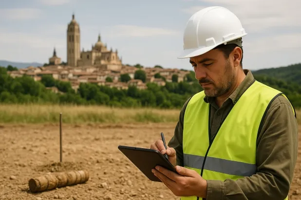
Comprehensive Geotechnical Studies
Comprehensive Geotechnical Studies
We combine field analysis and laboratory testing to provide accurate technical reports and foundation solutions.


Expert professional
Expert professional
Technicians with more than 15 years of experience in the industry. We are specialists in access to difficult locations such as sites with level changes, basements, etc.
Accredited
Accredited
Geotechnical calculations comply with the rules established by Eurocode 7, UNE-EN ISO 22476-4:2016.

Best price
Best price
Very competitive prices. The best prices for geotechnical studies in Spain. Request a quote and check it.
Speed and quality
Speed and quality
Within 7 to 10 days you will receive a signed report from a geologist. It is mandatory in order to carry out new construction or refurbishment works that involve modifications to the structure.

Work areas
We provide Geotechnical study in all locations of Navalmanzano.
This includes the following geographic areas: Avila Province, Province of Burgos, Province of León, Province of Palencia, Province of Salamanca, Segovia Province, Province of Soria, Province of Valladolid, Zamora Province, Castilla y León and surrounding areas.
We will come to your home in Navalmanzano at a time that suits you, agreeing on a day and time.

Types of ground in Navalmanzano
In Navalmanzano, the dominant ground is mainly composed of compact gravels and sands, which provide excellent bearing capacity and facilitate the execution of conventional shallow (direct) foundations. Limestones, dolomites and marbles, present in smaller proportions, also contribute with favourable geomechanical parameters, although they may require additional studies to control the presence of fractures. Areas associated with bodies of water require specific assessment due to their hydrogeological behaviour, but in general there are good conditions for shallow foundation construction.
Seismic activity in Navalmanzano is classified as high, with more than 150 events over 30 years and a maximum magnitude reaching 4.7; therefore, seismic action must be a relevant factor in structural design. Since the substrate is not clayey, the risk associated with expansiveness is ruled out, simplifying construction considerations. The key constraint for geotechnical studies in the area will be the seismic assessment and the detailed characterisation of the supporting material, particularly in areas close to bodies of water.
Compact gravels and sands
64.45%Water mass
13.24%
Construction risks in Navalmanzano
Approximate estimates. They do not replace the geotechnical study.
| Soil type | Expansivity | Settlements | Water table | Seismicity | Minimum foundation |
|---|---|---|---|---|---|
| Compact gravels and sands | None | Downward | High | Downward | Conventional shallow foundation without problems. Raft f... |
| Limestones, Dolomites and Marbles | None | Media | Media | Downward | In general, direct foundation using braced strip footing... |
| Water mass | None | Downward | High | Downward | It is not possible to found on a body of water. If the p... |
Interactive geological map · Navalmanzano
Mapping: IGME GEODE 50k · IGME MAGNA 50 · ICGC (Catalonia)
Geological Viewer
IGME · ICGC- Click on the map to see the geology at the point.
- Use the layer buttons to switch between geological views (GEODE, MAGNA, Lithology, Hydrogeology).
- Adjust the opacity of the geological layer with the control below.
- Press the full-screen button to expand the viewer.
Geological information
Typical stratigraphic profile
Indicative subsurface cross-section in Navalmanzano · Based on GEODE soil types
Indicative profile based on GEODE soil types and typical CTE thicknesses
Seismic risk in Navalmanzano
Seismic risk is assessed at municipal level. These are aggregated data for the area.
- 1 M 4.7 2006
- 2 M 4.6 1998
- 3 M 4.6 2007
How do we carry out your geotechnical study?
How do we carry out your geotechnical study?
Step
Free quote
Free quote
Request a quotation for your geotechnical study. Completely free and with no obligation.
Step
We arrange a day
We arrange a day
We are looking for a day and time to carry out the field study.
Step
Conducting the geotechnical study
Conducting the geotechnical study
We’re going to move and carry out the study. In an hour or two we’ll have finished.
Step
Report submission
Report submission
Within a week we will send you the signed documents of the geotechnical study by an accredited geologist.
Also available in
Spain’s most populated cities
Useful information about Geotechnical study
In-depth articles


Entities and institutions


