Estudio geotécnico in Mancha Real
Do you need a Geotechnical study?
Find the best price and service in Mancha Real. Get a free quote.
More than 1000 geotechnical studies carried out
Get personalized attention
We can contact you via WhatsApp, phone, or email, whichever you prefer.
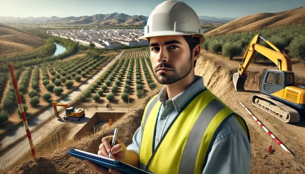
Comprehensive Geotechnical Studies
Comprehensive Geotechnical Studies
We combine field analysis and laboratory testing to provide accurate technical reports and foundation solutions.


Expert professional
Expert professional
Technicians with more than 15 years of experience in the industry. We are specialists in access to difficult locations such as sites with level changes, basements, etc.
Accredited
Accredited
Geotechnical calculations comply with the rules established by Eurocode 7, UNE-EN ISO 22476-4:2016.

Best price
Best price
Very competitive prices. The best prices for geotechnical studies in Spain. Request a quote and check it.
Speed and quality
Speed and quality
Within 7 to 10 days you will receive a signed report from a geologist. It is mandatory in order to carry out new construction or refurbishment works that involve modifications to the structure.

Work areas
We provide Geotechnical study in all localities of Mancha Real.
This includes the following geographic areas: Province of Almería, Province of Cádiz, Province of Córdoba, Province of Granada, Province of Huelva, Province of Jaén, Province of Málaga, Province of Seville, Andalucía and surrounding areas.
We come to your home in Mancha Real when it suits you, agreeing a day and time.

Types of ground in Mancha Real
In Mancha Real, soils of sandstones, conglomerates and flysch predominate, followed by limestones, dolomites and marbles—materials that offer good bearing-capacity conditions and generally allow the construction of shallow or semi-deep direct foundations. The occasional presence of compact gravel and sand is favourable for transmitting loads, whereas clays and marls, although infrequent and overconsolidated, can be considered to have low deformability. The low permeability of most formations limits infiltration, although there is a possibility of finding shallow aquifers in some areas.
Regarding structural risks, seismicity in Mancha Real is very low, with low seismic activity and a maximum recorded magnitude of 3.1, which minimises the need for specific measures on account of this factor. The presence of a karstified environment is a critical aspect to assess, especially in areas of limestones and dolomites, as cavities may occur that affect foundation safety; therefore, it is essential to verify the presence of karst before the development of any project. As for expansivity, expansive clays appear subordinately or in areas with low climatic-risk, which reduces their direct impact. Verification of karst is the main local geotechnical constraint.
Construction risks in Mancha Real
Approximate estimates. They do not replace the geotechnical study.
| Soil type | Expansivity | Settlements | Water table | Seismicity | Minimum foundation |
|---|---|---|---|---|---|
| Sandstones, Conglomerates and Flysch | None | Media | Media | Media | Direct foundation is feasible in most cases. For flysch ... |
| Limestones, Dolomites and Marbles | None | Media | Media | Downward | In general, direct foundation using braced strip footing... |
| Compact gravels and sands | None | Downward | High | Downward | Conventional shallow foundation without problems. Raft f... |
| Overconsolidated clays and marls (Duras) | Media | Media | Downward | Downward | Direct foundation is viable. Piling is rarely resorted t... |
Interactive geological map · Mancha Real
Mapping: IGME GEODE 50k · IGME MAGNA 50 · ICGC (Catalonia)
Geological Viewer
IGME · ICGC- Click on the map to see the geology at the point.
- Use the layer buttons to switch between geological views (GEODE, MAGNA, Lithology, Hydrogeology).
- Adjust the opacity of the geological layer with the control below.
- Press the full-screen button to expand the viewer.
Geological information
Typical stratigraphic profile
Indicative subsurface cross-section in Mancha Real · Based on GEODE soil types
Indicative profile based on GEODE soil types and typical CTE thicknesses
Seismic risk in Mancha Real
- 1 M 3.1 2000
- 2 M 2.7 2014
- 3 M 2 2000
How do we carry out your geotechnical study?
How do we carry out your geotechnical study?
Step
Free quote
Free quote
Request a quotation for your geotechnical study. Completely free and with no obligation.
Step
We arrange a day
We arrange a day
We are looking for a day and time to carry out the field study.
Step
Conducting the geotechnical study
Conducting the geotechnical study
We’re going to move and carry out the study. In an hour or two we’ll have finished.
Step
Report submission
Report submission
Within a week we will send you the signed documents of the geotechnical study by an accredited geologist.
Also available in
Spain’s most populated cities
Useful information about Geotechnical study
In-depth articles


Entities and institutions


