Estudio geotécnico in Lodosa
Do you need a Geotechnical study?
Find the best price and service in Lodosa. Get a free quote.
More than 1000 geotechnical studies carried out
Get personalized attention
We can contact you via WhatsApp, phone, or email, whichever you prefer.
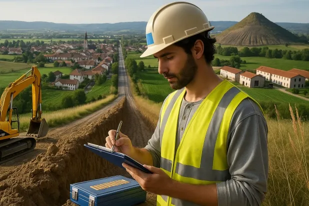
Comprehensive Geotechnical Studies
Comprehensive Geotechnical Studies
We combine field analysis and laboratory testing to provide accurate technical reports and foundation solutions.


Expert professional
Expert professional
Technicians with more than 15 years of experience in the industry. We are specialists in access to difficult locations such as sites with level changes, basements, etc.
Accredited
Accredited
Geotechnical calculations comply with the rules established by Eurocode 7, UNE-EN ISO 22476-4:2016.

Best price
Best price
Very competitive prices. The best prices for geotechnical studies in Spain. Request a quote and check it.
Speed and quality
Speed and quality
Within 7 to 10 days you will receive a signed report from a geologist. It is mandatory in order to carry out new construction or refurbishment works that involve modifications to the structure.

Work areas
We provide Geotechnical study in all localities of Lodosa.
This includes the following geographical areas: Ablitas, Altsasu/Alsasua, Allo, Andosilla, Ansoáin/Antsoain, Aoiz/Agoitz, Aranguren, Arbizu, Los Arcos, Arguedas, Arróniz, Artajona, Ayegui/Aiegi, Azagra, Baztan, Buñuel, Burlada/Burlata, Cabanillas, Cadreita, Caparroso, Cárcar, Carcastillo, Cascante, Castejón, Cintruénigo, Cizur, Corella, Cortes, Etxarri Aranatz, Valley of Egüés/Eguesibar, Noáin (Valle de Elorz)/Noain (Elortzibar), Estella-Lizarra, Esteribar, Ezcabarte, Falces, Fitero, Fontellas, Funes, Fustiñana, Galar, Huarte/Uharte, Iza/Itza, Lakuntza, Larraga, Leitza, Lerín, Lesaka, Lodosa, Lumbier, Marcilla, Mendavia, Mendigorria, Miracle, Monteagudo, Murchante, Olazti/Olazagutía, Olite/Erriberri, Cendea de Olza/Oltza Zendea, Pamplona/Iruña, Peralta/Azkoien, Puente la Reina/Gares, Ribaforada, San Adrián, Sangüesa/Zangoza, Doneztebe/Santesteban, Sartaguda, Sesma, Tafalla, Tudela, Ultzama, Valtierra, Bera, Viana, Villafranca, Villatuerta, Villava/Atarrabia, Yerri/Deierri Valley, Barañáin/Barañain, Berrioplano/Berriobeiti, Berriozar, Irurtzun, Beriáin, Orkoien, Zizur Mayor/Zizur Nagusia, Lekunberri, Navarra and the surrounding areas.
We travel to your home in Lodosa whenever suits you, agreeing a day and time.

Types of ground in Lodosa
In Lodosa, sandstone, conglomerates and flysch units predominate as the geological substrate, often accompanied by gypsum-bearing formations and occasional areas of gravel, compacted sands and fine deposits. The high presence of gypsum, anhydrite and salts implies a dissolution risk that directly affects bearing capacity and the durability of foundations, which is why verifying the stability of these materials is essential before defining the structural support system. The existence of highly productive aquifers and highly permeable soils also requires a detailed analysis of drainage and possible fluctuations of the groundwater table when planning foundations.
Lodosa exhibits high seismicity, with more than 200 recorded events over 30 years and an estimated maximum earthquake magnitude of 5.2, which makes it necessary to consider specific criteria for earthquake-resistant design in any structural project. On the other hand, the presence of karstic formations must be carefully assessed through an exhaustive geotechnical study, since the appearance of cavities can radically condition the stability of the works. The non-clayey substrate rules out the risk of shrink-swell, so the most relevant constraint in this area corresponds to gypsum-bearing materials and the potential development of karstification, both critical for the planning of safe foundations.
Gypsum, Anhydrite and Salts
22.40%Fine sands and silts
7.76%Water mass
7.35%
Construction risks in Lodosa
Approximate estimates. They do not replace the geotechnical study.
| Soil type | Expansivity | Settlements | Water table | Seismicity | Minimum foundation |
|---|---|---|---|---|---|
| Sandstones, Conglomerates and Flysch | None | Media | Media | Media | Direct foundation is feasible in most cases. For flysch ... |
| Gypsum, Anhydrite and Salts | Media | High | High | Media | The foundation must be designed to withstand local loss ... |
| Compact gravels and sands | None | Downward | High | Downward | Conventional shallow foundation without problems. Raft f... |
| Fine sands and silts | None | High | High | High | To avoid local punching, the foundation slab is used ext... |
| Water mass | None | Downward | High | Downward | It is not possible to found on a body of water. If the p... |
| Overconsolidated clays and marls (Duras) | Media | Media | Downward | Downward | Direct foundation is viable. Piling is rarely resorted t... |
| Limestones, Dolomites and Marbles | None | Media | Media | Downward | In general, direct foundation using braced strip footing... |
Interactive geological map · Lodosa
Mapping: IGME GEODE 50k · IGME MAGNA 50 · ICGC (Catalonia)
Geological Viewer
IGME · ICGC- Click on the map to see the geology at the point.
- Use the layer buttons to switch between geological views (GEODE, MAGNA, Lithology, Hydrogeology).
- Adjust the opacity of the geological layer with the control below.
- Press the full-screen button to expand the viewer.
Geological information
Typical stratigraphic profile
Indicative subsurface cross-section in Lodosa · Based on GEODE soil types
Indicative profile based on GEODE soil types and typical CTE thicknesses
Seismic risk in Lodosa
Seismic risk is assessed at municipal level. These are aggregated data for the area.
- 1 M 5.2 2004
- 2 M 4.6 1998
- 3 M 4.5 2020
How do we carry out your geotechnical study?
How do we carry out your geotechnical study?
Step
Free quote
Free quote
Request a quotation for your geotechnical study. Completely free and with no obligation.
Step
We arrange a day
We arrange a day
We are looking for a day and time to carry out the field study.
Step
Conducting the geotechnical study
Conducting the geotechnical study
We’re going to move and carry out the study. In an hour or two we’ll have finished.
Step
Report submission
Report submission
Within a week we will send you the signed documents of the geotechnical study by an accredited geologist.
Also available in
Spain’s most populated cities
Useful information about Geotechnical study
In-depth articles


Entities and institutions


