Estudio geotécnico in Laviana
Do you need a Geotechnical study?
Find the best price and service in Laviana. Get a free quote.
More than 1000 geotechnical studies carried out
Get personalized attention
We can contact you via WhatsApp, phone, or email, whichever you prefer.
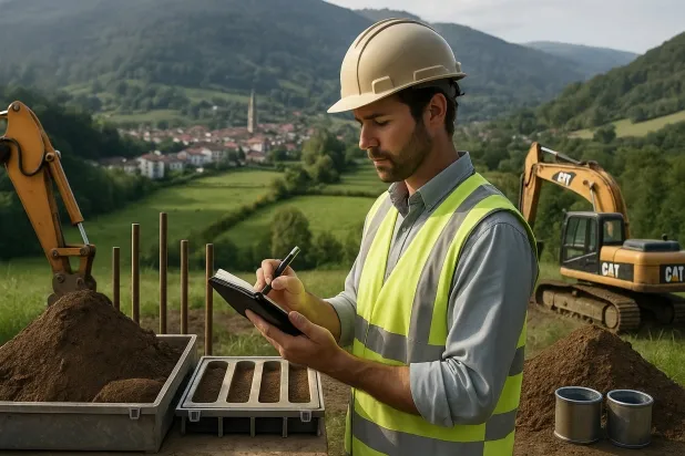
Comprehensive Geotechnical Studies
Comprehensive Geotechnical Studies
We combine field analysis and laboratory testing to provide accurate technical reports and foundation solutions.


Expert professional
Expert professional
Technicians with more than 15 years of experience in the industry. We are specialists in access to difficult locations such as sites with level changes, basements, etc.
Accredited
Accredited
Geotechnical calculations comply with the rules established by Eurocode 7, UNE-EN ISO 22476-4:2016.

Best price
Best price
Very competitive prices. The best prices for geotechnical studies in Spain. Request a quote and check it.
Speed and quality
Speed and quality
Within 7 to 10 days you will receive a signed report from a geologist. It is mandatory in order to carry out new construction or refurbishment works that involve modifications to the structure.

Work areas
We provide Geotechnical study in all localities of Laviana.
This includes the following geographical areas: Allande, Aller, Avilés, Belmonte de Miranda, Bimenes, Boal, Cabrales, Cabranes, Candamo, Cangas del Narcea, Cangas de Onís, Carreño, Case, Castrillón, Castropol, Coaña, Colunga, Corvera de Asturias, Cudillero, The Franco, Gijón, Gozón, Grade, Ibias, Illas, Langreo, Laviana, Lena, Valdés, Llanera, Llanes, Mieres, Morcín, Walls of Nalón, Nava, Navia, Noreña, Oviedo, Parres, Peñamellera Baja, Piloña, Pravia, Quirós, Las Regueras, Ribadedeva, Ribadesella, Ribera de Arriba, Riosa, Salas, San Martín del Rey Aurelio, Sariego, Siero, Somiedo, Soto del Barco, Tapia de Casariego, Teverga, Tineo, Vegadeo, Villaviciosa, Villayón, Asturias and surrounding areas.
We come to your home in Laviana when it suits you, agreeing on a day and time.

Types of ground in Laviana
In Laviana, the predominant materials include limestones, dolomites, marbles, as well as occasional occurrences of slates and schists, locally complemented by clays, peats and limited deposits of fine sands and silts. The formations are mostly of low or very low permeability, which implies limited circulation of groundwater except in shallow aquifers. The areas of limestones and dolomites can provide good bearing capacities, but it is essential to avoid founding on clays or peats due to their poor load-bearing capacity and high settlement potential.
Seismic activity in the municipality is considered high, with around 200 recorded events over 30 years, although the maximum magnitude observed (Mmax 4.2) does not exceed concerning thresholds and should be assessed in specific projects. The potential karst nature of the limestones requires a detailed verification of the existence of cavities or instabilities before carrying out any foundations. As it is composed of a non-clayey substratum, the risk of expansivity is ruled out, with karst being the most relevant geotechnical factor for the design of foundations in the area.
Phyllites and schists
14.17%Fine sands and silts
2.09%
Construction risks in Laviana
Approximate estimates. They do not replace the geotechnical study.
| Soil type | Expansivity | Settlements | Water table | Seismicity | Minimum foundation |
|---|---|---|---|---|---|
| Limestones, Dolomites and Marbles | None | Media | Media | Downward | In general, direct foundation using braced strip footing... |
| Phyllites and schists | None | Media | Media | Media | Shallow foundation if the stratum is competent. Strong b... |
| Fangy clays and peats (Deltaic) | Downward | High | High | High | Inviable with any natural means. Drive tests of enormous... |
| Fine sands and silts | None | High | High | High | To avoid local punching, the foundation slab is used ext... |
Interactive geological map · Laviana
Mapping: IGME GEODE 50k · IGME MAGNA 50 · ICGC (Catalonia)
Geological Viewer
IGME · ICGC- Click on the map to see the geology at the point.
- Use the layer buttons to switch between geological views (GEODE, MAGNA, Lithology, Hydrogeology).
- Adjust the opacity of the geological layer with the control below.
- Press the full-screen button to expand the viewer.
Geological information
Typical stratigraphic profile
Indicative subsurface cross-section in Laviana · Based on GEODE soil types
Indicative profile based on GEODE soil types and typical CTE thicknesses
Seismic risk in Laviana
Seismic risk is assessed at municipal level. These are aggregated data for the area.
- 1 M 4.2 2003
- 2 M 4 2018
- 3 M 3.9 2006
How do we carry out your geotechnical study?
How do we carry out your geotechnical study?
Step
Free quote
Free quote
Request a quotation for your geotechnical study. Completely free and with no obligation.
Step
We arrange a day
We arrange a day
We are looking for a day and time to carry out the field study.
Step
Conducting the geotechnical study
Conducting the geotechnical study
We’re going to move and carry out the study. In an hour or two we’ll have finished.
Step
Report submission
Report submission
Within a week we will send you the signed documents of the geotechnical study by an accredited geologist.
Also available in
Spain’s most populated cities
Useful information about Geotechnical study
In-depth articles


Entities and institutions


