Estudio geotécnico in Laukiz
Do you need a Geotechnical study?
Find the best price and service in Laukiz. Get a free quote.
More than 1000 geotechnical studies carried out
Get personalized attention
We can contact you via WhatsApp, phone, or email, whichever you prefer.
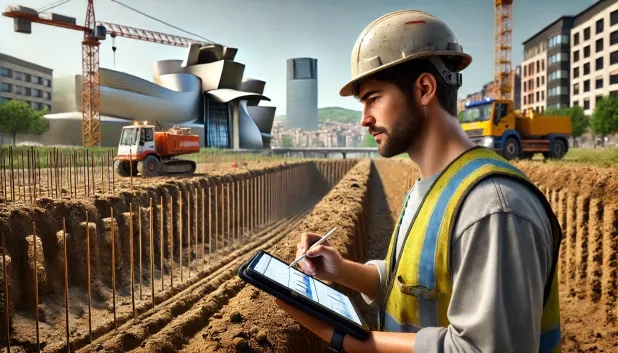
Comprehensive Geotechnical Studies
Comprehensive Geotechnical Studies
We combine field analysis and laboratory testing to provide accurate technical reports and foundation solutions.


Expert professional
Expert professional
Technicians with more than 15 years of experience in the industry. We are specialists in access to difficult locations such as sites with level changes, basements, etc.
Accredited
Accredited
Geotechnical calculations comply with the rules established by Eurocode 7, UNE-EN ISO 22476-4:2016.

Best price
Best price
Very competitive prices. The best prices for geotechnical studies in Spain. Request a quote and check it.
Speed and quality
Speed and quality
Within 7 to 10 days you will receive a signed report from a geologist. It is mandatory in order to carry out new construction or refurbishment works that involve modifications to the structure.

Work areas
We provide Geotechnical study in all locations of Laukiz.
This includes the following geographical areas: Álava, Gipuzkoa, Biscay, País Vasco and surrounding areas.
We will come to your home in Laukiz when it suits you, agreeing on a day and time.

Types of ground in Laukiz
In Laukiz, a substrate essentially made up of limestones, dolomites and marbles predominates, providing a solid and competent foundation for shallow and deep foundations. The most superficial layers may be composed of fine sands and silts, although their presence is secondary compared with the carbonate materials. These characteristics generally contribute to a good bearing capacity, although the presence of sands and silts may require caution in localised areas. Sandstones, conglomerates and flysch are found occasionally, without constituting a dominant conditioning factor in typical geotechnical design.
As regards its dynamic behaviour, seismicity in this municipality is classified as notable, with 94 events over the last 30 years, although the maximum magnitude does not exceed Mmax 3.7. Therefore, while seismic effects are not critical, they should be taken into account in the structural analysis of new buildings. Since the substrate is not clayey, the risk of expansiveness can be ruled out as a limiting factor. Thus, the main geotechnical consideration for Laukiz is linked to the proper identification of the near-surface materials in the event of silt and sand presence, as well as to the characterisation of the rock for the correct design of the foundation.
Calizas, Dolomías y Mármoles
58.84%Arenas finas y limos
22.40%
Construction risks in Laukiz
Approximate estimates. They do not replace the geotechnical study.
| Soil type | Expansivity | Settlements | Water table | Seismicity | Minimum foundation |
|---|---|---|---|---|---|
| Calizas, Dolomías y Mármoles | Nula | Media | Media | Baja | Generalmente cimentación directa mediante zapatas arrios... |
| Arenas finas y limos | Nula | Alta | Alta | Alta | Para evitar punzonamientos locales se usa profusamente l... |
| Areniscas, Conglomerados y Flysch | Nula | Media | Media | Media | Cimentación directa viable en la mayoría de los casos. P... |
Interactive geological map · Laukiz
Mapping: IGME GEODE 50k · IGME MAGNA 50 · ICGC (Catalonia)
Geological Viewer
IGME · ICGC- Click on the map to see the geology at the point.
- Use the layer buttons to switch between geological views (GEODE, MAGNA, Lithology, Hydrogeology).
- Adjust the opacity of the geological layer with the control below.
- Press the full-screen button to expand the viewer.
Geological information
Typical stratigraphic profile
Indicative subsurface cross-section in Laukiz · Based on GEODE soil types
Indicative profile based on GEODE soil types and typical CTE thicknesses
Seismic risk in Laukiz
Seismic risk is assessed at municipal level. These are aggregated data for the area.
- 1 M 3.7 2006
- 2 M 3.4 2000
- 3 M 3.1 2017
How do we carry out your geotechnical study?
How do we carry out your geotechnical study?
Step
Free quote
Free quote
Request a quotation for your geotechnical study. Completely free and with no obligation.
Step
We arrange a day
We arrange a day
We are looking for a day and time to carry out the field study.
Step
Conducting the geotechnical study
Conducting the geotechnical study
We’re going to move and carry out the study. In an hour or two we’ll have finished.
Step
Report submission
Report submission
Within a week we will send you the signed documents of the geotechnical study by an accredited geologist.
Also available in
Spain’s most populated cities
Useful information about Geotechnical study
In-depth articles


Entities and institutions


