Estudio geotécnico in Lanaja
Do you need a Geotechnical study?
Find the best price and service in Lanaja. Get a free quote.
More than 1000 geotechnical studies carried out
Approximate price 750€
We can contact you via WhatsApp, phone, or email, whichever you prefer.
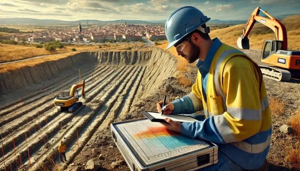
Comprehensive Geotechnical Studies
Comprehensive Geotechnical Studies
We combine field analysis and laboratory testing to provide accurate technical reports and foundation solutions.


Expert professional
Expert professional
Technicians with more than 15 years of experience in the industry. We are specialists in access to difficult locations such as sites with level changes, basements, etc.
Accredited
Accredited
Geotechnical calculations comply with the rules established by Eurocode 7, UNE-EN ISO 22476-4:2016.

Best price
Best price
Very competitive prices. The best prices for geotechnical studies in Spain. Request a quote and check it.
Speed and quality
Speed and quality
Within 7 to 10 days you will receive a signed report from a geologist. It is mandatory in order to carry out new construction or refurbishment works that involve modifications to the structure.

Work areas
We provide Geotechnical study in all locations of Lanaja.
This includes the following geographical areas: Province of Huesca, Province of Teruel, Province of Zaragoza, Aragón and surrounding areas.
We come to your home in Lanaja whenever it suits you, agreeing on a day and time.

Types of ground in Lanaja
In Lanaja, the dominant substrate is mainly made up of sandstones, conglomerates and flysch, which provides a competent and stable base for the execution of shallow and deep foundations. Other frequent ground elements include limestones, dolomites and marbles, as well as occasional layers of fine sands, silts and compact gravels. These soil types generally exhibit an adequate bearing capacity, although the localised presence of sands and silts may require specific analyses to avoid settlement problems. Permeability is usually low at the surface, although the existence of aquifers at greater depths cannot be ruled out and must be considered during excavations.
Lanaja is characterised by high seismic activity, recording around 200 events over 30 years and a maximum magnitude (Mmax) of 4.8; therefore, seismicity must be incorporated without fail in the structural design calculation criteria for buildings. In addition, the presence of calcareous formations indicates that karst is a relevant factor: it is essential to verify the existence of cavities or karst processes in order to avoid stability problems before designing any foundation. The non-clayey substrate rules out significant expansivity risks, confirming that the main geotechnical constraint in Lanaja is the possible influence of karst, in combination with the requirement for seismic design.
Fine sands and silts
18.81%Compact gravels and sands
11.65%Water mass
2.97%
Construction risks in Lanaja
Approximate estimates. They do not replace the geotechnical study.
| Soil type | Expansivity | Settlements | Water table | Seismicity | Minimum foundation |
|---|---|---|---|---|---|
| Sandstones, Conglomerates and Flysch | None | Media | Media | Media | Direct foundation is feasible in most cases. For flysch ... |
| Limestones, Dolomites and Marbles | None | Media | Media | Downward | In general, direct foundation using braced strip footing... |
| Fine sands and silts | None | High | High | High | To avoid local punching, the foundation slab is used ext... |
| Compact gravels and sands | None | Downward | High | Downward | Conventional shallow foundation without problems. Raft f... |
| Water mass | None | Downward | High | Downward | It is not possible to found on a body of water. If the p... |
Interactive geological map · Lanaja
Mapping: IGME GEODE 50k · IGME MAGNA 50 · ICGC (Catalonia)
Geological Viewer
IGME · ICGC- Click on the map to see the geology at the point.
- Use the layer buttons to switch between geological views (GEODE, MAGNA, Lithology, Hydrogeology).
- Adjust the opacity of the geological layer with the control below.
- Press the full-screen button to expand the viewer.
Geological information
Typical stratigraphic profile
Indicative subsurface cross-section in Lanaja · Based on GEODE soil types
Indicative profile based on GEODE soil types and typical CTE thicknesses
Seismic risk in Lanaja
Seismic risk is assessed at municipal level. These are aggregated data for the area.
- 1 M 4.8 2007
- 2 M 4 2018
- 3 M 3.9 2008
How do we carry out your geotechnical study?
How do we carry out your geotechnical study?
Step
Free quote
Free quote
Request a quotation for your geotechnical study. Completely free and with no obligation.
Step
We arrange a day
We arrange a day
We are looking for a day and time to carry out the field study.
Step
Conducting the geotechnical study
Conducting the geotechnical study
We’re going to move and carry out the study. In an hour or two we’ll have finished.
Step
Report submission
Report submission
Within a week we will send you the signed documents of the geotechnical study by an accredited geologist.
Also available in
Spain’s most populated cities
Useful information about Geotechnical study
In-depth articles


Entities and institutions


