Estudio geotécnico in La Lastrilla
Do you need a Geotechnical study?
Find the best price and service in La Lastrilla. Get a free quote.
More than 1000 geotechnical studies carried out
Get personalized attention
We can contact you via WhatsApp, phone, or email, whichever you prefer.
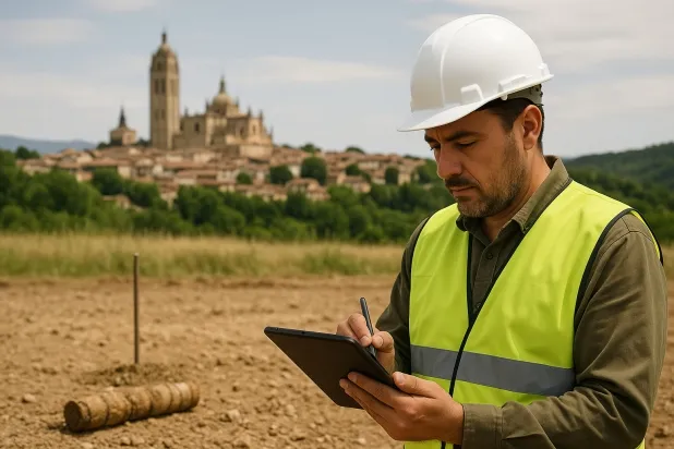
Comprehensive Geotechnical Studies
Comprehensive Geotechnical Studies
We combine field analysis and laboratory testing to provide accurate technical reports and foundation solutions.


Expert professional
Expert professional
Technicians with more than 15 years of experience in the industry. We are specialists in access to difficult locations such as sites with level changes, basements, etc.
Accredited
Accredited
Geotechnical calculations comply with the rules established by Eurocode 7, UNE-EN ISO 22476-4:2016.

Best price
Best price
Very competitive prices. The best prices for geotechnical studies in Spain. Request a quote and check it.
Speed and quality
Speed and quality
Within 7 to 10 days you will receive a signed report from a geologist. It is mandatory in order to carry out new construction or refurbishment works that involve modifications to the structure.

Work areas
We provide Geotechnical study in all towns and villages of La Lastrilla.
This includes the following geographical areas: Avila Province, Province of Burgos, Province of León, Province of Palencia, Province of Salamanca, Segovia Province, Province of Soria, Province of Valladolid, Zamora Province, Castilla y León and surrounding areas.
We travel to your home in La Lastrilla whenever it suits you, agreeing a day and time.

Types of ground in La Lastrilla
In La Lastrilla, soils formed by granite, gneiss and other igneous rocks predominate, comprising almost the entire geotechnical substrate of the municipality. These lithologies are characterised by high strength and are ideal for shallow (direct) foundations, as they exhibit high bearing capacity and low deformability. The formations, generally impermeable or with very low permeability, may host shallow aquifers in specific locations, which rarely affects the foundation except in the presence of weathered or altered zones.
Seismicity in La Lastrilla is high, with a record of around 200 events over the last 30 years and a maximum magnitude reaching 4.7; it is therefore essential that the structural design includes specific seismic actions. As the substrate is not formed by clayey materials, the risk of expansivity is ruled out, and there is also no presence of relevant karst features that could interfere with the foundations. The main technical consideration lies in the demanding seismic code, and it is necessary to verify the structural integrity under dynamic loading.
Construction risks in La Lastrilla
Approximate estimates. They do not replace the geotechnical study.
| Soil type | Expansivity | Settlements | Water table | Seismicity | Minimum foundation |
|---|---|---|---|---|---|
| Granite, gneiss and igneous rocks | None | Downward | Downward | Downward | Direct foundation using isolated spread footings bearing... |
Interactive geological map · La Lastrilla
Mapping: IGME GEODE 50k · IGME MAGNA 50 · ICGC (Catalonia)
Geological Viewer
IGME · ICGC- Click on the map to see the geology at the point.
- Use the layer buttons to switch between geological views (GEODE, MAGNA, Lithology, Hydrogeology).
- Adjust the opacity of the geological layer with the control below.
- Press the full-screen button to expand the viewer.
Geological information
Typical stratigraphic profile
Indicative subsurface cross-section in La Lastrilla · Based on GEODE soil types
Indicative profile based on GEODE soil types and typical CTE thicknesses
Seismic risk in La Lastrilla
Seismic risk is assessed at municipal level. These are aggregated data for the area.
- 1 M 4.7 2006
- 2 M 4.6 1998
- 3 M 4.6 2007
How do we carry out your geotechnical study?
How do we carry out your geotechnical study?
Step
Free quote
Free quote
Request a quotation for your geotechnical study. Completely free and with no obligation.
Step
We arrange a day
We arrange a day
We are looking for a day and time to carry out the field study.
Step
Conducting the geotechnical study
Conducting the geotechnical study
We’re going to move and carry out the study. In an hour or two we’ll have finished.
Step
Report submission
Report submission
Within a week we will send you the signed documents of the geotechnical study by an accredited geologist.
Also available in
Spain’s most populated cities
Useful information about Geotechnical study
In-depth articles


Entities and institutions


