Estudio geotécnico in La Codosera
Do you need a Estudio geotécnico?
Find the best price and service in La Codosera. Get a free quote.
Más de 1000 estudios realizados
Get personalized attention
We can contact you via WhatsApp, phone, or email, whichever you prefer.
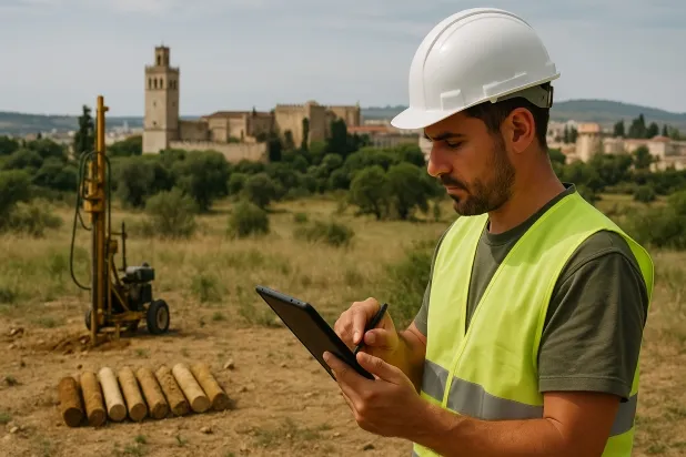
Estudios Geotécnicos Integrales
Estudios Geotécnicos Integrales
Combinamos análisis de campo y ensayos de laboratorio para ofrecer informes técnicos precisos y soluciones de cimentación.


Profesionales expertos
Profesionales expertos
Técnicos con más de 15 años de experiencia en el sector. Somos especialistas en accesos a lugares difíciles como sitios con desniveles, sótanos, etc.
Acreditados
Acreditados
Los cálculos geotécnicos cumplen con las reglas establecidas por el Eurocódigo 7, norma UNE-EN ISO 22476-4 de 2016.

Mejor precio
Mejor precio
Precios muy competitivos. Los mejores precios de estudios geotécnicos en España. Pide presupuesto y compruébalo.
Rapidez y calidad
Rapidez y calidad
En el plazo de 7 a 10 días obtendrás un informe firmado por un geólogo. Es obligatorio para hacer una construcción nueva, reformas que impliquen modificaciones de la estructura.

Work areas
We provide Estudio geotécnico in all locations of La Codosera.
This includes the following geographical areas: Province of Badajoz, Province of Cáceres, Extremadura and surrounding areas.
We travel to your home in La Codosera when it suits you best, agreeing a day and time.

Tipos de terreno en La Codosera
In La Codosera, the dominant subsoil is formed by phyllites and schists, metamorphic materials characterised by low permeability and high consistency. As these soils are generally impermeable, they provide favourable conditions for shallow foundations since they offer adequate bearing capacity and limited susceptibility to deformability-related problems, which simplifies the design of the supporting structure. However, the presence of occasional shallow aquifers in altered zones may require special attention to drainage management during foundation construction.
The recorded seismic activity in La Codosera is notable, with 52 events over 30 years and a maximum magnitude (Mmax) of 4,4, although it does not exceed the threshold requiring mandatory consideration for seismic structural design. The non-clayey subsoil completely rules out the risk of expansivity, favouring the dimensional stability of the ground. The main conditioning factor in the area is the need for an adequate geotechnical study of the local hydrogeological conditions, together with control of infiltration, with seismicity being less relevant.
Pizarras y Esquistos
100.00%
Construction risks in La Codosera
Approximate estimates. They do not replace the geotechnical study.
| Soil type | Expansivity | Settlements | Water table | Seismicity | Minimum foundation |
|---|---|---|---|---|---|
| Pizarras y Esquistos | Nula | Media | Media | Media | Cimentación superficial si el estrato es competente. Se ... |
Interactive geological map · La Codosera
Mapping: IGME GEODE 50k · IGME MAGNA 50 · ICGC (Catalonia)
Geological Viewer
IGME · ICGC- Click on the map to see the geology at the point.
- Use the layer buttons to switch between geological views (GEODE, MAGNA, Lithology, Hydrogeology).
- Adjust the opacity of the geological layer with the control below.
- Press the full-screen button to expand the viewer.
Geological information
Typical stratigraphic profile
Indicative subsurface cross-section in La Codosera · Based on GEODE soil types
Indicative profile based on GEODE soil types and typical CTE thicknesses
Seismic risk in La Codosera
Seismic risk is assessed at municipal level. These are aggregated data for the area.
- 1 M 4.4 1998
- 2 M 3.6 2007
- 3 M 3 2008
¿Cómo realizamos tu estudio geotécnico?
¿Cómo realizamos tu estudio geotécnico?
Step
Presupuesto gratuito
Presupuesto gratuito
Pide un presupuesto para tu estudio geotécnico. Totalmente gratuito y sin compromiso.
Step
Concertamos un día
Concertamos un día
Buscamos un día y hora para hacer el estudio de campo.
Step
Realización del estudio
Realización del estudio
Nos desplazamos y realizamos el estudio. En una hora o dos habremos acabado.
Step
Envío del informe
Envío del informe
En una semana te enviamos los documentos del estudio firmado por un geólogo acreditado.
Also available in
Spain’s most populated cities
Useful information about Estudio geotécnico
In-depth articles


Entities and institutions


