Estudio geotécnico in La Alberca de Záncara
Do you need a Geotechnical study?
Find the best price and service in La Alberca de Záncara. Get a free quote.
More than 1000 geotechnical studies carried out
Get personalized attention
We can contact you via WhatsApp, phone, or email, whichever you prefer.
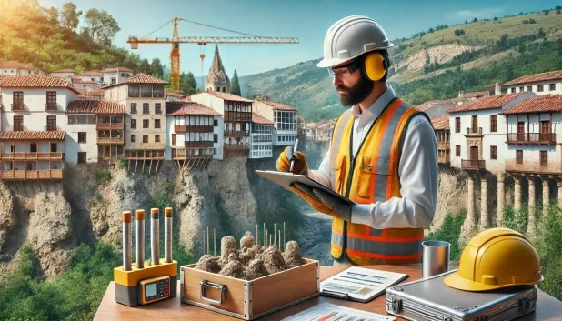
Comprehensive Geotechnical Studies
Comprehensive Geotechnical Studies
We combine field analysis and laboratory testing to provide accurate technical reports and foundation solutions.


Expert professional
Expert professional
Technicians with more than 15 years of experience in the industry. We are specialists in access to difficult locations such as sites with level changes, basements, etc.
Accredited
Accredited
Geotechnical calculations comply with the rules established by Eurocode 7, UNE-EN ISO 22476-4:2016.

Best price
Best price
Very competitive prices. The best prices for geotechnical studies in Spain. Request a quote and check it.
Speed and quality
Speed and quality
Within 7 to 10 days you will receive a signed report from a geologist. It is mandatory in order to carry out new construction or refurbishment works that involve modifications to the structure.

Work areas
We provide Geotechnical study in all locations of La Alberca de Záncara.
This includes the following geographical areas: Province of Ciudad Real, Province of Cuenca, Province of Guadalajara, Province of Toledo, Province of Albacete, Castilla-La Mancha and the surrounding areas.
We come to your home in La Alberca de Záncara whenever it suits you, agreeing a day and time.

Types of ground in La Alberca de Záncara
In La Alberca de Záncara, the dominant substrate is composed almost exclusively of gypsum, anhydrite and salts, characterising the area by extensive but low-permeability formations in depth, which may allow the existence of aquifers at deeper levels. These materials present a significant risk of dissolution, so any project that requires foundation work must consider the potential instability associated with collapse or subsidence. Additionally, although expansive clays exist, their occurrence is secondary or limited to specific climatic zones, generally reducing the dominant expansive risk, but not ruling it out completely in localised sectors.
As regards seismicity, the municipality records moderate seismic activity with 40 events in the last 30 years and a maximum magnitude of 4.1, so the possible seismic effect should be considered in structural design, albeit with restrictions specific to the local context. The possible presence of karst makes it necessary to carry out detailed checks before any foundation work, given the risk of cavities and natural subsidence associated with these soluble materials. In conclusion, the most relevant constraint for the feasibility and safety of foundations in La Alberca de Záncara lies in the interaction between the gypsum-bearing substrate, the susceptibility to karst-related phenomena, and the risk of salt dissolution.
Gypsum, Anhydrite and Salts
100.00%
Construction risks in La Alberca de Záncara
Approximate estimates. They do not replace the geotechnical study.
| Soil type | Expansivity | Settlements | Water table | Seismicity | Minimum foundation |
|---|---|---|---|---|---|
| Gypsum, Anhydrite and Salts | Media | High | High | Media | The foundation must be designed to withstand local loss ... |
Interactive geological map · La Alberca de Záncara
Mapping: IGME GEODE 50k · IGME MAGNA 50 · ICGC (Catalonia)
Geological Viewer
IGME · ICGC- Click on the map to see the geology at the point.
- Use the layer buttons to switch between geological views (GEODE, MAGNA, Lithology, Hydrogeology).
- Adjust the opacity of the geological layer with the control below.
- Press the full-screen button to expand the viewer.
Geological information
Typical stratigraphic profile
Indicative subsurface cross-section in La Alberca de Záncara · Based on GEODE soil types
Indicative profile based on GEODE soil types and typical CTE thicknesses
Seismic risk in La Alberca de Záncara
Seismic risk is assessed at municipal level. These are aggregated data for the area.
- 1 M 4.1 1998
- 2 M 4 2009
- 3 M 3.7 2001
How do we carry out your geotechnical study?
How do we carry out your geotechnical study?
Step
Free quote
Free quote
Request a quotation for your geotechnical study. Completely free and with no obligation.
Step
We arrange a day
We arrange a day
We are looking for a day and time to carry out the field study.
Step
Conducting the geotechnical study
Conducting the geotechnical study
We’re going to move and carry out the study. In an hour or two we’ll have finished.
Step
Report submission
Report submission
Within a week we will send you the signed documents of the geotechnical study by an accredited geologist.
Also available in
Spain’s most populated cities
Useful information about Geotechnical study
In-depth articles


Entities and institutions


