Estudio geotécnico in Jarandilla de la Vera
Do you need a Geotechnical study?
Find the best price and service in Jarandilla de la Vera. Get a free quote.
More than 1000 geotechnical studies carried out
Get personalized attention
We can contact you via WhatsApp, phone, or email, whichever you prefer.
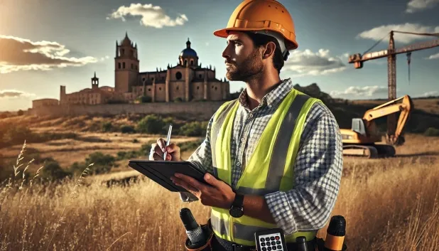
Comprehensive Geotechnical Studies
Comprehensive Geotechnical Studies
We combine field analysis and laboratory testing to provide accurate technical reports and foundation solutions.


Expert professional
Expert professional
Technicians with more than 15 years of experience in the industry. We are specialists in access to difficult locations such as sites with level changes, basements, etc.
Accredited
Accredited
Geotechnical calculations comply with the rules established by Eurocode 7, UNE-EN ISO 22476-4:2016.

Best price
Best price
Very competitive prices. The best prices for geotechnical studies in Spain. Request a quote and check it.
Speed and quality
Speed and quality
Within 7 to 10 days you will receive a signed report from a geologist. It is mandatory in order to carry out new construction or refurbishment works that involve modifications to the structure.

Work areas
We provide Geotechnical study in all localities of Jarandilla de la Vera.
This includes the following geographical areas: Province of Badajoz, Province of Cáceres, Extremadura and surrounding areas.
We travel to your home in Jarandilla de la Vera when it suits you best, agreeing a day and time.

Types of ground in Jarandilla de la Vera
In Jarandilla de la Vera, the prevailing geological substrate is composed mostly of granite, gneiss and other igneous rocks, which accounts for around 69% of the municipal surface area. These lithologies are characterised by very low deformability and high bearing capacity, making them suitable for supporting loads from medium and heavy buildings by means of shallow (direct) foundations. In addition, smaller areas occur with sandstones and conglomerates, whose mechanical strength is also usually good, although they may require complementary studies to assess the point presence of looser or heterogeneous materials. The low permeability of the predominant materials implies little susceptibility to settlement due to the washout or transport of fines, but it is recommended to verify the groundwater level in the vicinity of water bodies.
The seismic activity in the municipality is rated as notable, with 56 events in the last 30 years, although the maximum magnitude recorded (Mmax 3.1) is considered low and does not entail special requirements for the seismic design of structures. There are no signs of karstification or risks associated with swelling, since the non-clayey substrate rules out this type of pathology. Thus, the most important geotechnical conditions to consider are the presence of rock masses as a foundation horizon and the possible local variability of secondary detrital materials.
Water mass
2.59%
Construction risks in Jarandilla de la Vera
Approximate estimates. They do not replace the geotechnical study.
| Soil type | Expansivity | Settlements | Water table | Seismicity | Minimum foundation |
|---|---|---|---|---|---|
| Granite, gneiss and igneous rocks | None | Downward | Downward | Downward | Direct foundation using isolated spread footings bearing... |
| Sandstones, Conglomerates and Flysch | None | Media | Media | Media | Direct foundation is feasible in most cases. For flysch ... |
| Water mass | None | Downward | High | Downward | It is not possible to found on a body of water. If the p... |
Interactive geological map · Jarandilla de la Vera
Mapping: IGME GEODE 50k · IGME MAGNA 50 · ICGC (Catalonia)
Geological Viewer
IGME · ICGC- Click on the map to see the geology at the point.
- Use the layer buttons to switch between geological views (GEODE, MAGNA, Lithology, Hydrogeology).
- Adjust the opacity of the geological layer with the control below.
- Press the full-screen button to expand the viewer.
Geological information
Typical stratigraphic profile
Indicative subsurface cross-section in Jarandilla de la Vera · Based on GEODE soil types
Indicative profile based on GEODE soil types and typical CTE thicknesses
Seismic risk in Jarandilla de la Vera
Seismic risk is assessed at municipal level. These are aggregated data for the area.
- 1 M 3.1 2015
- 2 M 2 2009
- 3 M 1.9 2009
How do we carry out your geotechnical study?
How do we carry out your geotechnical study?
Step
Free quote
Free quote
Request a quotation for your geotechnical study. Completely free and with no obligation.
Step
We arrange a day
We arrange a day
We are looking for a day and time to carry out the field study.
Step
Conducting the geotechnical study
Conducting the geotechnical study
We’re going to move and carry out the study. In an hour or two we’ll have finished.
Step
Report submission
Report submission
Within a week we will send you the signed documents of the geotechnical study by an accredited geologist.
Also available in
Spain’s most populated cities
Useful information about Geotechnical study
In-depth articles


Entities and institutions


