Estudio geotécnico in Guadalcázar
Do you need a Geotechnical study?
Find the best price and service in Guadalcázar. Get a free quote.
More than 1000 geotechnical studies carried out
Get personalized attention
We can contact you via WhatsApp, phone, or email, whichever you prefer.
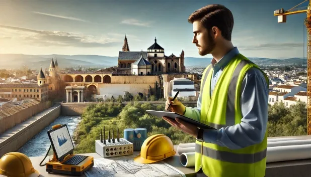
Comprehensive Geotechnical Studies
Comprehensive Geotechnical Studies
We combine field analysis and laboratory testing to provide accurate technical reports and foundation solutions.


Expert professional
Expert professional
Technicians with more than 15 years of experience in the industry. We are specialists in access to difficult locations such as sites with level changes, basements, etc.
Accredited
Accredited
Geotechnical calculations comply with the rules established by Eurocode 7, UNE-EN ISO 22476-4:2016.

Best price
Best price
Very competitive prices. The best prices for geotechnical studies in Spain. Request a quote and check it.
Speed and quality
Speed and quality
Within 7 to 10 days you will receive a signed report from a geologist. It is mandatory in order to carry out new construction or refurbishment works that involve modifications to the structure.

Work areas
We provide Geotechnical study in all locations in Guadalcázar.
This includes the following geographical areas: Province of Almería, Province of Cádiz, Province of Córdoba, Province of Granada, Province of Huelva, Province of Jaén, Province of Málaga, Province of Seville, Andalucía and surrounding areas.
We travel to your home in Guadalcázar when it suits you, agreeing a day and time.

Types of ground in Guadalcázar
In Guadalcázar, the near-surface ground composition shows a predominance of fine sands and silts, accompanied in importance by limestones, dolomites and marbles. The presence of carbonate formations may positively influence bearing capacity, enabling conventional foundations, whereas silty levels or those with loose sands require specific checks to control possible settlement. For their part, the formations generally exhibit low permeability, although they may capture shallow aquifers in a localised manner—an aspect to be considered for water management in the project and during execution of the works.
In the seismic aspect, Guadalcázar shows notable seismicity, with a total of 54 events over 30 years and a maximum magnitude value (Mmax) of 4.6, which means that seismic actions must be taken into account in the structural and foundation design. The absence of clayey strata rules out the risk of expansivity, and there are also no karst-related constraints in the area. As the most determining element, control of the behaviour of the sandy levels and compliance with the seismic regulations will be key for any geotechnical study in this municipality.
Fine sands and silts
39.40%Water mass
16.05%
Construction risks in Guadalcázar
Approximate estimates. They do not replace the geotechnical study.
| Soil type | Expansivity | Settlements | Water table | Seismicity | Minimum foundation |
|---|---|---|---|---|---|
| Fine sands and silts | None | High | High | High | To avoid local punching, the foundation slab is used ext... |
| Limestones, Dolomites and Marbles | None | Media | Media | Downward | In general, direct foundation using braced strip footing... |
| Water mass | None | Downward | High | Downward | It is not possible to found on a body of water. If the p... |
| Compact gravels and sands | None | Downward | High | Downward | Conventional shallow foundation without problems. Raft f... |
Interactive geological map · Guadalcázar
Mapping: IGME GEODE 50k · IGME MAGNA 50 · ICGC (Catalonia)
Geological Viewer
IGME · ICGC- Click on the map to see the geology at the point.
- Use the layer buttons to switch between geological views (GEODE, MAGNA, Lithology, Hydrogeology).
- Adjust the opacity of the geological layer with the control below.
- Press the full-screen button to expand the viewer.
Geological information
Typical stratigraphic profile
Indicative subsurface cross-section in Guadalcázar · Based on GEODE soil types
Indicative profile based on GEODE soil types and typical CTE thicknesses
Seismic risk in Guadalcázar
Seismic risk is assessed at municipal level. These are aggregated data for the area.
- 1 M 4.6 2003
- 2 M 3.5 2001
- 3 M 3.5 2002
How do we carry out your geotechnical study?
How do we carry out your geotechnical study?
Step
Free quote
Free quote
Request a quotation for your geotechnical study. Completely free and with no obligation.
Step
We arrange a day
We arrange a day
We are looking for a day and time to carry out the field study.
Step
Conducting the geotechnical study
Conducting the geotechnical study
We’re going to move and carry out the study. In an hour or two we’ll have finished.
Step
Report submission
Report submission
Within a week we will send you the signed documents of the geotechnical study by an accredited geologist.
Also available in
Spain’s most populated cities
Useful information about Geotechnical study
In-depth articles


Entities and institutions


