Estudio geotécnico in Fontanar
Do you need a Geotechnical study?
Find the best price and service in Fontanar. Get a free quote.
More than 1000 geotechnical studies carried out
Get personalized attention
We can contact you via WhatsApp, phone, or email, whichever you prefer.
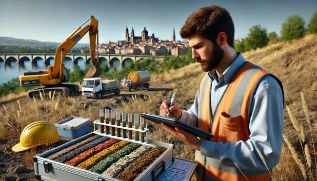
Comprehensive Geotechnical Studies
Comprehensive Geotechnical Studies
We combine field analysis and laboratory testing to provide accurate technical reports and foundation solutions.


Expert professional
Expert professional
Technicians with more than 15 years of experience in the industry. We are specialists in access to difficult locations such as sites with level changes, basements, etc.
Accredited
Accredited
Geotechnical calculations comply with the rules established by Eurocode 7, UNE-EN ISO 22476-4:2016.

Best price
Best price
Very competitive prices. The best prices for geotechnical studies in Spain. Request a quote and check it.
Speed and quality
Speed and quality
Within 7 to 10 days you will receive a signed report from a geologist. It is mandatory in order to carry out new construction or refurbishment works that involve modifications to the structure.

Work areas
We provide Geotechnical study in all localities of Fontanar.
This includes the following geographical areas: Province of Ciudad Real, Province of Cuenca, Province of Guadalajara, Province of Toledo, Province of Albacete, Castilla-La Mancha and surrounding areas.
We travel to your home in Fontanar whenever it suits you, agreeing a day and time.

Types of ground in Fontanar
In the municipality of Fontanar, the near-surface materials are dominated by water masses and sedimentary rocks such as sandstones, conglomerates and flysch, accompanied in smaller proportions by limestones and shales. The soils generally have high permeability, associated with extensive and productive aquifers, which has a positive effect on drainage and may enhance bearing capacity, particularly over sandstones and conglomerates. However, given the significant presence of detrital materials and areas with possible stratification, it is essential to carry out a detailed geotechnical study to determine the depth and type of foundation most suitable, based on lateral facies changes.
With regard to the seismic aspect, Fontanar shows significant activity, with 200 events over 30 years and a maximum magnitude of 4.6. This level of seismicity must be incorporated into the sizing and structural design of any foundation. Although expansive clays only occur subordinately and in specific areas, their localised presence must be assessed in the affected zones. The main constraint for building in Fontanar is the interaction between relatively high seismicity and the lithological heterogeneity of the soils; both factors require particular attention during the design and construction phases of the works.
Water mass
45.14%Phyllites and schists
7.31%
Construction risks in Fontanar
Approximate estimates. They do not replace the geotechnical study.
| Soil type | Expansivity | Settlements | Water table | Seismicity | Minimum foundation |
|---|---|---|---|---|---|
| Water mass | None | Downward | High | Downward | It is not possible to found on a body of water. If the p... |
| Sandstones, Conglomerates and Flysch | None | Media | Media | Media | Direct foundation is feasible in most cases. For flysch ... |
| Limestones, Dolomites and Marbles | None | Media | Media | Downward | In general, direct foundation using braced strip footing... |
| Phyllites and schists | None | Media | Media | Media | Shallow foundation if the stratum is competent. Strong b... |
Interactive geological map · Fontanar
Mapping: IGME GEODE 50k · IGME MAGNA 50 · ICGC (Catalonia)
Geological Viewer
IGME · ICGC- Click on the map to see the geology at the point.
- Use the layer buttons to switch between geological views (GEODE, MAGNA, Lithology, Hydrogeology).
- Adjust the opacity of the geological layer with the control below.
- Press the full-screen button to expand the viewer.
Geological information
Typical stratigraphic profile
Indicative subsurface cross-section in Fontanar · Based on GEODE soil types
Indicative profile based on GEODE soil types and typical CTE thicknesses
Seismic risk in Fontanar
Seismic risk is assessed at municipal level. These are aggregated data for the area.
- 1 M 4.6 2007
- 2 M 4.1 1998
- 3 M 4 1998
How do we carry out your geotechnical study?
How do we carry out your geotechnical study?
Step
Free quote
Free quote
Request a quotation for your geotechnical study. Completely free and with no obligation.
Step
We arrange a day
We arrange a day
We are looking for a day and time to carry out the field study.
Step
Conducting the geotechnical study
Conducting the geotechnical study
We’re going to move and carry out the study. In an hour or two we’ll have finished.
Step
Report submission
Report submission
Within a week we will send you the signed documents of the geotechnical study by an accredited geologist.
Also available in
Spain’s most populated cities
Useful information about Geotechnical study
In-depth articles


Entities and institutions


