Estudio geotécnico in El Palmar de Troya
Do you need a Geotechnical study?
Find the best price and service in El Palmar de Troya. Get a free quote.
More than 1000 geotechnical studies carried out
Get personalized attention
We can contact you via WhatsApp, phone, or email, whichever you prefer.
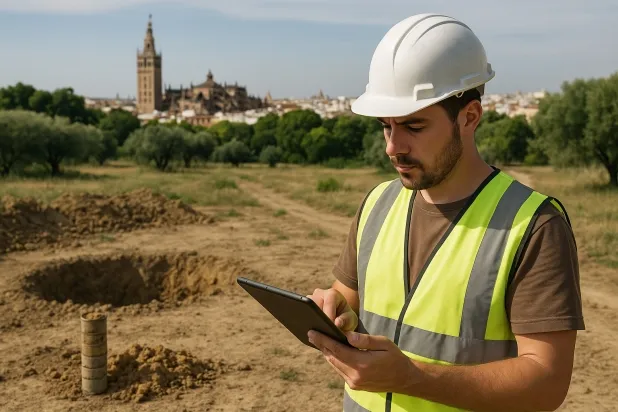
Comprehensive Geotechnical Studies
Comprehensive Geotechnical Studies
We combine field analysis and laboratory testing to provide accurate technical reports and foundation solutions.


Expert professional
Expert professional
Technicians with more than 15 years of experience in the industry. We are specialists in access to difficult locations such as sites with level changes, basements, etc.
Accredited
Accredited
Geotechnical calculations comply with the rules established by Eurocode 7, UNE-EN ISO 22476-4:2016.

Best price
Best price
Very competitive prices. The best prices for geotechnical studies in Spain. Request a quote and check it.
Speed and quality
Speed and quality
Within 7 to 10 days you will receive a signed report from a geologist. It is mandatory in order to carry out new construction or refurbishment works that involve modifications to the structure.

Work areas
We provide Geotechnical study in all localities of El Palmar de Troya.
This includes the following geographical areas: Province of Almería, Province of Cádiz, Province of Córdoba, Province of Granada, Province of Huelva, Province of Jaén, Province of Málaga, Province of Seville, Andalucía and surrounding areas.
We travel to your home in El Palmar de Troya when it suits you, agreeing a day and time.

Types of ground in El Palmar de Troya
In El Palmar de Troya, the geotechnical substrate is composed mainly of fine sands and silts, which occur very frequently in the area. Although these formations are extensive and have low permeability, they can host aquifers at depth, which require specific analysis in geotechnical studies. The predominance of these materials implies medium to low bearing capacities and the need to assess the foundations carefully, paying particular attention to the possible influence of thin layers of saturated sand or silt that could undermine stability if they are not properly taken into account in the foundation design.
With regard to seismic hazard, El Palmar de Troya presents a very low level, with a single recorded event over three decades and a maximum magnitude of 1.7, which implies a negligible impact on structural design. However, the potential existence of karst in the area requires thorough verification before proceeding with any type of foundation, since the presence of cavities or underground dissolutions can seriously compromise the integrity of structures. Although expansive clays are only subordinate or associated with areas without a relevant environmental deficit, the main geotechnical constraint remains the possible presence of karstification, which must be ruled out or confirmed through detailed investigation.
Fine sands and silts
99.47%
Construction risks in El Palmar de Troya
Approximate estimates. They do not replace the geotechnical study.
| Soil type | Expansivity | Settlements | Water table | Seismicity | Minimum foundation |
|---|---|---|---|---|---|
| Fine sands and silts | None | High | High | High | To avoid local punching, the foundation slab is used ext... |
Interactive geological map · El Palmar de Troya
Mapping: IGME GEODE 50k · IGME MAGNA 50 · ICGC (Catalonia)
Geological Viewer
IGME · ICGC- Click on the map to see the geology at the point.
- Use the layer buttons to switch between geological views (GEODE, MAGNA, Lithology, Hydrogeology).
- Adjust the opacity of the geological layer with the control below.
- Press the full-screen button to expand the viewer.
Geological information
Typical stratigraphic profile
Indicative subsurface cross-section in El Palmar de Troya · Based on GEODE soil types
Indicative profile based on GEODE soil types and typical CTE thicknesses
Seismic risk in El Palmar de Troya
Seismic risk is assessed at municipal level. These are aggregated data for the area.
- 1 M 1.7 2023
How do we carry out your geotechnical study?
How do we carry out your geotechnical study?
Step
Free quote
Free quote
Request a quotation for your geotechnical study. Completely free and with no obligation.
Step
We arrange a day
We arrange a day
We are looking for a day and time to carry out the field study.
Step
Conducting the geotechnical study
Conducting the geotechnical study
We’re going to move and carry out the study. In an hour or two we’ll have finished.
Step
Report submission
Report submission
Within a week we will send you the signed documents of the geotechnical study by an accredited geologist.
Also available in
Spain’s most populated cities
Useful information about Geotechnical study
In-depth articles


Entities and institutions


