Estudio geotécnico in Colmenar de Oreja
Do you need a Geotechnical study?
Find the best price and service in Colmenar de Oreja. Get a free quote.
More than 1000 geotechnical studies carried out
Get personalized attention
We can contact you via WhatsApp, phone, or email, whichever you prefer.
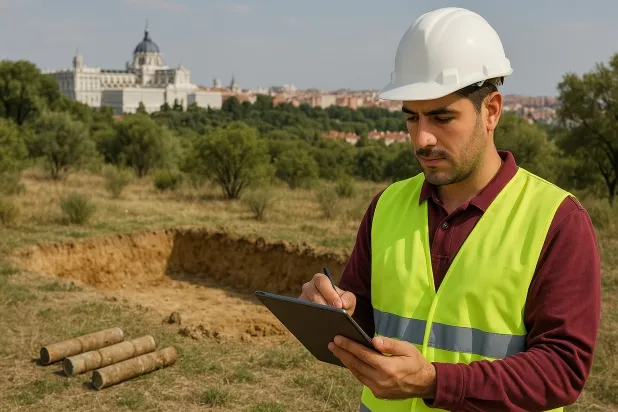
Comprehensive Geotechnical Studies
Comprehensive Geotechnical Studies
We combine field analysis and laboratory testing to provide accurate technical reports and foundation solutions.


Expert professional
Expert professional
Technicians with more than 15 years of experience in the industry. We are specialists in access to difficult locations such as sites with level changes, basements, etc.
Accredited
Accredited
Geotechnical calculations comply with the rules established by Eurocode 7, UNE-EN ISO 22476-4:2016.

Best price
Best price
Very competitive prices. The best prices for geotechnical studies in Spain. Request a quote and check it.
Speed and quality
Speed and quality
Within 7 to 10 days you will receive a signed report from a geologist. It is mandatory in order to carry out new construction or refurbishment works that involve modifications to the structure.

Work areas
We provide Geotechnical study in all localities of Colmenar de Oreja.
This includes the following geographical areas: Province of Madrid, Comunidad de Madrid and surrounding areas.
We visit your home in Colmenar de Oreja when it suits you, agreeing a day and time.

Types of ground in Colmenar de Oreja
In Colmenar de Oreja, the substrate is characterised by the frequent presence of water-bearing masses, gypsum, anhydrite, salts, and granulometrically coarse materials such as compact gravels and sands. The gypsum and salts present increase the risk of dissolution, which may affect the stability of any foundation if the integrity of the ground is not verified properly. The limestones and dolomites, although less frequent, can provide high bearing capacity, but it is essential to analyse their continuity and fracturing. The abundance of highly productive aquifers demands particular attention to the interaction between water–soil–foundation, especially in areas of gypsum or soluble salts, to prevent future ground settlement or underground erosion.
With regard to geotechnical risks, the seismicity is notable, with 107 events in 30 years and maximum magnitudes of 3.1; therefore, although there is no serious structural constraint, it must nevertheless be taken into account at the design level and in accordance with current regulations. It should be noted that the non-clayey substrate in the area eliminates the risk of expansivity. However, the possible presence of karstification in limestones and gypsum necessitates an exhaustive verification of cavities and dissolutions before founding, as this phenomenon may be the main constraint for projects in the municipality.
Water mass
24.47%Gypsum, Anhydrite and Salts
21.08%Compact gravels and sands
20.34%Phyllites and schists
5.48%
Construction risks in Colmenar de Oreja
Approximate estimates. They do not replace the geotechnical study.
| Soil type | Expansivity | Settlements | Water table | Seismicity | Minimum foundation |
|---|---|---|---|---|---|
| Water mass | None | Downward | High | Downward | It is not possible to found on a body of water. If the p... |
| Gypsum, Anhydrite and Salts | Media | High | High | Media | The foundation must be designed to withstand local loss ... |
| Compact gravels and sands | None | Downward | High | Downward | Conventional shallow foundation without problems. Raft f... |
| Limestones, Dolomites and Marbles | None | Media | Media | Downward | In general, direct foundation using braced strip footing... |
| Sandstones, Conglomerates and Flysch | None | Media | Media | Media | Direct foundation is feasible in most cases. For flysch ... |
| Phyllites and schists | None | Media | Media | Media | Shallow foundation if the stratum is competent. Strong b... |
Interactive geological map · Colmenar de Oreja
Mapping: IGME GEODE 50k · IGME MAGNA 50 · ICGC (Catalonia)
Geological Viewer
IGME · ICGC- Click on the map to see the geology at the point.
- Use the layer buttons to switch between geological views (GEODE, MAGNA, Lithology, Hydrogeology).
- Adjust the opacity of the geological layer with the control below.
- Press the full-screen button to expand the viewer.
Geological information
Typical stratigraphic profile
Indicative subsurface cross-section in Colmenar de Oreja · Based on GEODE soil types
Indicative profile based on GEODE soil types and typical CTE thicknesses
Seismic risk in Colmenar de Oreja
- 1 M 3.1 2006
- 2 M 2.6 2010
- 3 M 2.5 2010
How do we carry out your geotechnical study?
How do we carry out your geotechnical study?
Step
Free quote
Free quote
Request a quotation for your geotechnical study. Completely free and with no obligation.
Step
We arrange a day
We arrange a day
We are looking for a day and time to carry out the field study.
Step
Conducting the geotechnical study
Conducting the geotechnical study
We’re going to move and carry out the study. In an hour or two we’ll have finished.
Step
Report submission
Report submission
Within a week we will send you the signed documents of the geotechnical study by an accredited geologist.
Also available in
Spain’s most populated cities
Useful information about Geotechnical study
In-depth articles


Entities and institutions


