Estudio geotécnico in Castilléjar
Do you need a Geotechnical study?
Find the best price and service in Castilléjar. Get a free quote.
More than 1000 geotechnical studies carried out
Get personalized attention
We can contact you via WhatsApp, phone, or email, whichever you prefer.
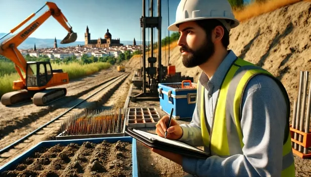
Comprehensive Geotechnical Studies
Comprehensive Geotechnical Studies
We combine field analysis and laboratory testing to provide accurate technical reports and foundation solutions.


Expert professional
Expert professional
Technicians with more than 15 years of experience in the industry. We are specialists in access to difficult locations such as sites with level changes, basements, etc.
Accredited
Accredited
Geotechnical calculations comply with the rules established by Eurocode 7, UNE-EN ISO 22476-4:2016.

Best price
Best price
Very competitive prices. The best prices for geotechnical studies in Spain. Request a quote and check it.
Speed and quality
Speed and quality
Within 7 to 10 days you will receive a signed report from a geologist. It is mandatory in order to carry out new construction or refurbishment works that involve modifications to the structure.

Work areas
We provide Geotechnical study in all locations in Castilléjar.
This includes the following geographical areas: Province of Almería, Province of Cádiz, Province of Córdoba, Province of Granada, Province of Huelva, Province of Jaén, Province of Málaga, Province of Seville, Andalucía and the surrounding areas.
We go to your home in Castilléjar when it suits you, agreeing a day and time.

Types of ground in Castilléjar
In Castilléjar, soils formed by gypsum, anhydrite and salts predominate, accounting for a significant proportion beneath the surface. The presence of compact gravels and sands, together with materials such as sandstones and conglomerates, indicates locally good conditions for supporting moderate loads, although the risk of dissolution associated with the gypsum and salts requires particular attention, as it may affect the stability of the foundation. The low occurrence of clays and hard marls suggests a reduced likelihood of differential settlements, but the high gypsum contents require a detailed geotechnical study before defining the most suitable type of foundation.
Seismicity in Castilléjar is very low, with five recorded events over thirty years and a maximum magnitude of 3.4, which implies a low level of seismic hazard for structural design. The presence of non-clayey bedrock eliminates the risk of clay expansivity. However, the main geotechnical constraint arises from the possible existence of karst processes and dissolution-related hazards associated with the gypsum, anhydrite and salts; therefore, it is essential to verify the presence of voids and the ground’s stability before establishing any foundation.
Gypsum, Anhydrite and Salts
34.19%Compact gravels and sands
15.95%Water mass
5.26%Fine sands and silts
3.61%
Construction risks in Castilléjar
Approximate estimates. They do not replace the geotechnical study.
| Soil type | Expansivity | Settlements | Water table | Seismicity | Minimum foundation |
|---|---|---|---|---|---|
| Gypsum, Anhydrite and Salts | Media | High | High | Media | The foundation must be designed to withstand local loss ... |
| Compact gravels and sands | None | Downward | High | Downward | Conventional shallow foundation without problems. Raft f... |
| Sandstones, Conglomerates and Flysch | None | Media | Media | Media | Direct foundation is feasible in most cases. For flysch ... |
| Limestones, Dolomites and Marbles | None | Media | Media | Downward | In general, direct foundation using braced strip footing... |
| Water mass | None | Downward | High | Downward | It is not possible to found on a body of water. If the p... |
| Fine sands and silts | None | High | High | High | To avoid local punching, the foundation slab is used ext... |
| Overconsolidated clays and marls (Duras) | Media | Media | Downward | Downward | Direct foundation is viable. Piling is rarely resorted t... |
Interactive geological map · Castilléjar
Mapping: IGME GEODE 50k · IGME MAGNA 50 · ICGC (Catalonia)
Geological Viewer
IGME · ICGC- Click on the map to see the geology at the point.
- Use the layer buttons to switch between geological views (GEODE, MAGNA, Lithology, Hydrogeology).
- Adjust the opacity of the geological layer with the control below.
- Press the full-screen button to expand the viewer.
Geological information
Typical stratigraphic profile
Indicative subsurface cross-section in Castilléjar · Based on GEODE soil types
Indicative profile based on GEODE soil types and typical CTE thicknesses
Seismic risk in Castilléjar
- 1 M 3.4 2002
- 2 M 2.2 2025
- 3 M 1.9 2025
How do we carry out your geotechnical study?
How do we carry out your geotechnical study?
Step
Free quote
Free quote
Request a quotation for your geotechnical study. Completely free and with no obligation.
Step
We arrange a day
We arrange a day
We are looking for a day and time to carry out the field study.
Step
Conducting the geotechnical study
Conducting the geotechnical study
We’re going to move and carry out the study. In an hour or two we’ll have finished.
Step
Report submission
Report submission
Within a week we will send you the signed documents of the geotechnical study by an accredited geologist.
Also available in
Spain’s most populated cities
Useful information about Geotechnical study
In-depth articles


Entities and institutions


