Estudio geotécnico in Casatejada
Do you need a Geotechnical study?
Find the best price and service in Casatejada. Get a free quote.
More than 1000 geotechnical studies carried out
Get personalized attention
We can contact you via WhatsApp, phone, or email, whichever you prefer.
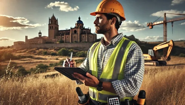
Comprehensive Geotechnical Studies
Comprehensive Geotechnical Studies
We combine field analysis and laboratory testing to provide accurate technical reports and foundation solutions.


Expert professional
Expert professional
Technicians with more than 15 years of experience in the industry. We are specialists in access to difficult locations such as sites with level changes, basements, etc.
Accredited
Accredited
Geotechnical calculations comply with the rules established by Eurocode 7, UNE-EN ISO 22476-4:2016.

Best price
Best price
Very competitive prices. The best prices for geotechnical studies in Spain. Request a quote and check it.
Speed and quality
Speed and quality
Within 7 to 10 days you will receive a signed report from a geologist. It is mandatory in order to carry out new construction or refurbishment works that involve modifications to the structure.

Work areas
We provide Geotechnical study in all locations of Casatejada.
This includes the following geographical areas: Province of Badajoz, Province of Cáceres, Extremadura and surrounding areas.
We travel to your home in Casatejada when it suits you, agreeing a day and time.

Types of ground in Casatejada
In Casatejada, the dominant geological substrate is mainly composed of sandstones, conglomerates and flysch—materials that are characterised by having good bearing capacity, making them ideal for building and civil engineering projects. The occasional presence of granite, gneiss and other igneous rocks increases the stability of the foundations and minimises the risk of deformation. Compact gravels and sands, although less frequent, provide favourable conditions for shallow foundations, provided that their relative density is sufficient. Limestones, dolomites and marbles complete the lithological picture, being important in areas where deep foundations are proposed. In general, these materials allow a positive assessment for support safety, but particular attention must be paid to the presence of water bodies that may condition local drainage and affect the durability of the foundations.
The Casatejada area shows very low seismicity, with only one recorded event every 30 years and a maximum magnitude of 1.5, so this factor does not represent a significant constraint for structural design. No karst phenomena or formations of expansive clays are observed, since the non-clayey substrate rules out risks associated with volumetric expansiveness. Groundwater conditions are influenced by the low permeability of the prevailing materials, although shallow aquifers may be found in certain areas. In conclusion, the main geotechnical constraint for the municipality lies in lithological heterogeneity and the need to assess locally the bearing capacity and any possible interference with water masses.
Compact gravels and sands
11.39%Water mass
5.07%
Construction risks in Casatejada
Approximate estimates. They do not replace the geotechnical study.
| Soil type | Expansivity | Settlements | Water table | Seismicity | Minimum foundation |
|---|---|---|---|---|---|
| Sandstones, Conglomerates and Flysch | None | Media | Media | Media | Direct foundation is feasible in most cases. For flysch ... |
| Granite, gneiss and igneous rocks | None | Downward | Downward | Downward | Direct foundation using isolated spread footings bearing... |
| Compact gravels and sands | None | Downward | High | Downward | Conventional shallow foundation without problems. Raft f... |
| Limestones, Dolomites and Marbles | None | Media | Media | Downward | In general, direct foundation using braced strip footing... |
| Water mass | None | Downward | High | Downward | It is not possible to found on a body of water. If the p... |
Interactive geological map · Casatejada
Mapping: IGME GEODE 50k · IGME MAGNA 50 · ICGC (Catalonia)
Geological Viewer
IGME · ICGC- Click on the map to see the geology at the point.
- Use the layer buttons to switch between geological views (GEODE, MAGNA, Lithology, Hydrogeology).
- Adjust the opacity of the geological layer with the control below.
- Press the full-screen button to expand the viewer.
Geological information
Typical stratigraphic profile
Indicative subsurface cross-section in Casatejada · Based on GEODE soil types
Indicative profile based on GEODE soil types and typical CTE thicknesses
Seismic risk in Casatejada
- 1 M 1.5 2009
How do we carry out your geotechnical study?
How do we carry out your geotechnical study?
Step
Free quote
Free quote
Request a quotation for your geotechnical study. Completely free and with no obligation.
Step
We arrange a day
We arrange a day
We are looking for a day and time to carry out the field study.
Step
Conducting the geotechnical study
Conducting the geotechnical study
We’re going to move and carry out the study. In an hour or two we’ll have finished.
Step
Report submission
Report submission
Within a week we will send you the signed documents of the geotechnical study by an accredited geologist.
Also available in
Spain’s most populated cities
Useful information about Geotechnical study
In-depth articles


Entities and institutions


