Estudio geotécnico in Cardeñajimeno
Do you need a Geotechnical study?
Find the best price and service in Cardeñajimeno. Get a free quote.
More than 1000 geotechnical studies carried out
Get personalized attention
We can contact you via WhatsApp, phone, or email, whichever you prefer.
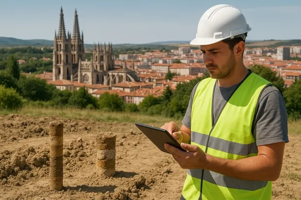
Comprehensive Geotechnical Studies
Comprehensive Geotechnical Studies
We combine field analysis and laboratory testing to provide accurate technical reports and foundation solutions.


Expert professional
Expert professional
Technicians with more than 15 years of experience in the industry. We are specialists in access to difficult locations such as sites with level changes, basements, etc.
Accredited
Accredited
Geotechnical calculations comply with the rules established by Eurocode 7, UNE-EN ISO 22476-4:2016.

Best price
Best price
Very competitive prices. The best prices for geotechnical studies in Spain. Request a quote and check it.
Speed and quality
Speed and quality
Within 7 to 10 days you will receive a signed report from a geologist. It is mandatory in order to carry out new construction or refurbishment works that involve modifications to the structure.

Work areas
We provide Geotechnical study in all locations of Cardeñajimeno.
This includes the following geographic areas: Avila Province, Province of Burgos, Province of León, Province of Palencia, Province of Salamanca, Segovia Province, Province of Soria, Province of Valladolid, Zamora Province, Castilla y León and surrounding areas.
We travel to your home in Cardeñajimeno when it suits you, agreeing a day and time.

Types of ground in Cardeñajimeno
In Cardeñajimeno, the predominant geotechnical subsoil is mainly made up of limestones, dolomites and marbles, with a significant presence of masses of water and, to a lesser extent, compacted gravels and sands. This composition provides an excellent natural bearing capacity, making the use of direct foundations on the rock common when these materials crop out. However, the intermittent presence of gypsum, anhydrite and salts implies a certain risk of dissolution, which can lead to voids or localised subsidence under specific hydrological conditions, requiring additional studies in areas where these materials are detected to avoid foundation-related problems.
Seismic activity in the area is very low, with only 2 events recorded in the last 30 years and a maximum magnitude of 1.7, so structural design is practically free from constraints due to seismicity. There are no detected risks of karstification in the area nor problems associated with expansive soils, since the non-clayey substrate eliminates the possibility of expansivity. The main geotechnical constraint in Cardeñajimeno is linked to checking for the presence of gypsum or soluble salts; it is essential to analyse their distribution before carrying out the foundation to ensure the durability and safety of the structure.
Water mass
31.99%Compact gravels and sands
15.65%Gypsum, Anhydrite and Salts
11.35%Fine sands and silts
4.46%
Construction risks in Cardeñajimeno
Approximate estimates. They do not replace the geotechnical study.
| Soil type | Expansivity | Settlements | Water table | Seismicity | Minimum foundation |
|---|---|---|---|---|---|
| Water mass | None | Downward | High | Downward | It is not possible to found on a body of water. If the p... |
| Limestones, Dolomites and Marbles | None | Media | Media | Downward | In general, direct foundation using braced strip footing... |
| Compact gravels and sands | None | Downward | High | Downward | Conventional shallow foundation without problems. Raft f... |
| Gypsum, Anhydrite and Salts | Media | High | High | Media | The foundation must be designed to withstand local loss ... |
| Fine sands and silts | None | High | High | High | To avoid local punching, the foundation slab is used ext... |
| Sandstones, Conglomerates and Flysch | None | Media | Media | Media | Direct foundation is feasible in most cases. For flysch ... |
Interactive geological map · Cardeñajimeno
Mapping: IGME GEODE 50k · IGME MAGNA 50 · ICGC (Catalonia)
Geological Viewer
IGME · ICGC- Click on the map to see the geology at the point.
- Use the layer buttons to switch between geological views (GEODE, MAGNA, Lithology, Hydrogeology).
- Adjust the opacity of the geological layer with the control below.
- Press the full-screen button to expand the viewer.
Geological information
Typical stratigraphic profile
Indicative subsurface cross-section in Cardeñajimeno · Based on GEODE soil types
Indicative profile based on GEODE soil types and typical CTE thicknesses
Seismic risk in Cardeñajimeno
- 1 M 1.7 2009
- 2 M 1.7 2011
How do we carry out your geotechnical study?
How do we carry out your geotechnical study?
Step
Free quote
Free quote
Request a quotation for your geotechnical study. Completely free and with no obligation.
Step
We arrange a day
We arrange a day
We are looking for a day and time to carry out the field study.
Step
Conducting the geotechnical study
Conducting the geotechnical study
We’re going to move and carry out the study. In an hour or two we’ll have finished.
Step
Report submission
Report submission
Within a week we will send you the signed documents of the geotechnical study by an accredited geologist.
Also available in
Spain’s most populated cities
Useful information about Geotechnical study
In-depth articles


Entities and institutions


