Estudio geotécnico in Cambados
Do you need a Geotechnical study?
Find the best price and service in Cambados. Get a free quote.
More than 1000 geotechnical studies carried out
Get personalized attention
We can contact you via WhatsApp, phone, or email, whichever you prefer.
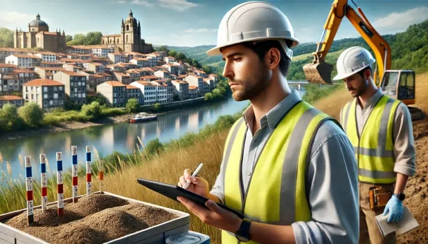
Comprehensive Geotechnical Studies
Comprehensive Geotechnical Studies
We combine field analysis and laboratory testing to provide accurate technical reports and foundation solutions.


Expert professional
Expert professional
Technicians with more than 15 years of experience in the industry. We are specialists in access to difficult locations such as sites with level changes, basements, etc.
Accredited
Accredited
Geotechnical calculations comply with the rules established by Eurocode 7, UNE-EN ISO 22476-4:2016.

Best price
Best price
Very competitive prices. The best prices for geotechnical studies in Spain. Request a quote and check it.
Speed and quality
Speed and quality
Within 7 to 10 days you will receive a signed report from a geologist. It is mandatory in order to carry out new construction or refurbishment works that involve modifications to the structure.

Work areas
We provide Geotechnical study in all locations of Cambados.
This includes the following geographical areas: Province of A Coruña, Lugo Province, Province of Ourense, Province of Pontevedra, Galicia and the surrounding areas.
We travel to your home in Cambados whenever it suits you, arranging a day and time.

Types of ground in Cambados
In Cambados, the dominant substrate corresponds to sandstones, conglomerates and flysch, which make up more than 60% of the ground, while fine sands and silts occupy a significant part of the municipality. These lithologies exhibit favourable mechanical behaviour, with a good overall bearing capacity, although the possible presence of silt levels with low compaction must be assessed. The formations mentioned generally have low permeability, except when they include specific shallow aquifers, and this directly influences the selection of the foundation type. In practice, conventional strip footings or slabs are usually viable after analysing the homogeneity of the ground.
The seismic activity recorded in the area is very low, with only 9 events over 30 years and a mild maximum magnitude of 2.4, which minimises the need for reinforcement against seismic actions in structural design. No karstification phenomena are detected either, and no risks associated with expansivity are presented, since the non-clayey substrate rules out this problem. In conclusion, the main focus of the geotechnical study in Cambados should be centred on identifying possible individualised silt layers or poorly compacted materials within the dominant formations.
Fine sands and silts
31.74%Phyllites and schists
2.48%
Construction risks in Cambados
Approximate estimates. They do not replace the geotechnical study.
| Soil type | Expansivity | Settlements | Water table | Seismicity | Minimum foundation |
|---|---|---|---|---|---|
| Sandstones, Conglomerates and Flysch | None | Media | Media | Media | Direct foundation is feasible in most cases. For flysch ... |
| Fine sands and silts | None | High | High | High | To avoid local punching, the foundation slab is used ext... |
| Compact gravels and sands | None | Downward | High | Downward | Conventional shallow foundation without problems. Raft f... |
| Phyllites and schists | None | Media | Media | Media | Shallow foundation if the stratum is competent. Strong b... |
Interactive geological map · Cambados
Mapping: IGME GEODE 50k · IGME MAGNA 50 · ICGC (Catalonia)
Geological Viewer
IGME · ICGC- Click on the map to see the geology at the point.
- Use the layer buttons to switch between geological views (GEODE, MAGNA, Lithology, Hydrogeology).
- Adjust the opacity of the geological layer with the control below.
- Press the full-screen button to expand the viewer.
Geological information
Typical stratigraphic profile
Indicative subsurface cross-section in Cambados · Based on GEODE soil types
Indicative profile based on GEODE soil types and typical CTE thicknesses
Seismic risk in Cambados
- 1 M 2.4 2010
- 2 M 2.2 2018
- 3 M 2.1 2018
How do we carry out your geotechnical study?
How do we carry out your geotechnical study?
Step
Free quote
Free quote
Request a quotation for your geotechnical study. Completely free and with no obligation.
Step
We arrange a day
We arrange a day
We are looking for a day and time to carry out the field study.
Step
Conducting the geotechnical study
Conducting the geotechnical study
We’re going to move and carry out the study. In an hour or two we’ll have finished.
Step
Report submission
Report submission
Within a week we will send you the signed documents of the geotechnical study by an accredited geologist.
Also available in
Spain’s most populated cities
Useful information about Geotechnical study
In-depth articles


Entities and institutions


