Estudio geotécnico in Beniarbeig
Do you need a Geotechnical study?
Find the best price and service in Beniarbeig. Get a free quote.
More than 1000 geotechnical studies carried out
Get personalized attention
We can contact you via WhatsApp, phone, or email, whichever you prefer.
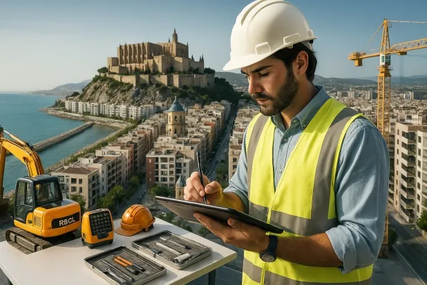
Comprehensive Geotechnical Studies
Comprehensive Geotechnical Studies
We combine field analysis and laboratory testing to provide accurate technical reports and foundation solutions.


Expert professional
Expert professional
Technicians with more than 15 years of experience in the industry. We are specialists in access to difficult locations such as sites with level changes, basements, etc.
Accredited
Accredited
Geotechnical calculations comply with the rules established by Eurocode 7, UNE-EN ISO 22476-4:2016.

Best price
Best price
Very competitive prices. The best prices for geotechnical studies in Spain. Request a quote and check it.
Speed and quality
Speed and quality
Within 7 to 10 days you will receive a signed report from a geologist. It is mandatory in order to carry out new construction or refurbishment works that involve modifications to the structure.

Work areas
We provide Geotechnical study in all locations of Beniarbeig.
This includes the following geographic areas: Alicante, Castellón, Valencia, Comunidad Valenciana and surrounding areas.
We’ll come to your home in Beniarbeig when it suits you best, agreeing a day and time.

Types of ground in Beniarbeig
In the municipality of Beniarbeig, the predominant subsoil is made up of compact gravels and sands, which form a ground with high bearing capacity and low susceptibility to expansion, facilitating the construction of deep and shallow foundations with a lower risk of differential settlement. Limestone, dolomite and marble formations are also common, which may influence the choice of foundation techniques and the stability of ground, particularly in the case of underground works or galleries. The low permeability of these formations, in a context of shallow aquifers, requires attention to possible groundwater movements in the design of structures.
Seismicity in the area, with a maximum magnitude of 3.4 and 52 events over 30 years, is considered moderate, so it should be taken into account in structural projects. In addition, although the municipality has karst features, the non-argillaceous substrate condition and the absence of significant expansivity risks, such as predominant expansive clays, make it possible to rule out problems related to soil dilation or shrinkage. However, it is advisable to check in advance for the presence of karst formations before carrying out foundations in order to avoid risks of sinking or collapse in the planned foundations.
Compact gravels and sands
59.29%Fine sands and silts
10.11%
Construction risks in Beniarbeig
Approximate estimates. They do not replace the geotechnical study.
| Soil type | Expansivity | Settlements | Water table | Seismicity | Minimum foundation |
|---|---|---|---|---|---|
| Compact gravels and sands | None | Downward | High | Downward | Conventional shallow foundation without problems. Raft f... |
| Limestones, Dolomites and Marbles | None | Media | Media | Downward | In general, direct foundation using braced strip footing... |
| Fine sands and silts | None | High | High | High | To avoid local punching, the foundation slab is used ext... |
Interactive geological map · Beniarbeig
Mapping: IGME GEODE 50k · IGME MAGNA 50 · ICGC (Catalonia)
Geological Viewer
IGME · ICGC- Click on the map to see the geology at the point.
- Use the layer buttons to switch between geological views (GEODE, MAGNA, Lithology, Hydrogeology).
- Adjust the opacity of the geological layer with the control below.
- Press the full-screen button to expand the viewer.
Geological information
Typical stratigraphic profile
Indicative subsurface cross-section in Beniarbeig · Based on GEODE soil types
Indicative profile based on GEODE soil types and typical CTE thicknesses
Seismic risk in Beniarbeig
Seismic risk is assessed at municipal level. These are aggregated data for the area.
- 1 M 3.4 1998
- 2 M 3.2 2014
- 3 M 3.2 2001
How do we carry out your geotechnical study?
How do we carry out your geotechnical study?
Step
Free quote
Free quote
Request a quotation for your geotechnical study. Completely free and with no obligation.
Step
We arrange a day
We arrange a day
We are looking for a day and time to carry out the field study.
Step
Conducting the geotechnical study
Conducting the geotechnical study
We’re going to move and carry out the study. In an hour or two we’ll have finished.
Step
Report submission
Report submission
Within a week we will send you the signed documents of the geotechnical study by an accredited geologist.
Also available in
Spain’s most populated cities
Useful information about Geotechnical study
In-depth articles


Entities and institutions


