Estudio geotécnico in Belorado
Do you need a Geotechnical study?
Find the best price and service in Belorado. Get a free quote.
More than 1000 geotechnical studies carried out
Get personalized attention
We can contact you via WhatsApp, phone, or email, whichever you prefer.
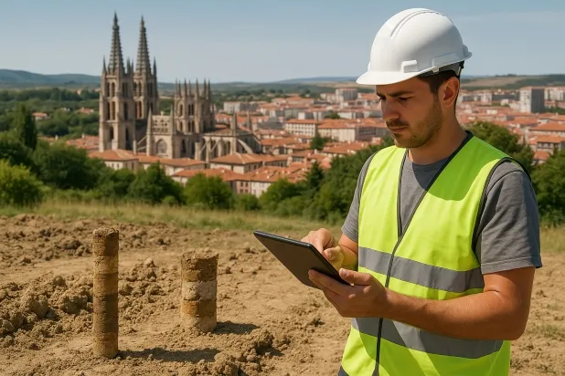
Comprehensive Geotechnical Studies
Comprehensive Geotechnical Studies
We combine field analysis and laboratory testing to provide accurate technical reports and foundation solutions.


Expert professional
Expert professional
Technicians with more than 15 years of experience in the industry. We are specialists in access to difficult locations such as sites with level changes, basements, etc.
Accredited
Accredited
Geotechnical calculations comply with the rules established by Eurocode 7, UNE-EN ISO 22476-4:2016.

Best price
Best price
Very competitive prices. The best prices for geotechnical studies in Spain. Request a quote and check it.
Speed and quality
Speed and quality
Within 7 to 10 days you will receive a signed report from a geologist. It is mandatory in order to carry out new construction or refurbishment works that involve modifications to the structure.

Work areas
We provide Geotechnical study in all towns and cities of Belorado.
This includes the following geographical areas: Avila Province, Province of Burgos, Province of León, Province of Palencia, Province of Salamanca, Segovia Province, Province of Soria, Province of Valladolid, Zamora Province, Castilla y León and the surrounding areas.
We travel to your home in Belorado when it suits you, agreeing a day and time.

Types of ground in Belorado
In Belorado, the subsoil is dominated primarily by the presence of gypsum, anhydrite and salts, accompanied by significant proportions of sandstone, conglomerates and flysch. This mineralogical setting poses particular challenges with regard to the ground’s bearing capacity, since soils formed by gypsum, anhydrite and salts present risks associated with dissolution and subsidence, especially in contact with flowing water. The sandstone and conglomeratic formations can provide a degree of stable support, but the heterogeneous distribution of the materials requires careful assessment to determine the optimal foundation zones. Special caution is recommended when selecting the support level and the type of foundation, prioritising specific geotechnical studies before any works begin.
Seismicity in the area is classified as notable, with 133 events recorded over 30 years and a maximum magnitude of 3.7, which although moderate should be taken into account in the analysis of the stability and safety of the designed structures. The presence of karstification is a relevant constraint, as it is necessary to thoroughly verify the possible karst processes before any intervention, given the frequent occurrence of cavities associated with gypsum and salts. The non-clayey nature of the substrate rules out expansivity risks. The main geotechnical constraint in this municipality is the combination of risks linked to dissolution and potential karstification; these are critical factors that drive the need for a detailed geotechnical study for the safe execution of any foundation.
Gypsum, Anhydrite and Salts
36.11%Fine sands and silts
6.67%
Construction risks in Belorado
Approximate estimates. They do not replace the geotechnical study.
| Soil type | Expansivity | Settlements | Water table | Seismicity | Minimum foundation |
|---|---|---|---|---|---|
| Gypsum, Anhydrite and Salts | Media | High | High | Media | The foundation must be designed to withstand local loss ... |
| Sandstones, Conglomerates and Flysch | None | Media | Media | Media | Direct foundation is feasible in most cases. For flysch ... |
| Limestones, Dolomites and Marbles | None | Media | Media | Downward | In general, direct foundation using braced strip footing... |
| Fine sands and silts | None | High | High | High | To avoid local punching, the foundation slab is used ext... |
| Compact gravels and sands | None | Downward | High | Downward | Conventional shallow foundation without problems. Raft f... |
Interactive geological map · Belorado
Mapping: IGME GEODE 50k · IGME MAGNA 50 · ICGC (Catalonia)
Geological Viewer
IGME · ICGC- Click on the map to see the geology at the point.
- Use the layer buttons to switch between geological views (GEODE, MAGNA, Lithology, Hydrogeology).
- Adjust the opacity of the geological layer with the control below.
- Press the full-screen button to expand the viewer.
Geological information
Typical stratigraphic profile
Indicative subsurface cross-section in Belorado · Based on GEODE soil types
Indicative profile based on GEODE soil types and typical CTE thicknesses
Seismic risk in Belorado
- 1 M 3.7 2007
- 2 M 3.2 2007
- 3 M 2.9 2006
How do we carry out your geotechnical study?
How do we carry out your geotechnical study?
Step
Free quote
Free quote
Request a quotation for your geotechnical study. Completely free and with no obligation.
Step
We arrange a day
We arrange a day
We are looking for a day and time to carry out the field study.
Step
Conducting the geotechnical study
Conducting the geotechnical study
We’re going to move and carry out the study. In an hour or two we’ll have finished.
Step
Report submission
Report submission
Within a week we will send you the signed documents of the geotechnical study by an accredited geologist.
Also available in
Spain’s most populated cities
Useful information about Geotechnical study
In-depth articles


Entities and institutions


