Estudio geotécnico in Belalcázar
Do you need a Geotechnical study?
Find the best price and service in Belalcázar. Get a free quote.
More than 1000 geotechnical studies carried out
Get personalized attention
We can contact you via WhatsApp, phone, or email, whichever you prefer.
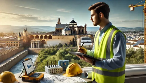
Comprehensive Geotechnical Studies
Comprehensive Geotechnical Studies
We combine field analysis and laboratory testing to provide accurate technical reports and foundation solutions.


Expert professional
Expert professional
Technicians with more than 15 years of experience in the industry. We are specialists in access to difficult locations such as sites with level changes, basements, etc.
Accredited
Accredited
Geotechnical calculations comply with the rules established by Eurocode 7, UNE-EN ISO 22476-4:2016.

Best price
Best price
Very competitive prices. The best prices for geotechnical studies in Spain. Request a quote and check it.
Speed and quality
Speed and quality
Within 7 to 10 days you will receive a signed report from a geologist. It is mandatory in order to carry out new construction or refurbishment works that involve modifications to the structure.

Work areas
We provide Geotechnical study in all locations of Belalcázar.
This includes the following geographical areas: Province of Almería, Province of Cádiz, Province of Córdoba, Province of Granada, Province of Huelva, Province of Jaén, Province of Málaga, Province of Seville, Andalucía and surrounding areas.
We travel to your home in Belalcázar when it suits you best, agreeing a day and time.

Types of ground in Belalcázar
In Belalcázar, the geological substrate is predominantly dominated by slates and schists, with a secondary presence of granite, gneiss and other igneous rocks. Locally, compact gravels and sands are also found, as well as small areas of overconsolidated clays and marls. These lithologies, in particular the slates and schists, tend to provide a moderate bearing capacity and low deformability, which favours conventional shallow foundations in most cases. The low overall permeability of these materials implies favourable behaviour with regard to infiltration problems, although there may be associated shallow aquifers in specific areas that will need to be studied in order to prevent situations involving undermining or soil washout.
Seismic activity in Belalcázar is very low, with barely one recorded event in the last 30 years and a maximum magnitude of 1.5, so it does not represent a relevant constraint for structural design. There are no signs of karstic processes or significant expansiveness, given the predominance of non-clayey materials in the substrate. As a main conclusion, the lithological typology and the low level of seismicity mean that the appropriate characterisation of the degree of fracturing of the materials and the possible presence of local aquifers are among the key aspects to control during the geotechnical study and the definition of the foundation solutions.
Phyllites and schists
51.01%Water mass
8.52%
Construction risks in Belalcázar
Approximate estimates. They do not replace the geotechnical study.
| Soil type | Expansivity | Settlements | Water table | Seismicity | Minimum foundation |
|---|---|---|---|---|---|
| Phyllites and schists | None | Media | Media | Media | Shallow foundation if the stratum is competent. Strong b... |
| Granite, gneiss and igneous rocks | None | Downward | Downward | Downward | Direct foundation using isolated spread footings bearing... |
| Compact gravels and sands | None | Downward | High | Downward | Conventional shallow foundation without problems. Raft f... |
| Water mass | None | Downward | High | Downward | It is not possible to found on a body of water. If the p... |
| Overconsolidated clays and marls (Duras) | Media | Media | Downward | Downward | Direct foundation is viable. Piling is rarely resorted t... |
Interactive geological map · Belalcázar
Mapping: IGME GEODE 50k · IGME MAGNA 50 · ICGC (Catalonia)
Geological Viewer
IGME · ICGC- Click on the map to see the geology at the point.
- Use the layer buttons to switch between geological views (GEODE, MAGNA, Lithology, Hydrogeology).
- Adjust the opacity of the geological layer with the control below.
- Press the full-screen button to expand the viewer.
Geological information
Typical stratigraphic profile
Indicative subsurface cross-section in Belalcázar · Based on GEODE soil types
Indicative profile based on GEODE soil types and typical CTE thicknesses
Seismic risk in Belalcázar
- 1 M 1.5 2009
How do we carry out your geotechnical study?
How do we carry out your geotechnical study?
Step
Free quote
Free quote
Request a quotation for your geotechnical study. Completely free and with no obligation.
Step
We arrange a day
We arrange a day
We are looking for a day and time to carry out the field study.
Step
Conducting the geotechnical study
Conducting the geotechnical study
We’re going to move and carry out the study. In an hour or two we’ll have finished.
Step
Report submission
Report submission
Within a week we will send you the signed documents of the geotechnical study by an accredited geologist.
Also available in
Spain’s most populated cities
Useful information about Geotechnical study
In-depth articles


Entities and institutions


