Estudio geotécnico in Argamasilla de Calatrava
Do you need a Geotechnical study?
Find the best price and service in Argamasilla de Calatrava. Get a free quote.
More than 1000 geotechnical studies carried out
Get personalized attention
We can contact you via WhatsApp, phone, or email, whichever you prefer.
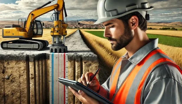
Comprehensive Geotechnical Studies
Comprehensive Geotechnical Studies
We combine field analysis and laboratory testing to provide accurate technical reports and foundation solutions.


Expert professional
Expert professional
Technicians with more than 15 years of experience in the industry. We are specialists in access to difficult locations such as sites with level changes, basements, etc.
Accredited
Accredited
Geotechnical calculations comply with the rules established by Eurocode 7, UNE-EN ISO 22476-4:2016.

Best price
Best price
Very competitive prices. The best prices for geotechnical studies in Spain. Request a quote and check it.
Speed and quality
Speed and quality
Within 7 to 10 days you will receive a signed report from a geologist. It is mandatory in order to carry out new construction or refurbishment works that involve modifications to the structure.

Work areas
We provide Geotechnical study in all locations of Argamasilla de Calatrava.
This includes the following geographical areas: Province of Ciudad Real, Province of Cuenca, Province of Guadalajara, Province of Toledo, Province of Albacete, Castilla-La Mancha and surrounding areas.
We travel to your home in Argamasilla de Calatrava when it suits you, agreeing a day and time.

Types of ground in Argamasilla de Calatrava
In Argamasilla de Calatrava, the dominant subsoil consists of slates and schists, metamorphic materials that exhibit low permeability and good stability conditions. These soils, together with a significant proportion of sandstones, conglomerates and flysch, allow direct foundations in most cases, provided that layers of poorly compacted gravels or local clayey lenses are avoided. The hard formations of overconsolidated clays and marls provide strength, while water-mass levels must be identified to prevent drainage problems during construction.
Seismicity in the area is moderate, reflecting 10 events in the last 30 years with a low maximum magnitude (Mmax 2.1), which implies that seismic risk is not a relevant constraint for structural design. Since the subsoil is fundamentally non-clayey, the risk associated with expansivity is ruled out. The main factor to be examined in geotechnical studies is therefore the identification of layers with possible water presence and the variable nature of the near-surface materials to ensure adequate bearing capacity and foundation stability.
Phyllites and schists
29.62%Water mass
18.62%Fine sands and silts
5.26%
Construction risks in Argamasilla de Calatrava
Approximate estimates. They do not replace the geotechnical study.
| Soil type | Expansivity | Settlements | Water table | Seismicity | Minimum foundation |
|---|---|---|---|---|---|
| Phyllites and schists | None | Media | Media | Media | Shallow foundation if the stratum is competent. Strong b... |
| Water mass | None | Downward | High | Downward | It is not possible to found on a body of water. If the p... |
| Sandstones, Conglomerates and Flysch | None | Media | Media | Media | Direct foundation is feasible in most cases. For flysch ... |
| Overconsolidated clays and marls (Duras) | Media | Media | Downward | Downward | Direct foundation is viable. Piling is rarely resorted t... |
| Limestones, Dolomites and Marbles | None | Media | Media | Downward | In general, direct foundation using braced strip footing... |
| Fine sands and silts | None | High | High | High | To avoid local punching, the foundation slab is used ext... |
| Compact gravels and sands | None | Downward | High | Downward | Conventional shallow foundation without problems. Raft f... |
Interactive geological map · Argamasilla de Calatrava
Mapping: IGME GEODE 50k · IGME MAGNA 50 · ICGC (Catalonia)
Geological Viewer
IGME · ICGC- Click on the map to see the geology at the point.
- Use the layer buttons to switch between geological views (GEODE, MAGNA, Lithology, Hydrogeology).
- Adjust the opacity of the geological layer with the control below.
- Press the full-screen button to expand the viewer.
Geological information
Typical stratigraphic profile
Indicative subsurface cross-section in Argamasilla de Calatrava · Based on GEODE soil types
Indicative profile based on GEODE soil types and typical CTE thicknesses
Seismic risk in Argamasilla de Calatrava
- 1 M 2.1 2009
- 2 M 2 2010
- 3 M 1.8 2009
How do we carry out your geotechnical study?
How do we carry out your geotechnical study?
Step
Free quote
Free quote
Request a quotation for your geotechnical study. Completely free and with no obligation.
Step
We arrange a day
We arrange a day
We are looking for a day and time to carry out the field study.
Step
Conducting the geotechnical study
Conducting the geotechnical study
We’re going to move and carry out the study. In an hour or two we’ll have finished.
Step
Report submission
Report submission
Within a week we will send you the signed documents of the geotechnical study by an accredited geologist.
Also available in
Spain’s most populated cities
Useful information about Geotechnical study
In-depth articles


Entities and institutions


