Estudio geotécnico in Argamasilla de Alba
Do you need a Geotechnical study?
Find the best price and service in Argamasilla de Alba. Get a free quote.
More than 1000 geotechnical studies carried out
Get personalized attention
We can contact you via WhatsApp, phone, or email, whichever you prefer.
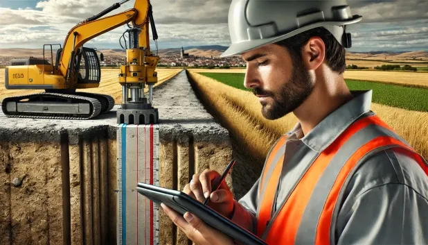
Comprehensive Geotechnical Studies
Comprehensive Geotechnical Studies
We combine field analysis and laboratory testing to provide accurate technical reports and foundation solutions.


Expert professional
Expert professional
Technicians with more than 15 years of experience in the industry. We are specialists in access to difficult locations such as sites with level changes, basements, etc.
Accredited
Accredited
Geotechnical calculations comply with the rules established by Eurocode 7, UNE-EN ISO 22476-4:2016.

Best price
Best price
Very competitive prices. The best prices for geotechnical studies in Spain. Request a quote and check it.
Speed and quality
Speed and quality
Within 7 to 10 days you will receive a signed report from a geologist. It is mandatory in order to carry out new construction or refurbishment works that involve modifications to the structure.

Work areas
We provide Geotechnical study in all towns of Argamasilla de Alba.
This includes the following geographical areas: Province of Ciudad Real, Province of Cuenca, Province of Guadalajara, Province of Toledo, Province of Albacete, Castilla-La Mancha and surrounding areas.
We go to your home in Argamasilla de Alba when it suits you, agreeing a day and time.

Types of ground in Argamasilla de Alba
The municipal district of Argamasilla de Alba is characterised by a predominantly calcareous bedrock consisting of limestones, dolomites and marbles, accompanied by significant proportions of gypsum, anhydrite and salts. These materials generally show good bearing capacity, which favours the execution of conventional shallow foundations, particularly in areas where compact gravels and sands are found. However, the frequent presence of gypsum, anhydrite and salts implies a risk associated with the possible dissolution and formation of voids, which calls for caution when assessing the definitive bearing capacity of the ground.
With regard to conditioning factors, the recorded seismicity is moderate, with 46 events over thirty years and a maximum magnitude of 3.6, which implies some attention during structural design but without requiring exceptional measures for earthquakes. Since karst is present, it is essential to verify the development of cavities before defining the foundation type. In addition, as the substrate is non-clayey, the risk of expansivity is ruled out, but the main challenge for the geotechnical study in Argamasilla de Alba lies in the investigation and treatment of possible karst-related phenomena and ground dissolution.
Gypsum, Anhydrite and Salts
29.87%Compact gravels and sands
13.10%Phyllites and schists
7.30%Fine sands and silts
2.85%
Construction risks in Argamasilla de Alba
Approximate estimates. They do not replace the geotechnical study.
| Soil type | Expansivity | Settlements | Water table | Seismicity | Minimum foundation |
|---|---|---|---|---|---|
| Limestones, Dolomites and Marbles | None | Media | Media | Downward | In general, direct foundation using braced strip footing... |
| Gypsum, Anhydrite and Salts | Media | High | High | Media | The foundation must be designed to withstand local loss ... |
| Compact gravels and sands | None | Downward | High | Downward | Conventional shallow foundation without problems. Raft f... |
| Phyllites and schists | None | Media | Media | Media | Shallow foundation if the stratum is competent. Strong b... |
| Fine sands and silts | None | High | High | High | To avoid local punching, the foundation slab is used ext... |
Interactive geological map · Argamasilla de Alba
Mapping: IGME GEODE 50k · IGME MAGNA 50 · ICGC (Catalonia)
Geological Viewer
IGME · ICGC- Click on the map to see the geology at the point.
- Use the layer buttons to switch between geological views (GEODE, MAGNA, Lithology, Hydrogeology).
- Adjust the opacity of the geological layer with the control below.
- Press the full-screen button to expand the viewer.
Geological information
Typical stratigraphic profile
Indicative subsurface cross-section in Argamasilla de Alba · Based on GEODE soil types
Indicative profile based on GEODE soil types and typical CTE thicknesses
Seismic risk in Argamasilla de Alba
- 1 M 3.6 2004
- 2 M 3.3 2003
- 3 M 3.3 2017
How do we carry out your geotechnical study?
How do we carry out your geotechnical study?
Step
Free quote
Free quote
Request a quotation for your geotechnical study. Completely free and with no obligation.
Step
We arrange a day
We arrange a day
We are looking for a day and time to carry out the field study.
Step
Conducting the geotechnical study
Conducting the geotechnical study
We’re going to move and carry out the study. In an hour or two we’ll have finished.
Step
Report submission
Report submission
Within a week we will send you the signed documents of the geotechnical study by an accredited geologist.
Also available in
Spain’s most populated cities
Useful information about Geotechnical study
In-depth articles


Entities and institutions


