Estudio geotécnico in Arcos de la Frontera
Do you need a Geotechnical study?
Find the best price and service in Arcos de la Frontera. Get a free quote.
More than 1000 geotechnical studies carried out
Get personalized attention
We can contact you via WhatsApp, phone, or email, whichever you prefer.
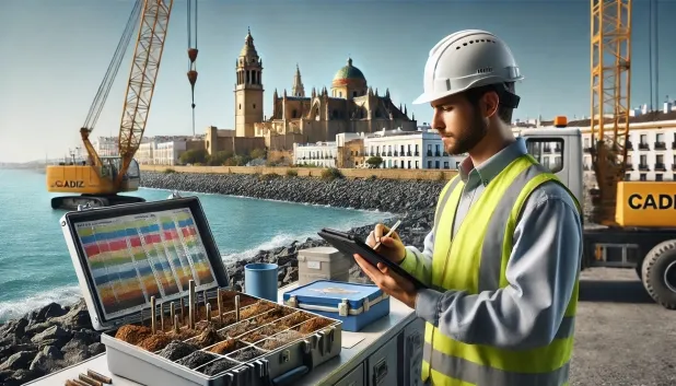
Comprehensive Geotechnical Studies
Comprehensive Geotechnical Studies
We combine field analysis and laboratory testing to provide accurate technical reports and foundation solutions.


Expert professional
Expert professional
Technicians with more than 15 years of experience in the industry. We are specialists in access to difficult locations such as sites with level changes, basements, etc.
Accredited
Accredited
Geotechnical calculations comply with the rules established by Eurocode 7, UNE-EN ISO 22476-4:2016.

Best price
Best price
Very competitive prices. The best prices for geotechnical studies in Spain. Request a quote and check it.
Speed and quality
Speed and quality
Within 7 to 10 days you will receive a signed report from a geologist. It is mandatory in order to carry out new construction or refurbishment works that involve modifications to the structure.

Work areas
We provide Geotechnical study in all towns and villages of Arcos de la Frontera.
This includes the following geographical areas: Province of Almería, Province of Cádiz, Province of Córdoba, Province of Granada, Province of Huelva, Province of Jaén, Province of Málaga, Province of Seville, Andalucía and surrounding areas.
We travel to your home in Arcos de la Frontera when it suits you, agreeing a day and time.

Types of ground in Arcos de la Frontera
In Arcos de la Frontera, formations of sandstones, conglomerates and flysch predominate, together with significant proportions of limestones, dolomites and marbles. These materials habitually provide a good bearing capacity and allow for shallow (direct) foundations in many areas, especially where the more competent rocks crop out. Gravels, compacted sands and the occasional presence of fine sands and silts may require a local review of density/compactness to ensure correct load transfer. The non-clayey substrate rules out the risk of expansivity, and the generally low permeability limits the migration of moisture, although there are small near-surface aquifers that must be identified.
In the municipality’s geotechnical context, seismic activity is classified as notable (58 events in 30 years), although the maximum recorded magnitude of Mmax 4.4 suggests that structural seismic demands will be moderate, without the need for special requirements beyond usual standards/regulations. Given the significant proportion of limestones and dolomites, it is essential to verify the presence of karstification and any possible cavities before defining the foundation, as their omission could compromise stability. In summary, the main technical constraint is risk control through karstification in carbonate materials.
Fine sands and silts
11.44%Water mass
4.19%
Construction risks in Arcos de la Frontera
Approximate estimates. They do not replace the geotechnical study.
| Soil type | Expansivity | Settlements | Water table | Seismicity | Minimum foundation |
|---|---|---|---|---|---|
| Sandstones, Conglomerates and Flysch | None | Media | Media | Media | Direct foundation is feasible in most cases. For flysch ... |
| Limestones, Dolomites and Marbles | None | Media | Media | Downward | In general, direct foundation using braced strip footing... |
| Fine sands and silts | None | High | High | High | To avoid local punching, the foundation slab is used ext... |
| Compact gravels and sands | None | Downward | High | Downward | Conventional shallow foundation without problems. Raft f... |
| Water mass | None | Downward | High | Downward | It is not possible to found on a body of water. If the p... |
| White/Soft Expansive Clays | High | High | Downward | Downward | Inviable the pure shallow isolated footing. Either a sym... |
Interactive geological map · Arcos de la Frontera
Mapping: IGME GEODE 50k · IGME MAGNA 50 · ICGC (Catalonia)
Geological Viewer
IGME · ICGC- Click on the map to see the geology at the point.
- Use the layer buttons to switch between geological views (GEODE, MAGNA, Lithology, Hydrogeology).
- Adjust the opacity of the geological layer with the control below.
- Press the full-screen button to expand the viewer.
Geological information
Typical stratigraphic profile
Indicative subsurface cross-section in Arcos de la Frontera · Based on GEODE soil types
Indicative profile based on GEODE soil types and typical CTE thicknesses
Seismic risk in Arcos de la Frontera
- 1 M 4.4 2005
- 2 M 4.2 2016
- 3 M 3.5 2002
How do we carry out your geotechnical study?
How do we carry out your geotechnical study?
Step
Free quote
Free quote
Request a quotation for your geotechnical study. Completely free and with no obligation.
Step
We arrange a day
We arrange a day
We are looking for a day and time to carry out the field study.
Step
Conducting the geotechnical study
Conducting the geotechnical study
We’re going to move and carry out the study. In an hour or two we’ll have finished.
Step
Report submission
Report submission
Within a week we will send you the signed documents of the geotechnical study by an accredited geologist.
Also available in
Spain’s most populated cities
Useful information about Geotechnical study
In-depth articles


Entities and institutions


