Estudio geotécnico in Almáchar
Do you need a Geotechnical study?
Find the best price and service in Almáchar. Get a free quote.
More than 1000 geotechnical studies carried out
Get personalized attention
We can contact you via WhatsApp, phone, or email, whichever you prefer.
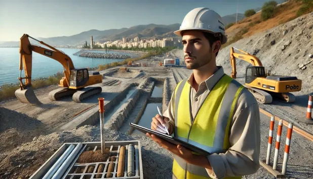
Comprehensive Geotechnical Studies
Comprehensive Geotechnical Studies
We combine field analysis and laboratory testing to provide accurate technical reports and foundation solutions.


Expert professional
Expert professional
Technicians with more than 15 years of experience in the industry. We are specialists in access to difficult locations such as sites with level changes, basements, etc.
Accredited
Accredited
Geotechnical calculations comply with the rules established by Eurocode 7, UNE-EN ISO 22476-4:2016.

Best price
Best price
Very competitive prices. The best prices for geotechnical studies in Spain. Request a quote and check it.
Speed and quality
Speed and quality
Within 7 to 10 days you will receive a signed report from a geologist. It is mandatory in order to carry out new construction or refurbishment works that involve modifications to the structure.

Work areas
We provide Geotechnical study in all locations of Almáchar.
This includes the following geographical areas: Province of Almería, Province of Cádiz, Province of Córdoba, Province of Granada, Province of Huelva, Province of Jaén, Province of Málaga, Province of Seville, Andalucía and surrounding areas.
We travel to your home in Almáchar whenever it suits you, agreeing a day and time.

Types of ground in Almáchar
In Almáchar, a substrate of slates and schists predominates, accounting for more than 70% of the local geology and providing a competent support for shallow and deep foundations. Sandstones, conglomerates and flysch occur occasionally, introducing specific variations in bearing capacity but without compromising overall stability. The marginal presence of gravels, compact sands and limestone deposits does not significantly condition the overall behaviour of the ground, although it is advisable to verify lithological transitions on a case-by-case basis in larger-scale projects.
Seismicity in the municipality of Almáchar is moderate, with 28 recorded events over the last 30 years and maximum magnitudes below 4.0, which minimises the direct seismic risk to projects. As there are no indications of karst or of expansive clayey soils, and the substrate is clearly non-clayey, the problem associated with swelling is ruled out. The main factor to consider in geotechnical studies in Almáchar is the limited permeability of the materials, which requires particular attention to drainage management and control of surface water to avoid problems of water accumulation on site.
Pizarras y Esquistos
72.91%Arenas finas y limos
4.48%
Construction risks in Almáchar
Approximate estimates. They do not replace the geotechnical study.
| Soil type | Expansivity | Settlements | Water table | Seismicity | Minimum foundation |
|---|---|---|---|---|---|
| Pizarras y Esquistos | None | Media | Media | Media | Cimentación superficial si el estrato es competente. Se ... |
| Areniscas, Conglomerados y Flysch | None | Media | Media | Media | Cimentación directa viable en la mayoría de los casos. P... |
| Gravas y Arenas compactas | None | Downward | High | Downward | Cimentación superficial convencional sin problemas. Losa... |
| Arenas finas y limos | None | High | High | High | Para evitar punzonamientos locales se usa profusamente l... |
| Calizas, Dolomías y Mármoles | None | Media | Media | Downward | Generalmente cimentación directa mediante zapatas arrios... |
Interactive geological map · Almáchar
Mapping: IGME GEODE 50k · IGME MAGNA 50 · ICGC (Catalonia)
Geological Viewer
IGME · ICGC- Click on the map to see the geology at the point.
- Use the layer buttons to switch between geological views (GEODE, MAGNA, Lithology, Hydrogeology).
- Adjust the opacity of the geological layer with the control below.
- Press the full-screen button to expand the viewer.
Geological information
Typical stratigraphic profile
Indicative subsurface cross-section in Almáchar · Based on GEODE soil types
Indicative profile based on GEODE soil types and typical CTE thicknesses
Seismic risk in Almáchar
- 1 M 3.7 2011
- 2 M 3.3 2023
- 3 M 3.2 2006
How do we carry out your geotechnical study?
How do we carry out your geotechnical study?
Step
Free quote
Free quote
Request a quotation for your geotechnical study. Completely free and with no obligation.
Step
We arrange a day
We arrange a day
We are looking for a day and time to carry out the field study.
Step
Conducting the geotechnical study
Conducting the geotechnical study
We’re going to move and carry out the study. In an hour or two we’ll have finished.
Step
Report submission
Report submission
Within a week we will send you the signed documents of the geotechnical study by an accredited geologist.
Also available in
Spain’s most populated cities
Useful information about Geotechnical study
In-depth articles


Entities and institutions


